Pride & Prejudice & Plague

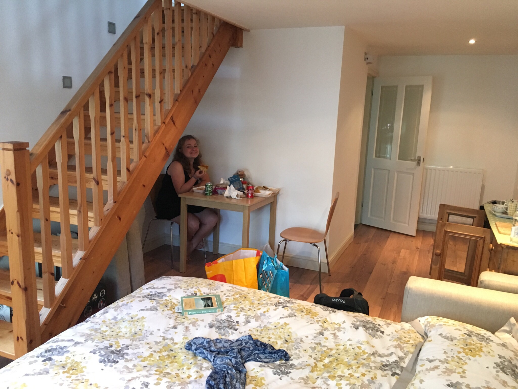
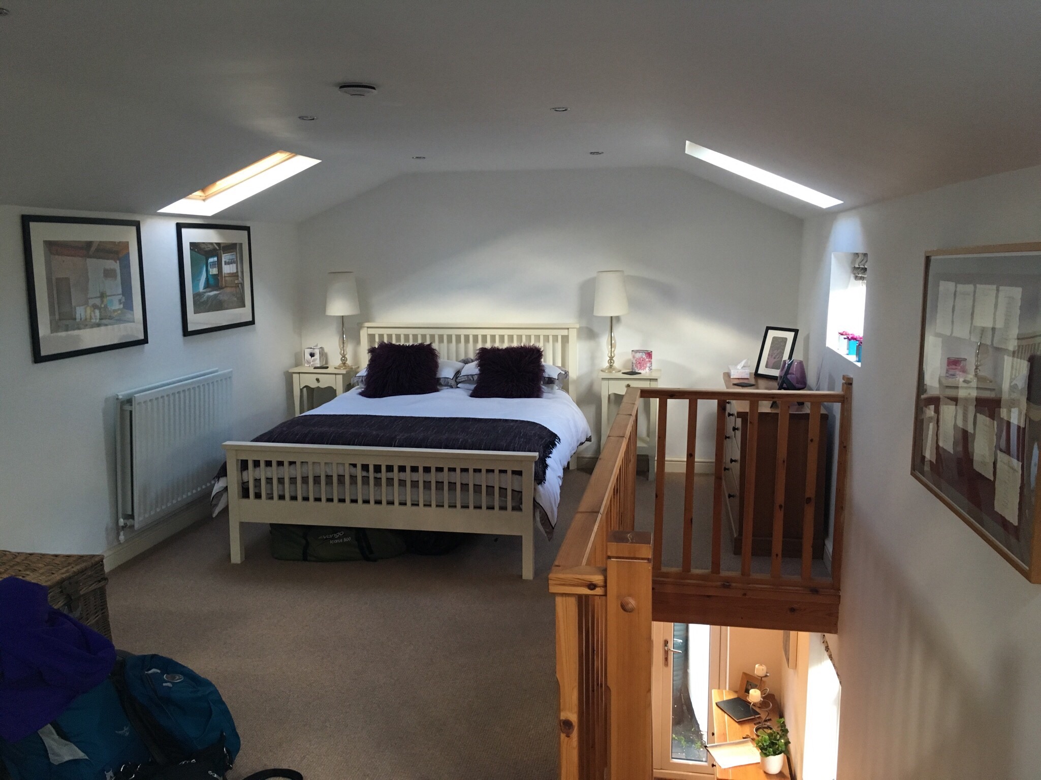
We dropped our house key in the neighbor’s mail slot and declared our first AirBnB experience a success. It was a nice way to spread out a bit along our route.  We were basically out of car food, but we got lucky and found a service area (gas/food) about 5 miles up the highway. We stocked up on water, sandwiches, carrots, and grapes for a later lunch (and wondered why gas stations at home can’t offer real food — it’s honestly what we’ve eaten every lunch so far).

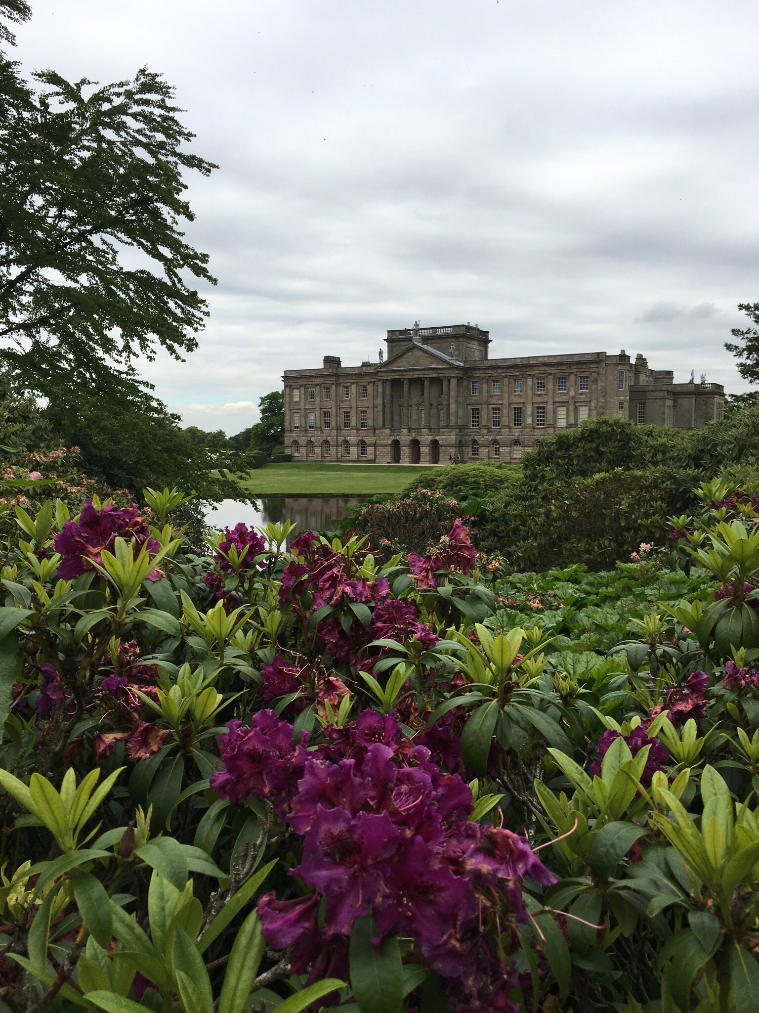
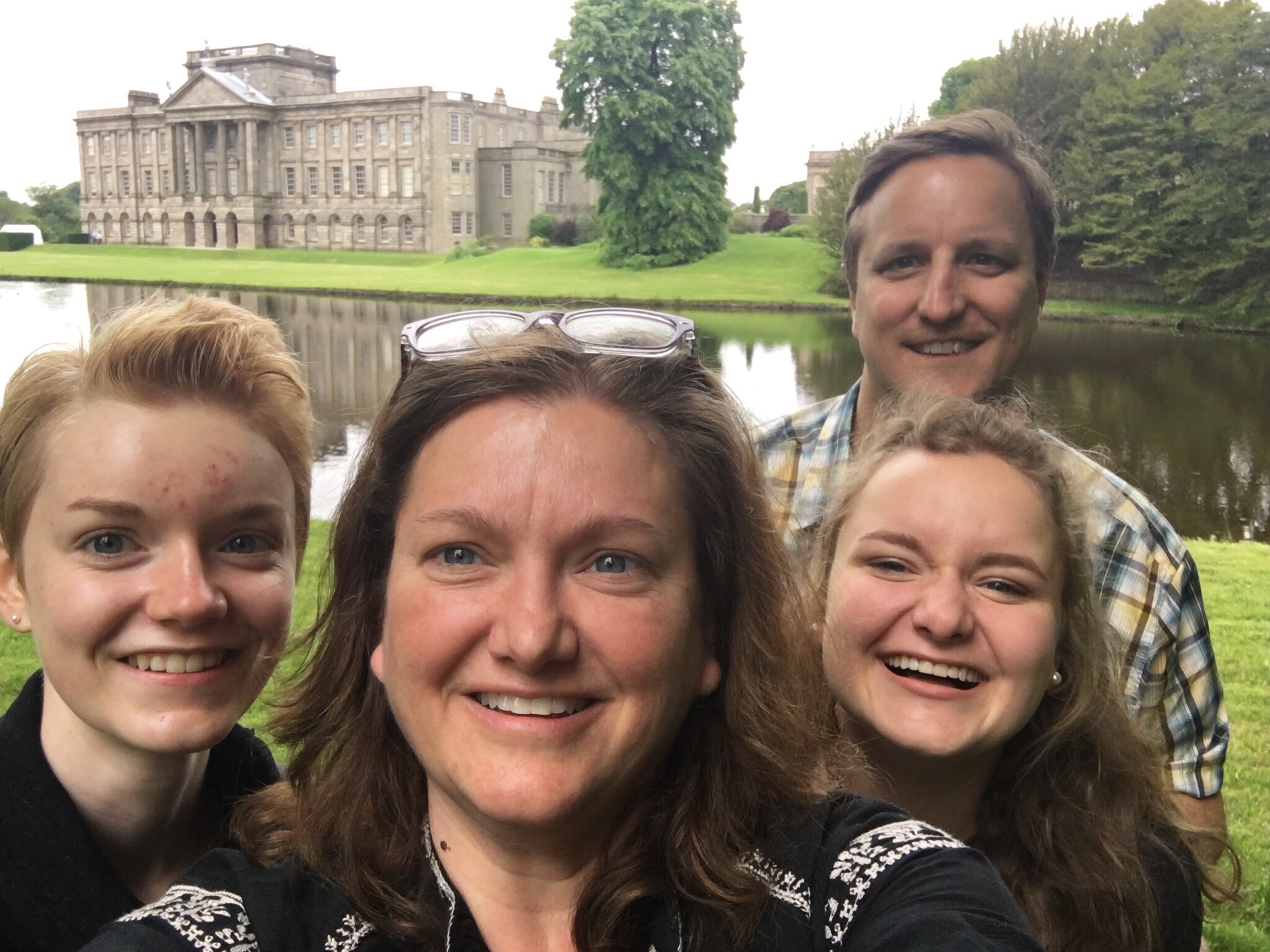
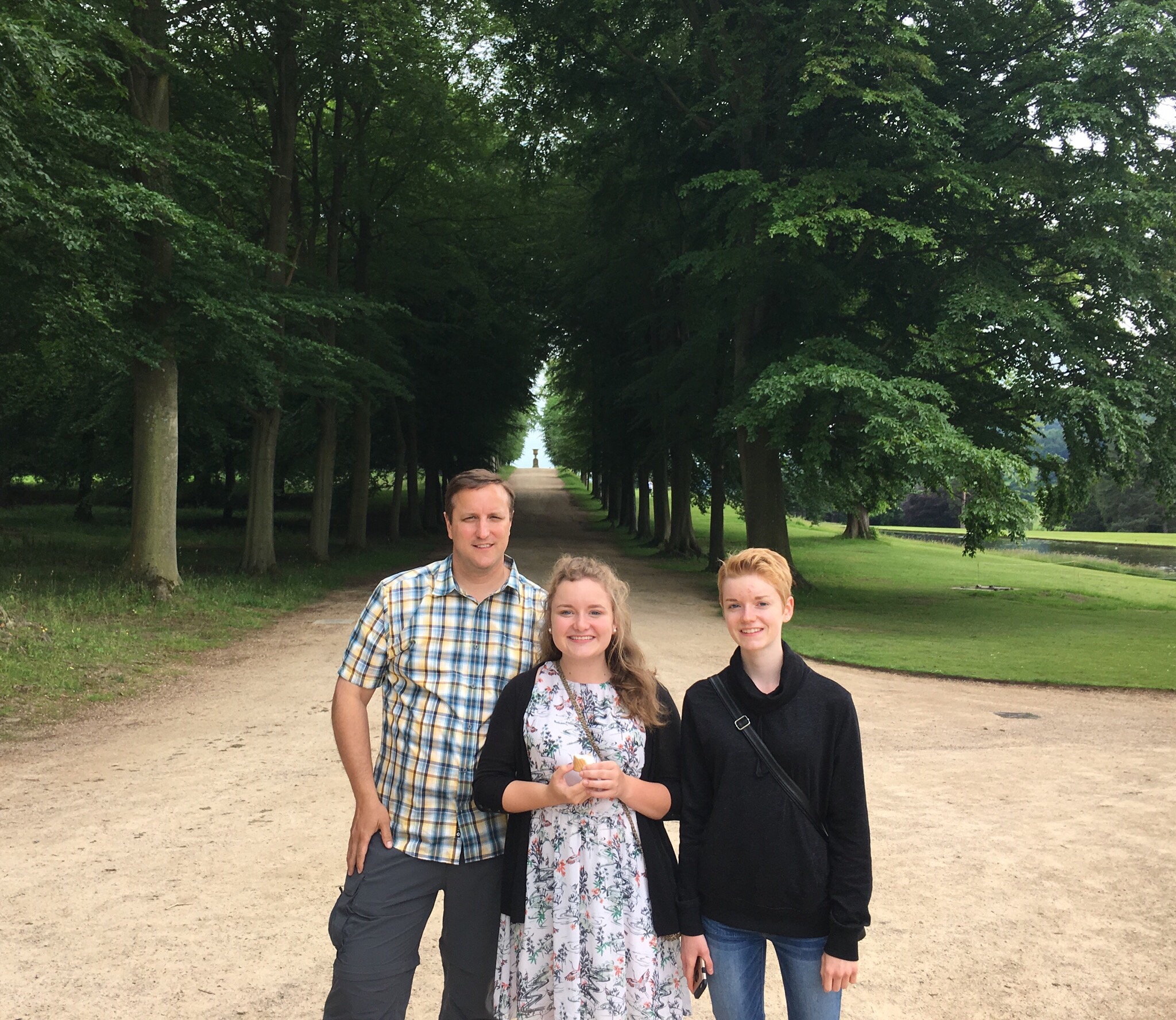
Lyme Park was the setting for the BBC’s 1996 version of Pride & Prejudice. The movie is a family favorite, and we were super excited to see the real place. We knew the grounds would be open but the house closed, so we decided to see all we could in an hour and then move on. We ended up taking about an hour and a half because the park and grounds were so beautiful. We also wasted some time watching everyone play with and walk their dogs. Only a few days into the trip, and we already missed our dogs.

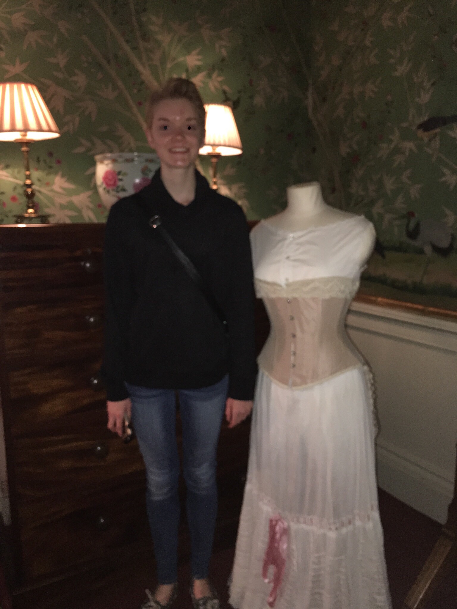
When the house is open, you can rent period dress for the day

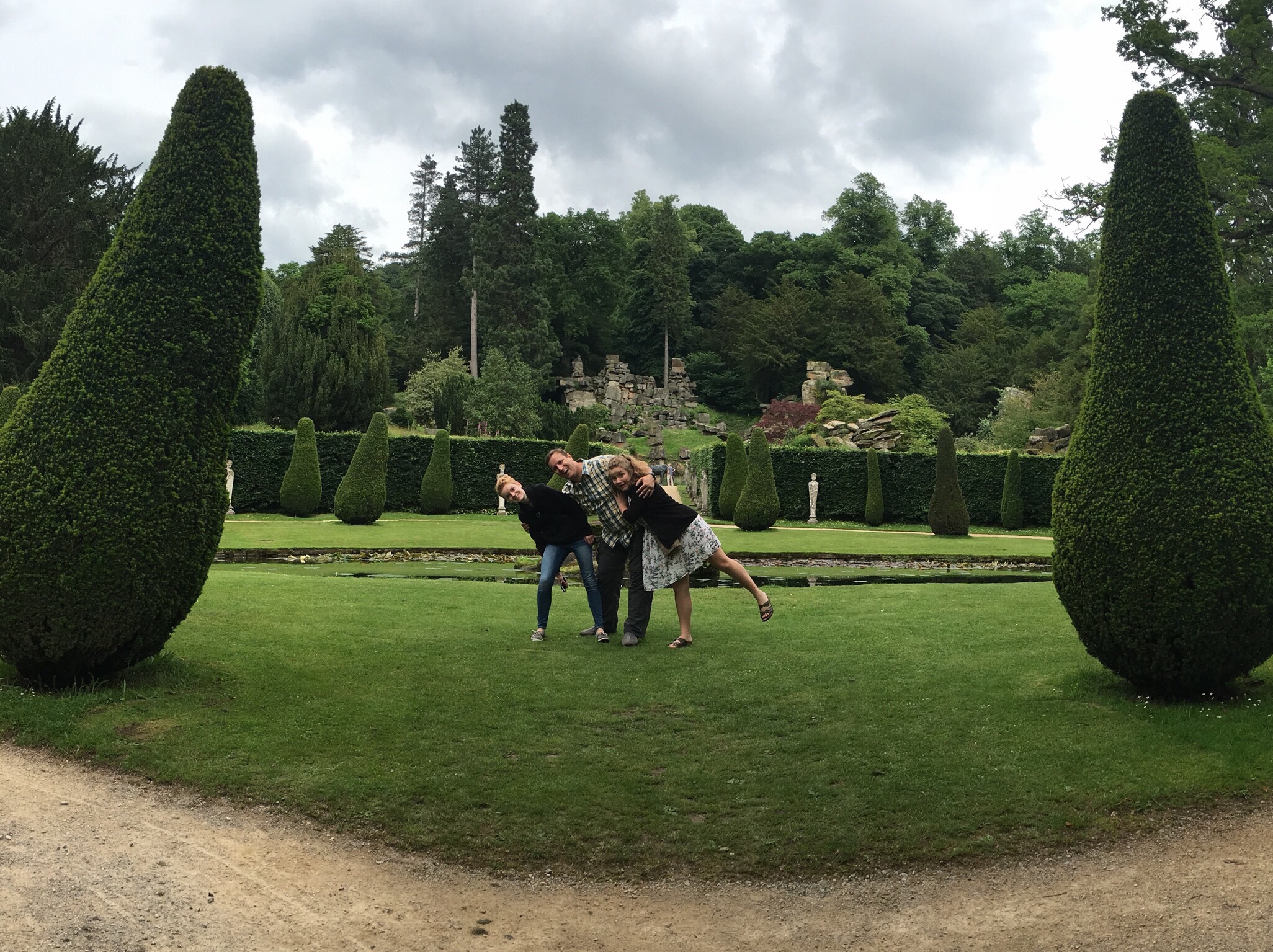
We made a special stop around the far end of the pond where Colin Firth’s Mr. Darcy famously dives into the pond and exits on the opposite side. What’s missing after the last pic is our children walking away as they try to pretend they don’t know us.

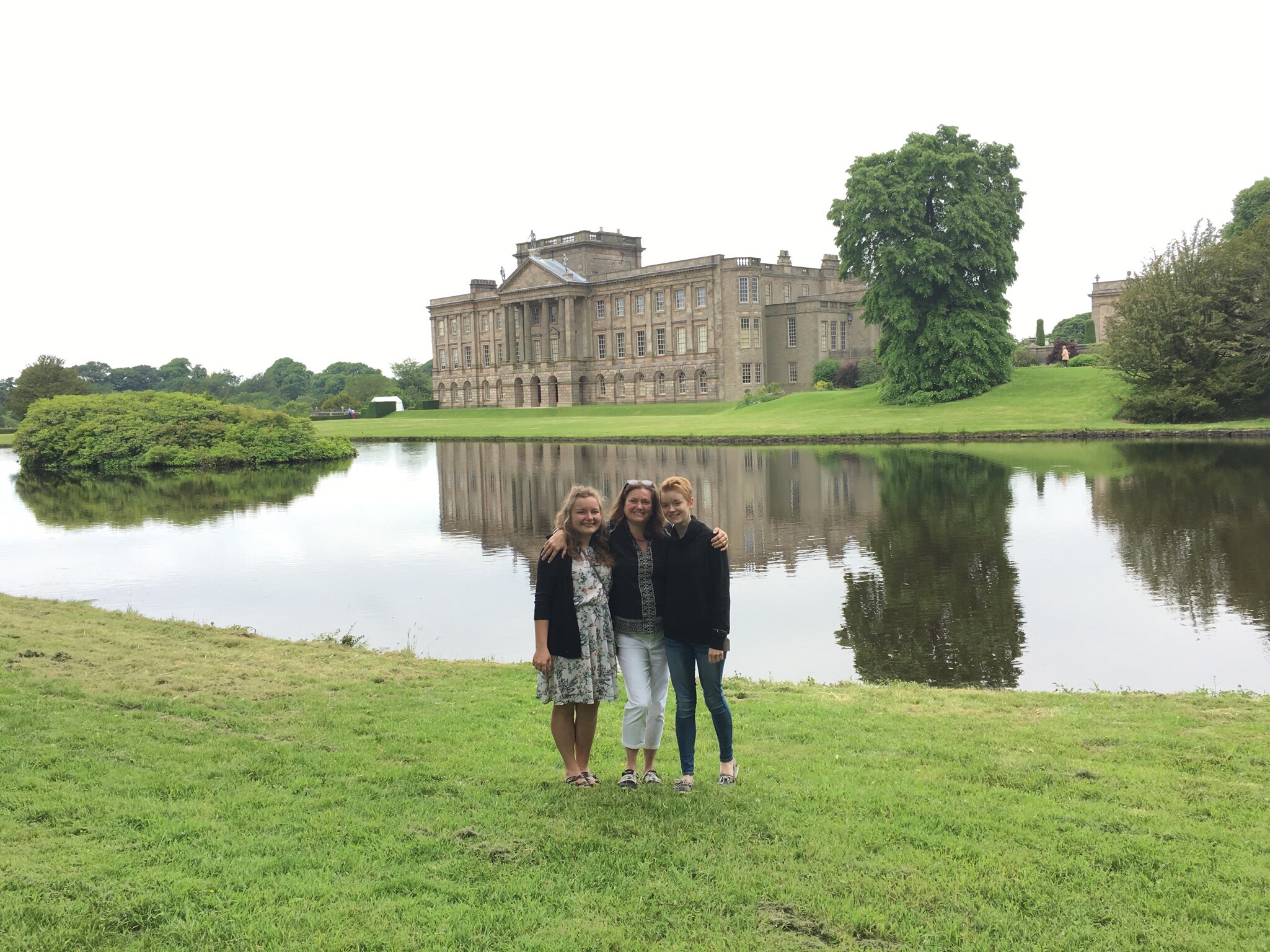
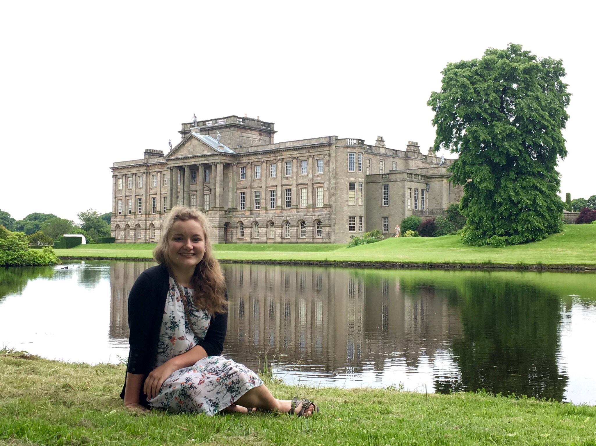
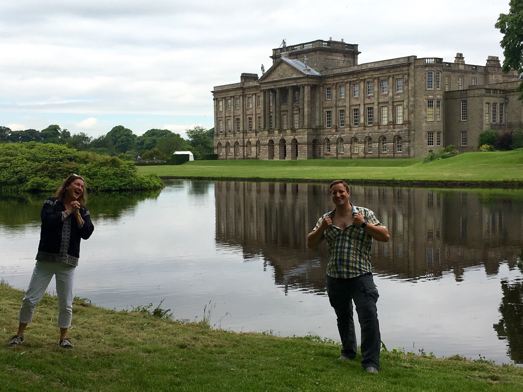
Re-enacting movie scenes while our kids beg us to stop


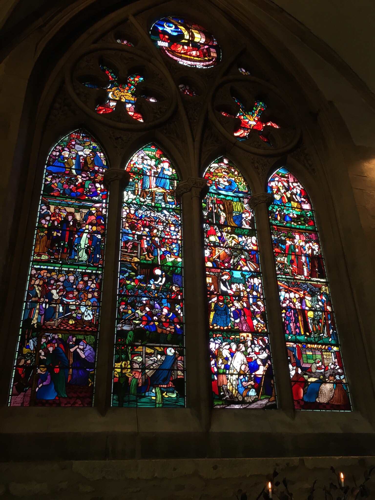
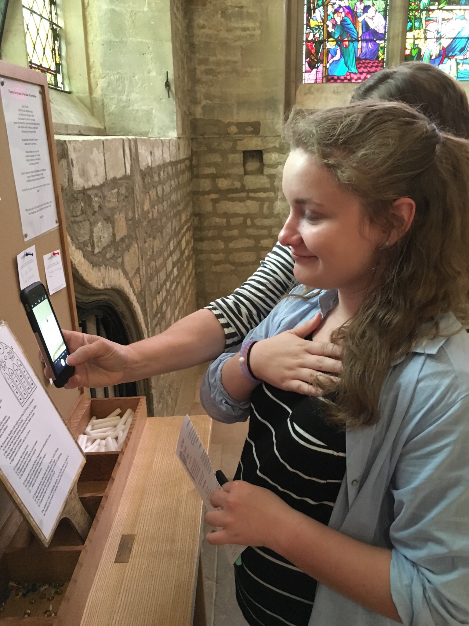
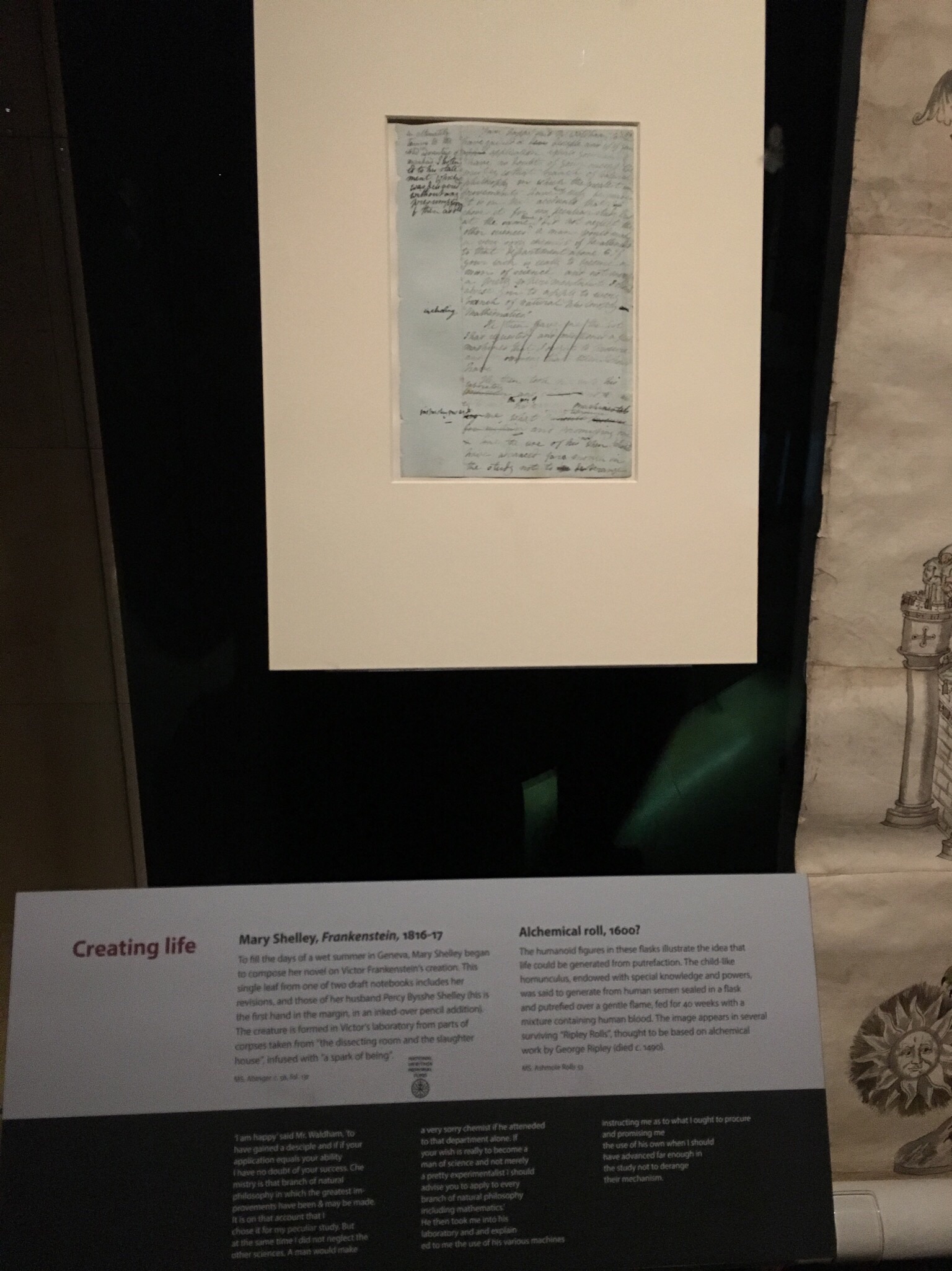
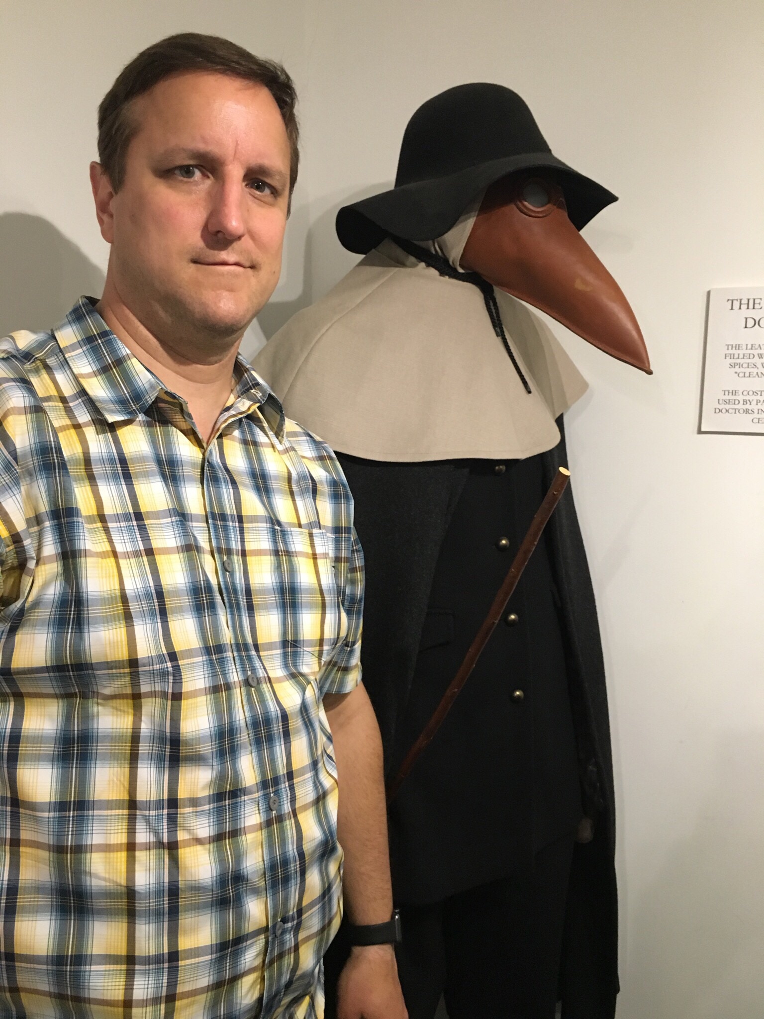
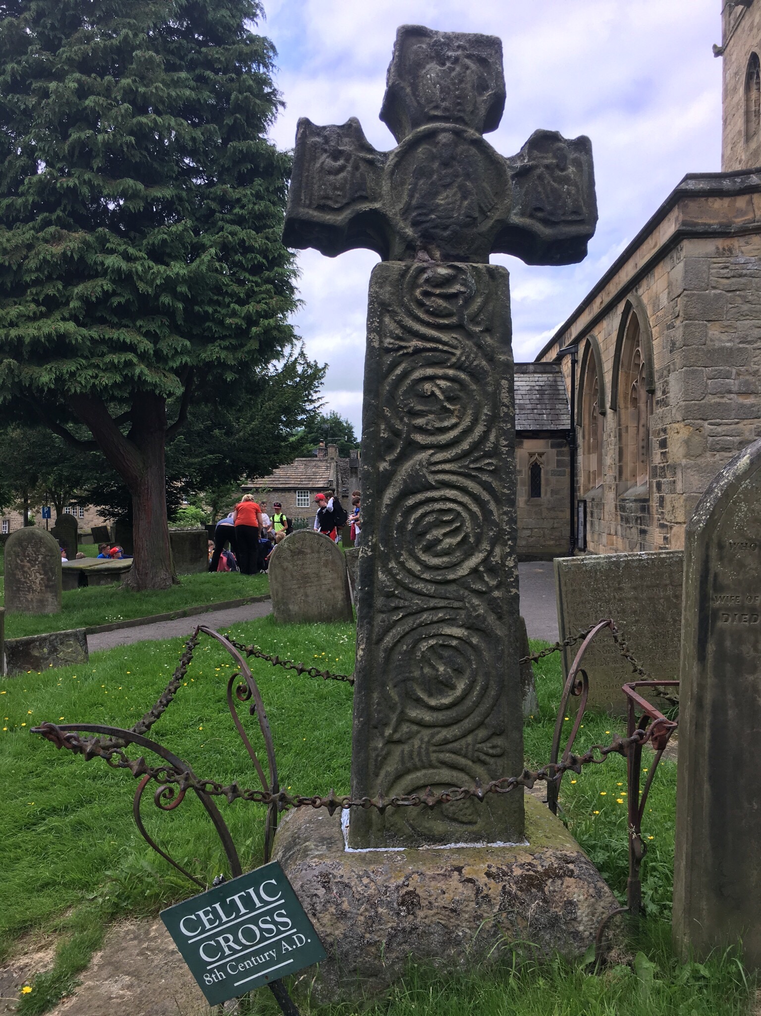
Our route then led us through the Peak District National Forest along some beautiful roads. We made a quick stop at Eyam, a small village best known for its decision in 1666 to quarantine itself for a full year as a plague outbreak killed a large number of residents. The museum’s displays told the personal stories of several families, and there were artifacts from the plague time on display. The most striking was the plague doctor’s uniform with its “beak” face covering. The face cover would have been filled with herbs in an effort to stop the disease from spreading. Several cottages were marked as the first outbreak  homes, and we paused there briefly before walking down to the churchyard. There is an Anglo-Saxon cross in the cemetery that dates to the 8th century and is now the town’s notable landmark.

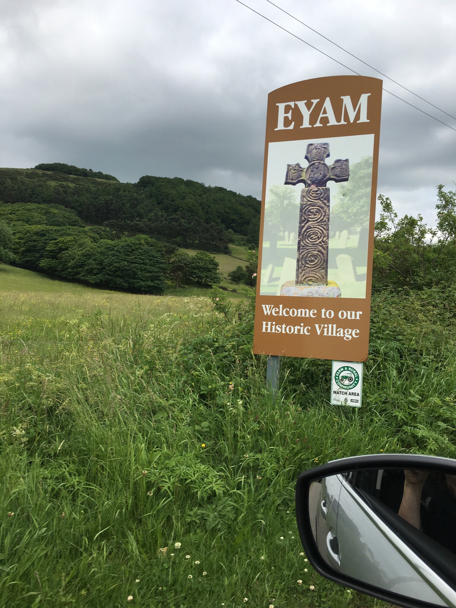
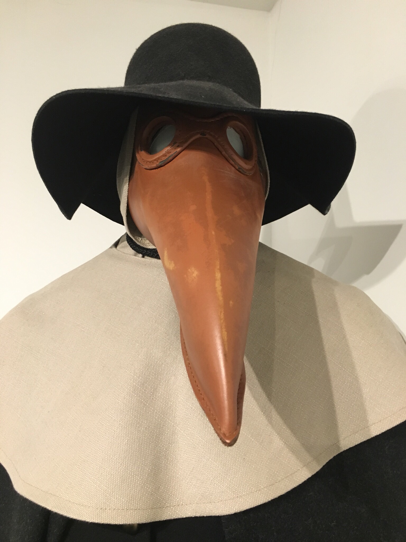
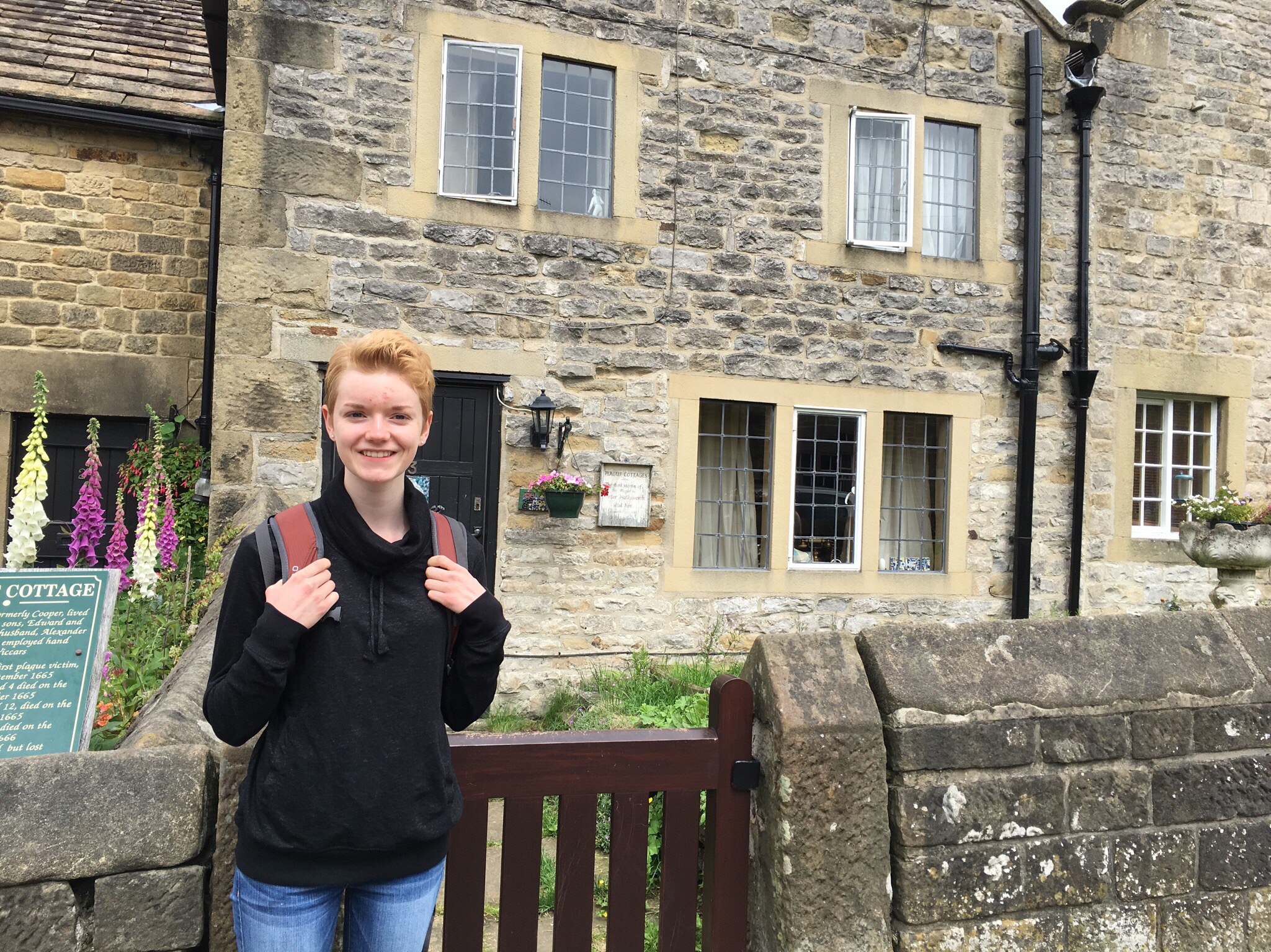
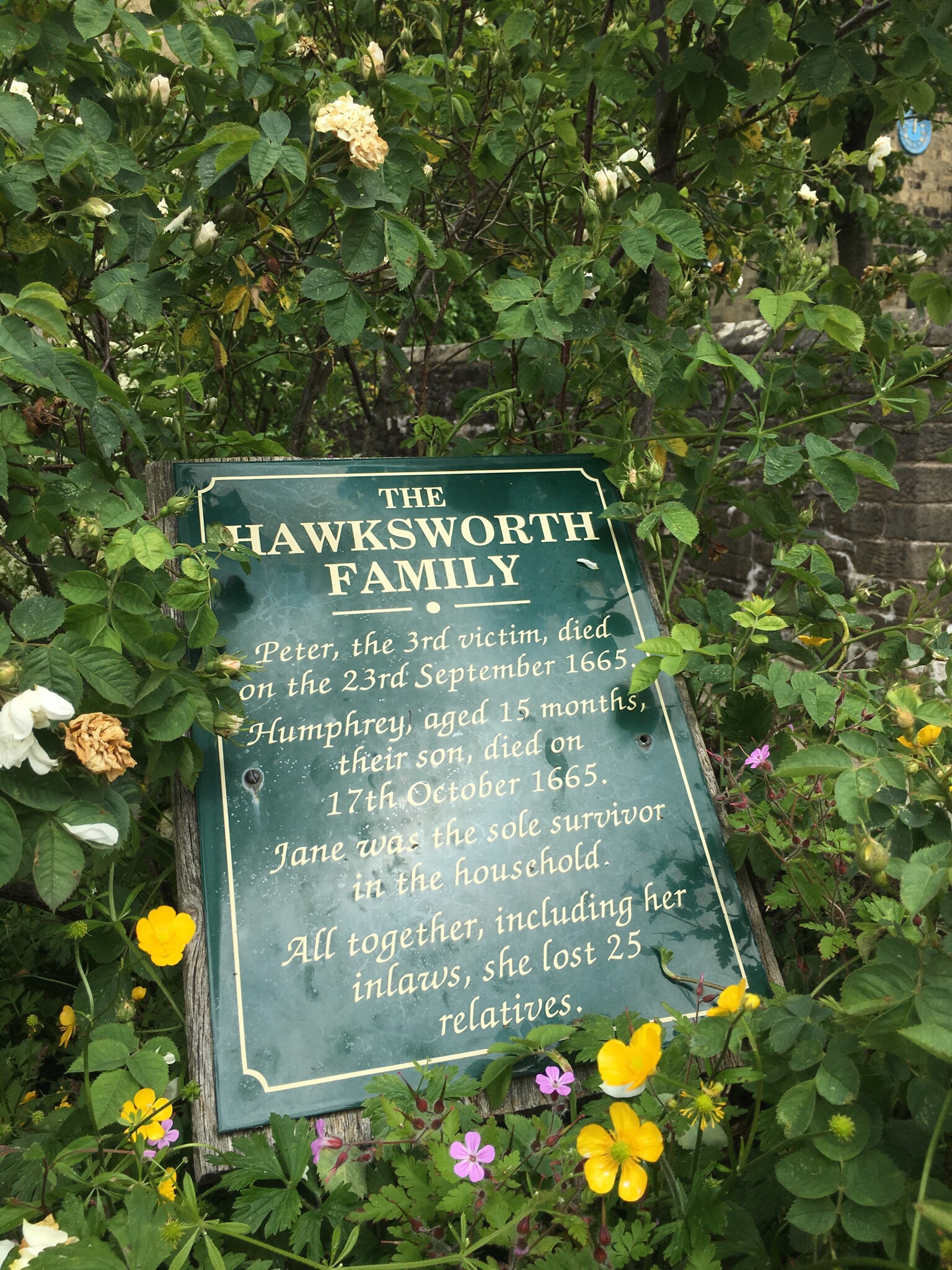
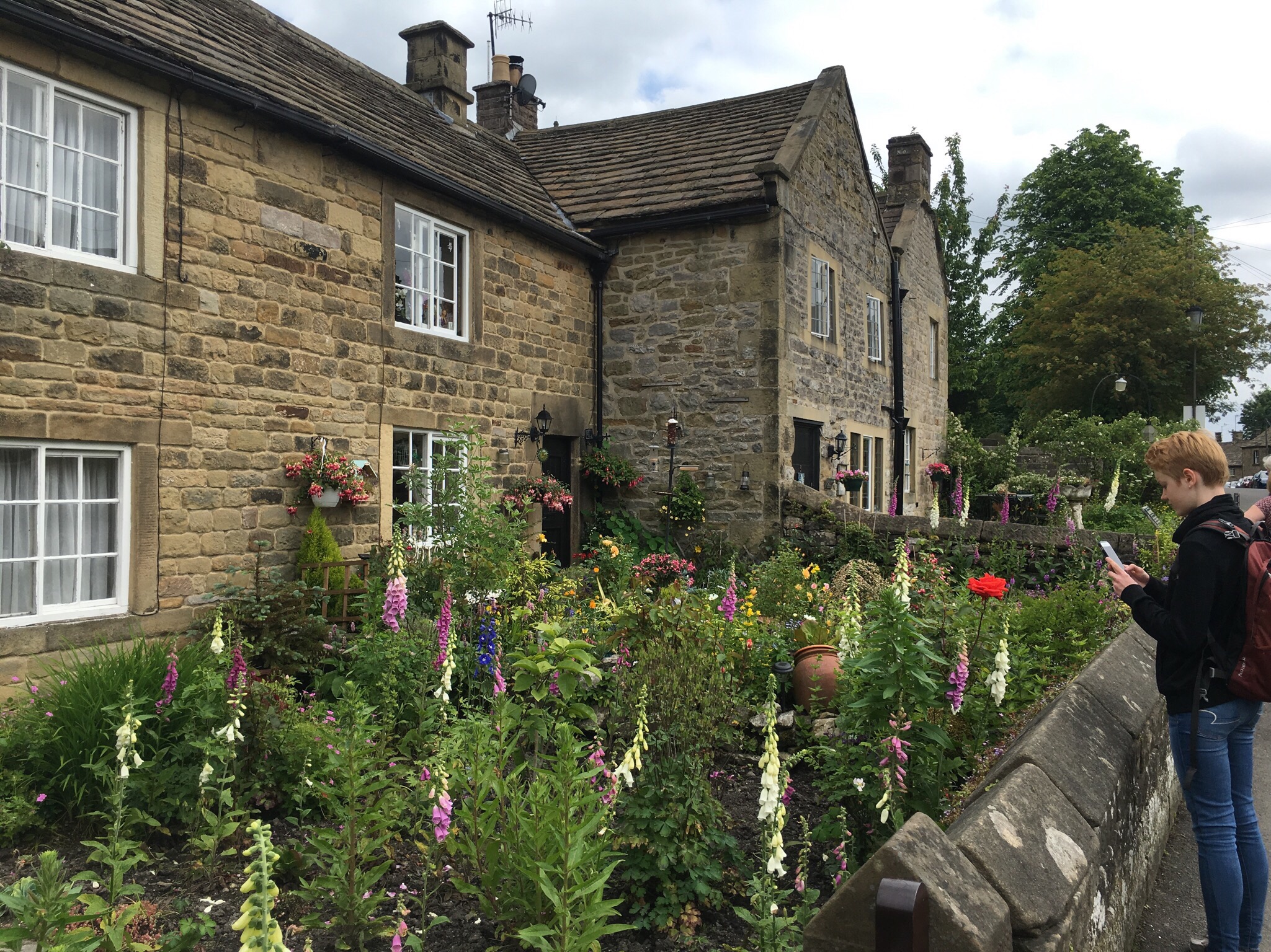
Ground zero for the village’s 1666 plague outbreak

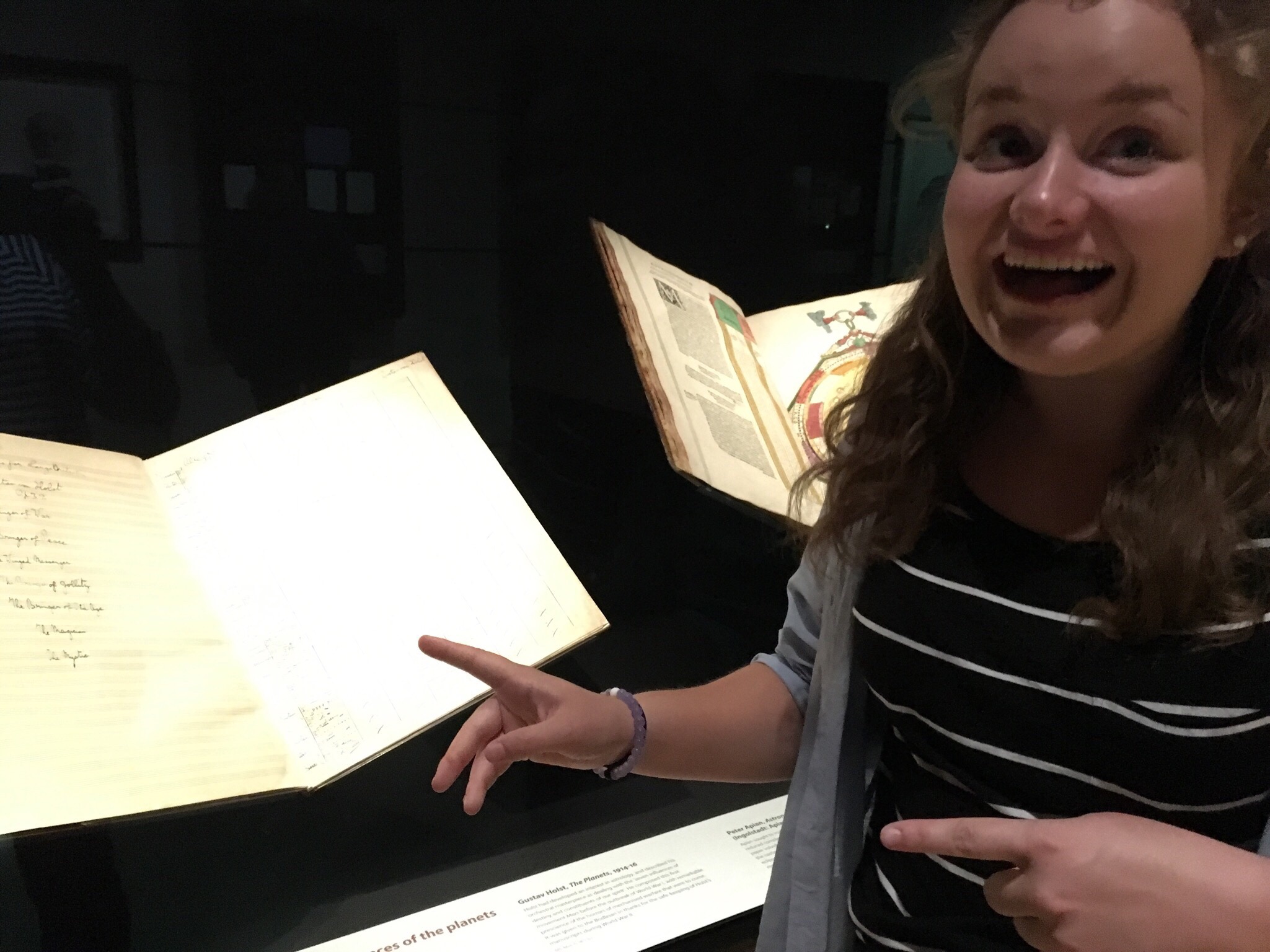
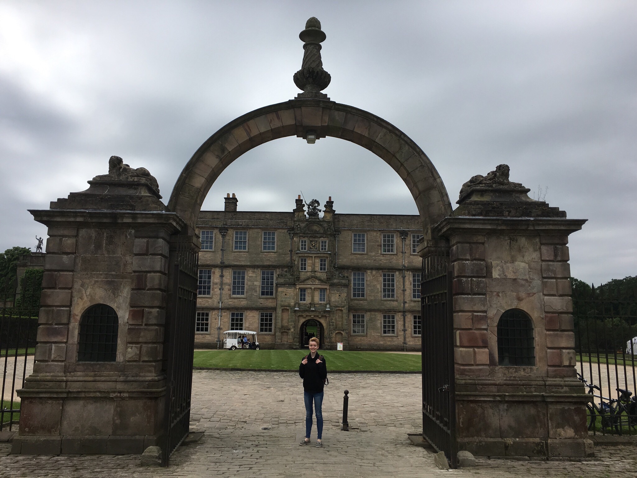
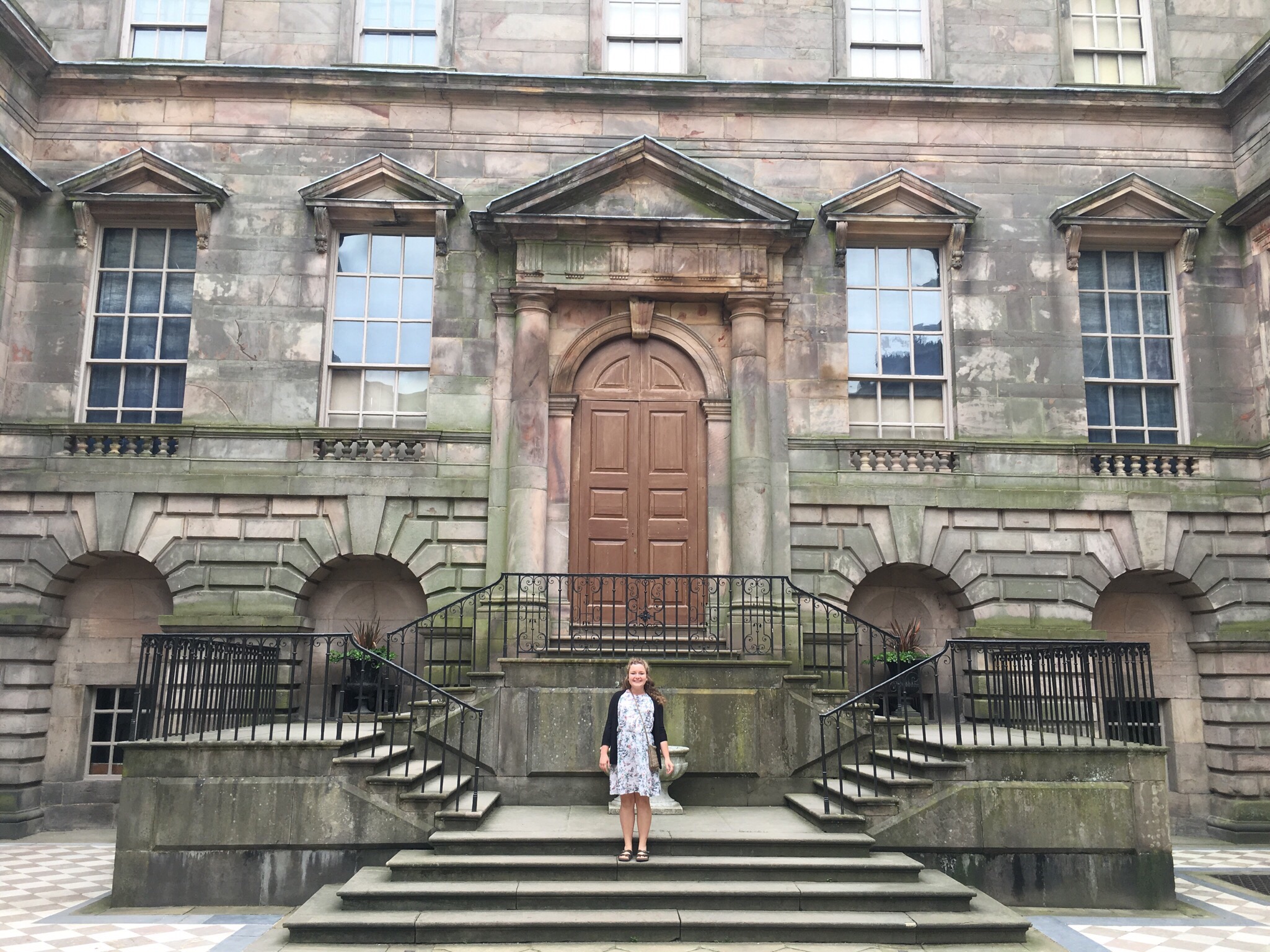
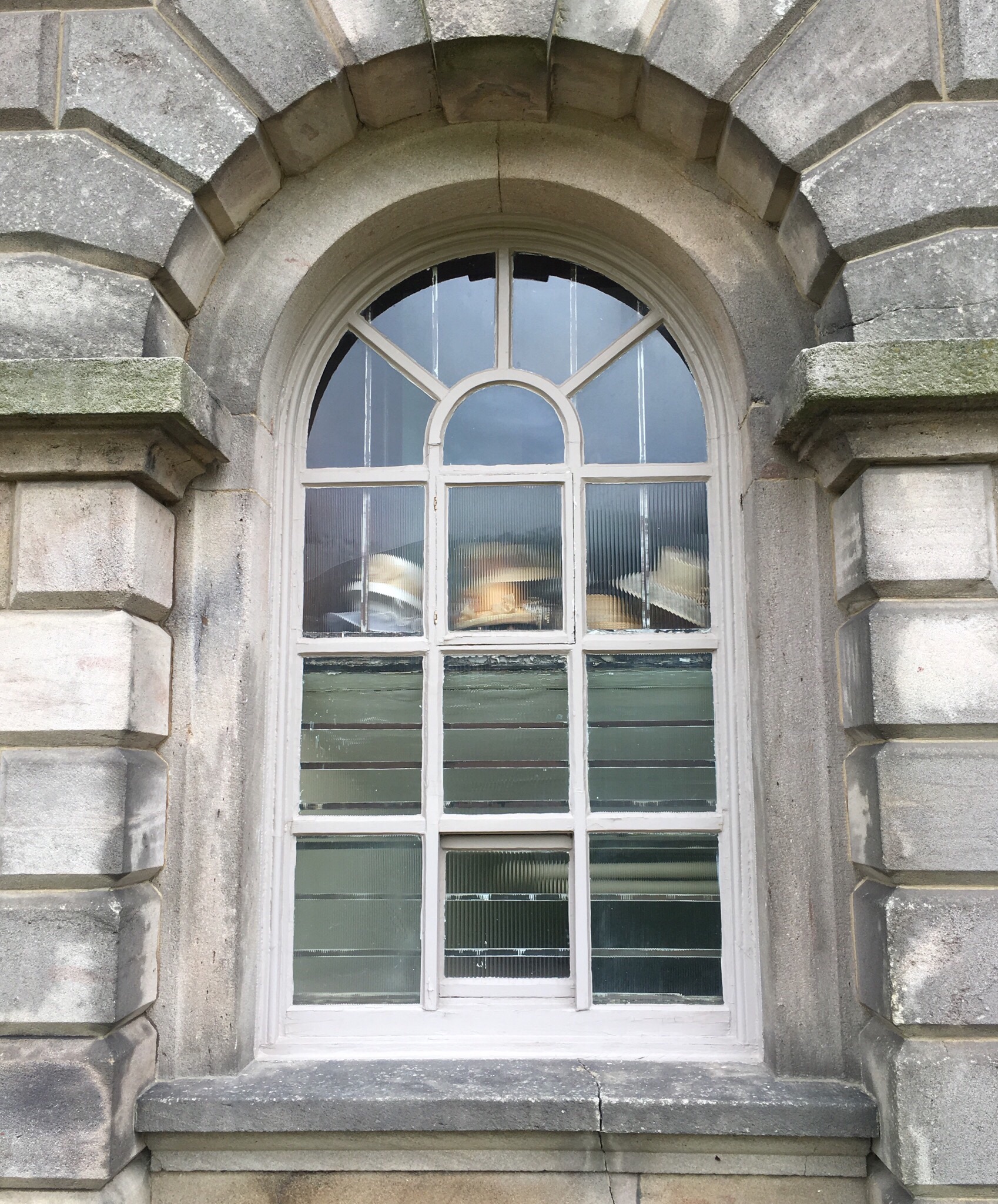
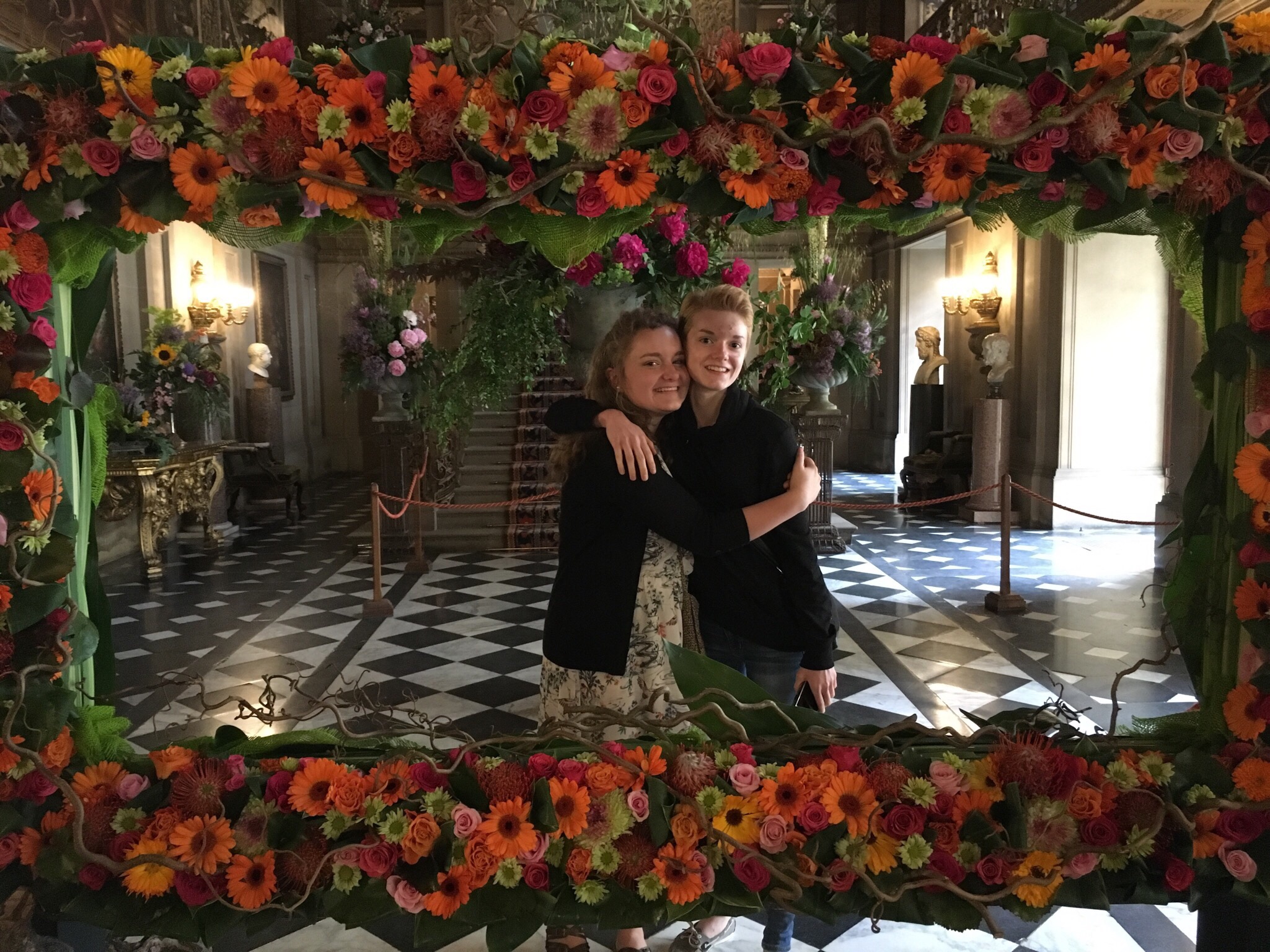
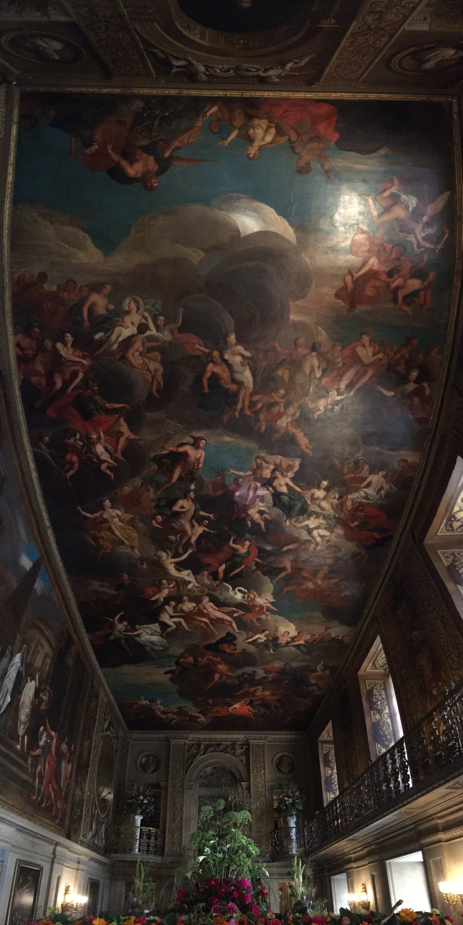
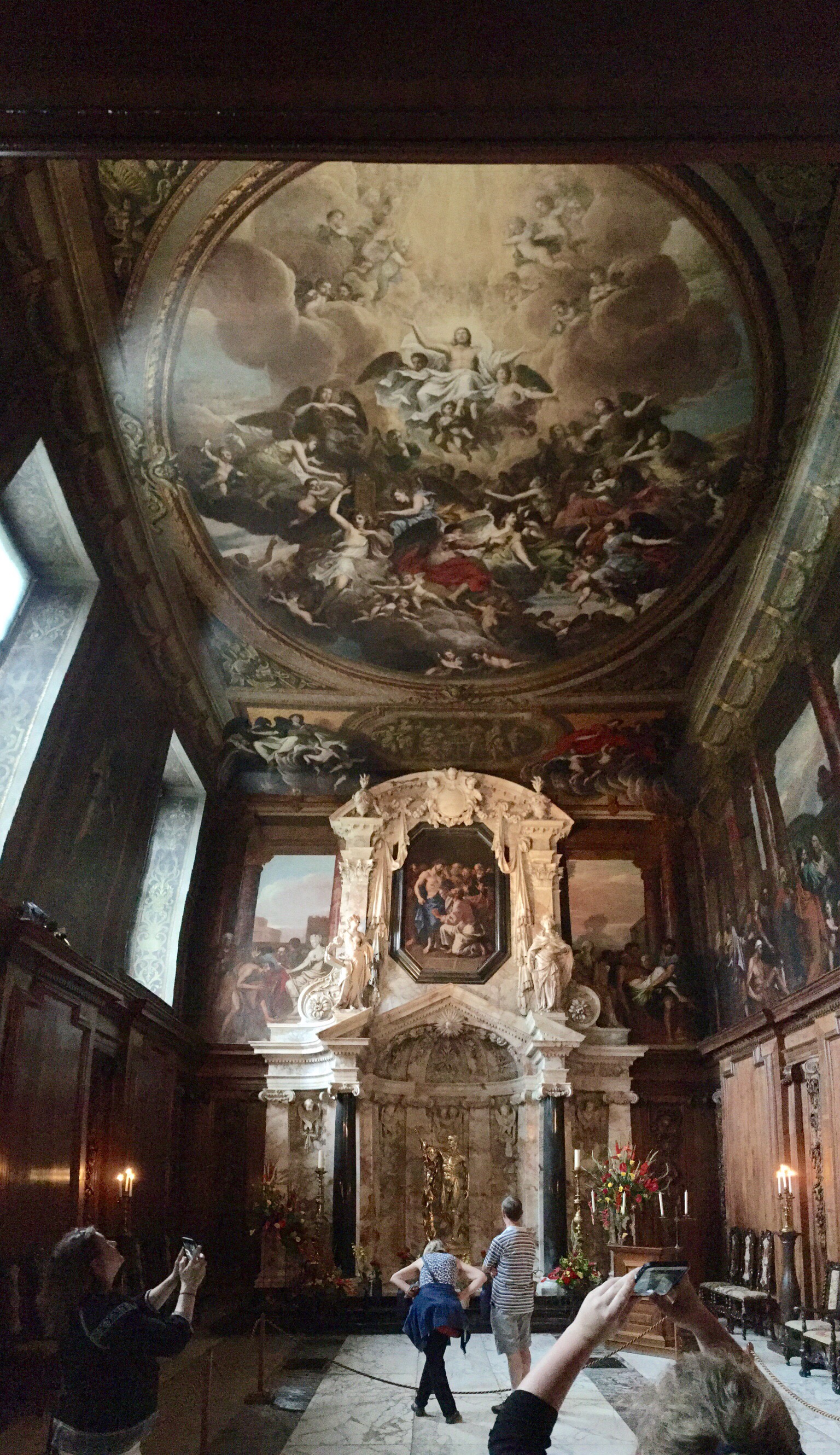
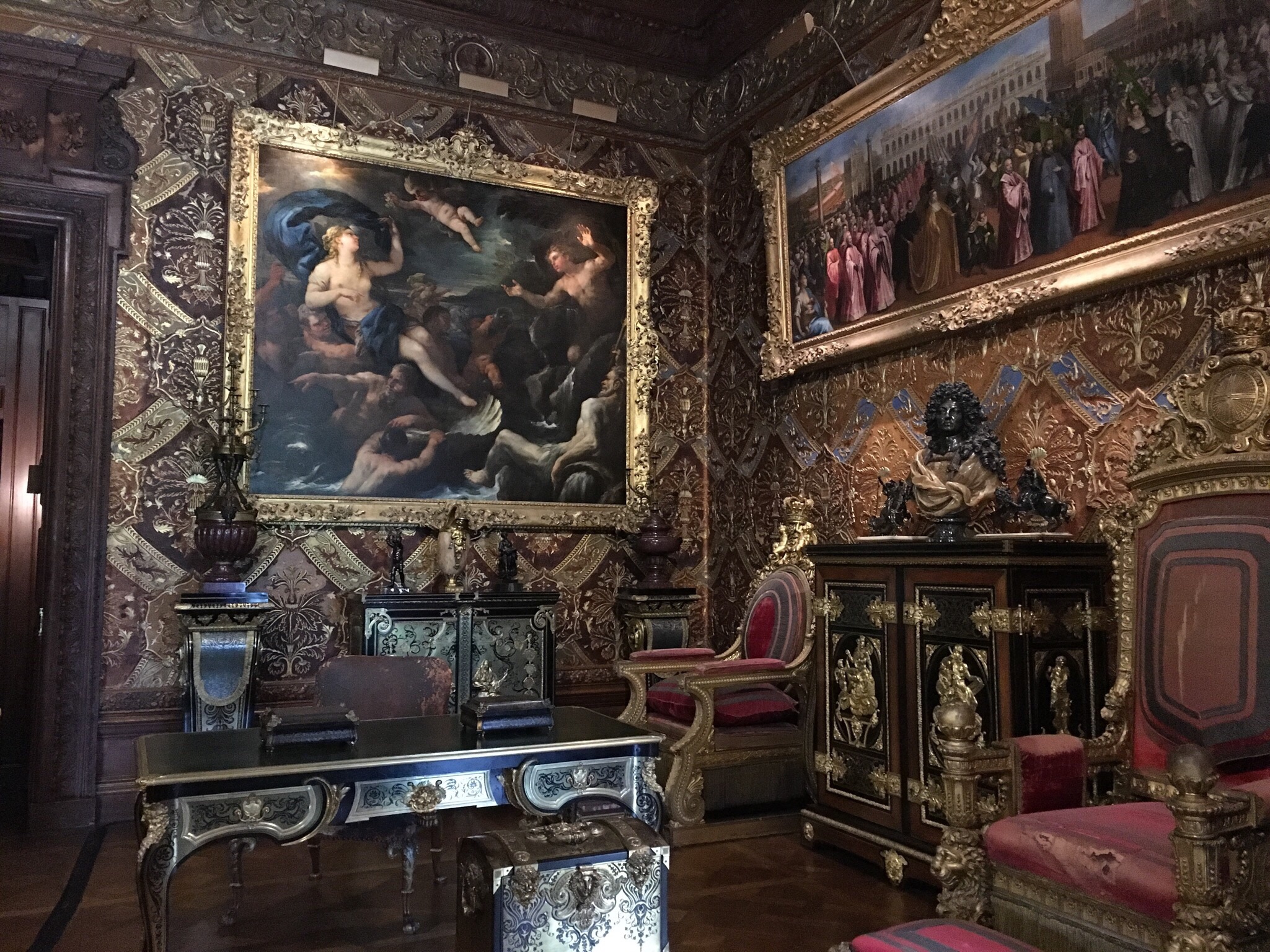
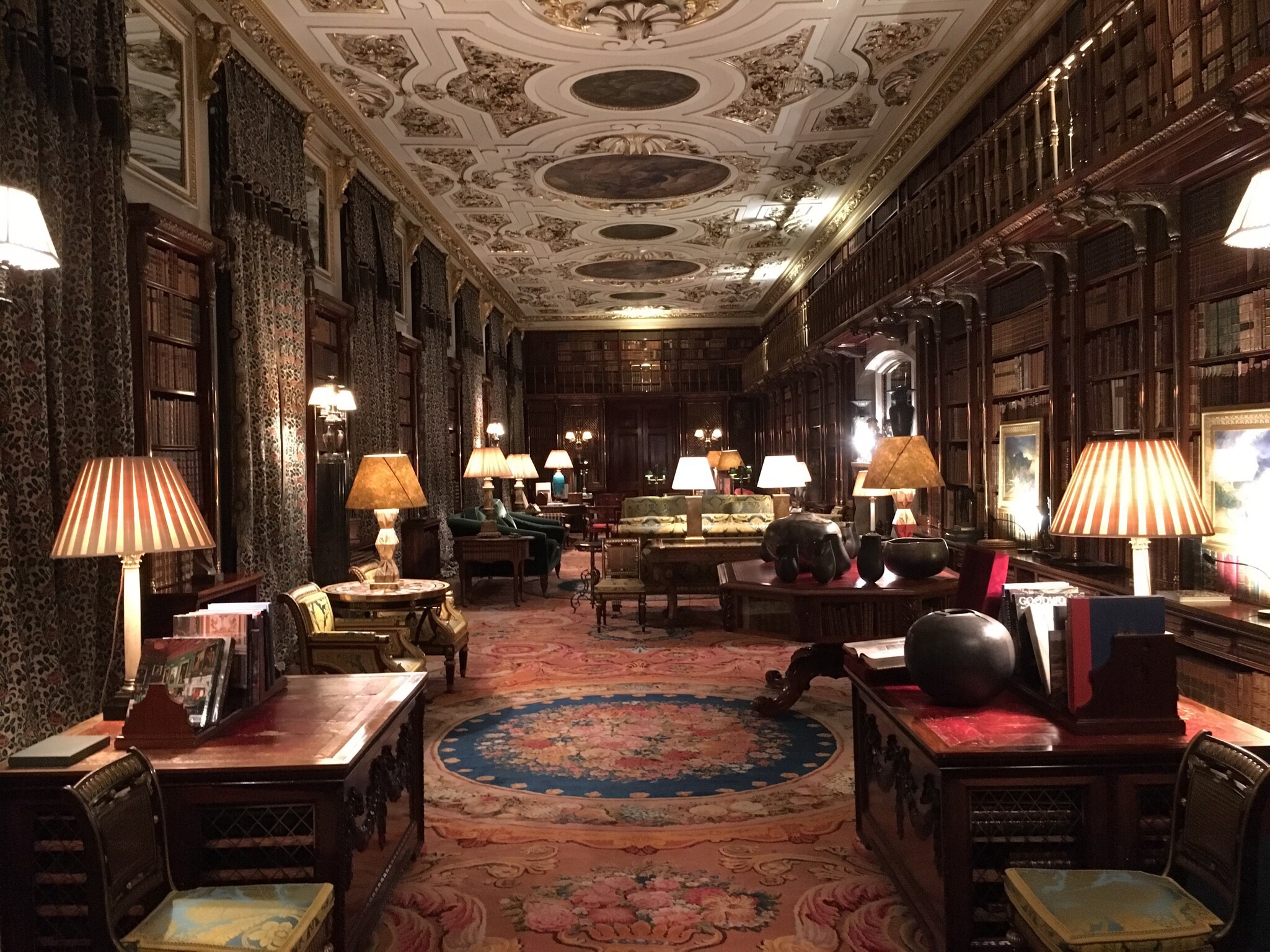
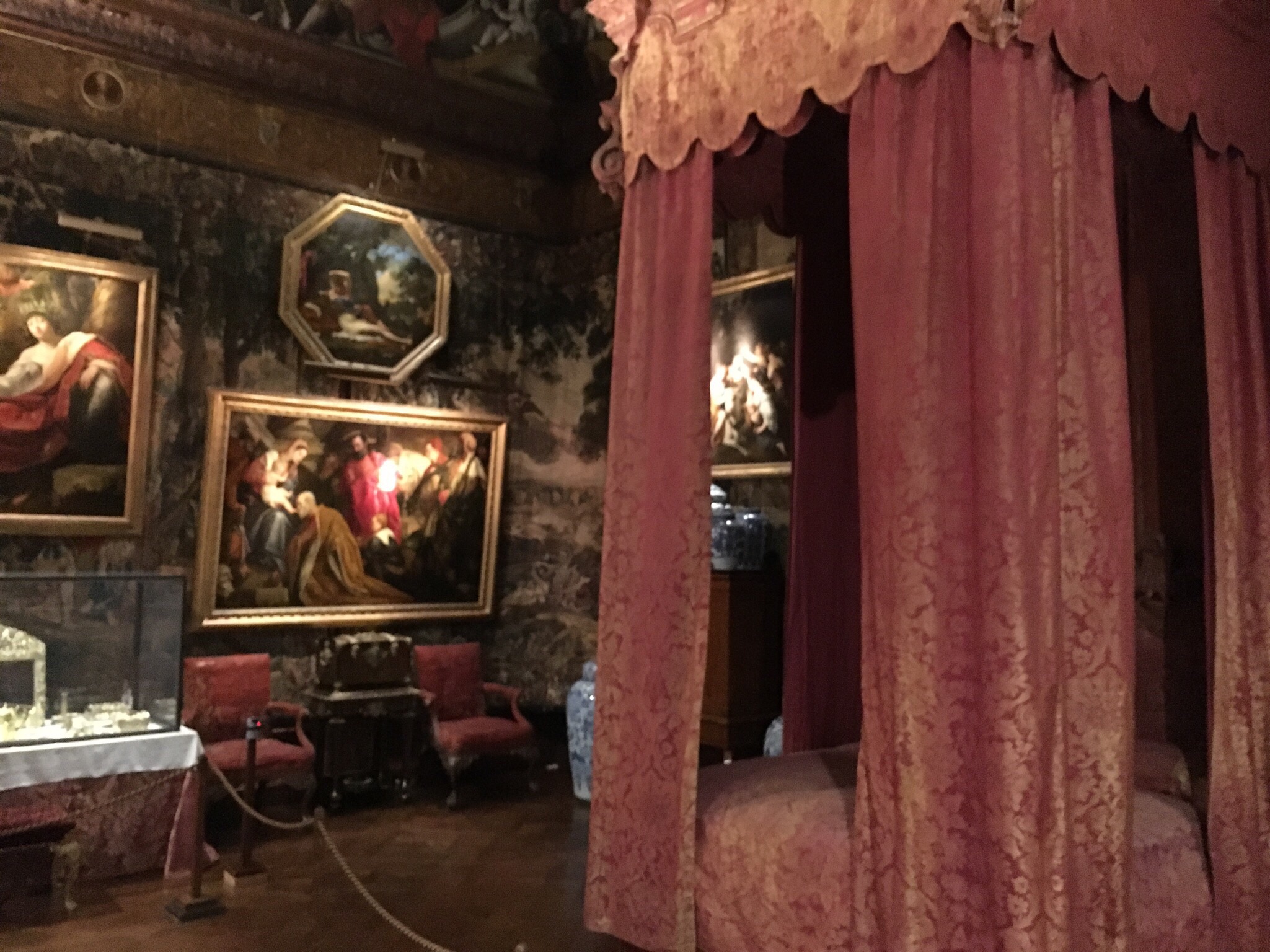
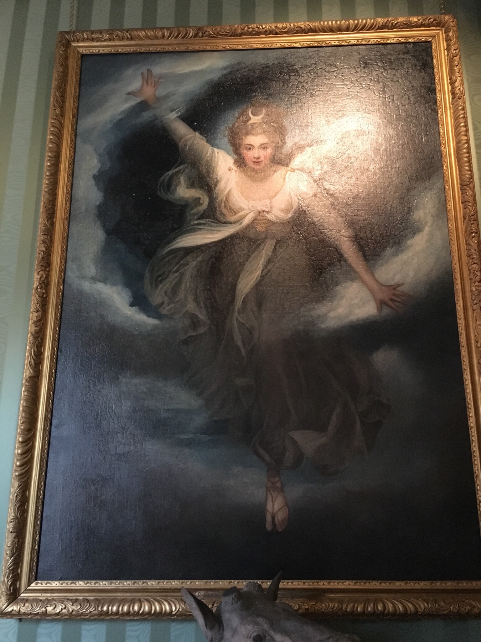
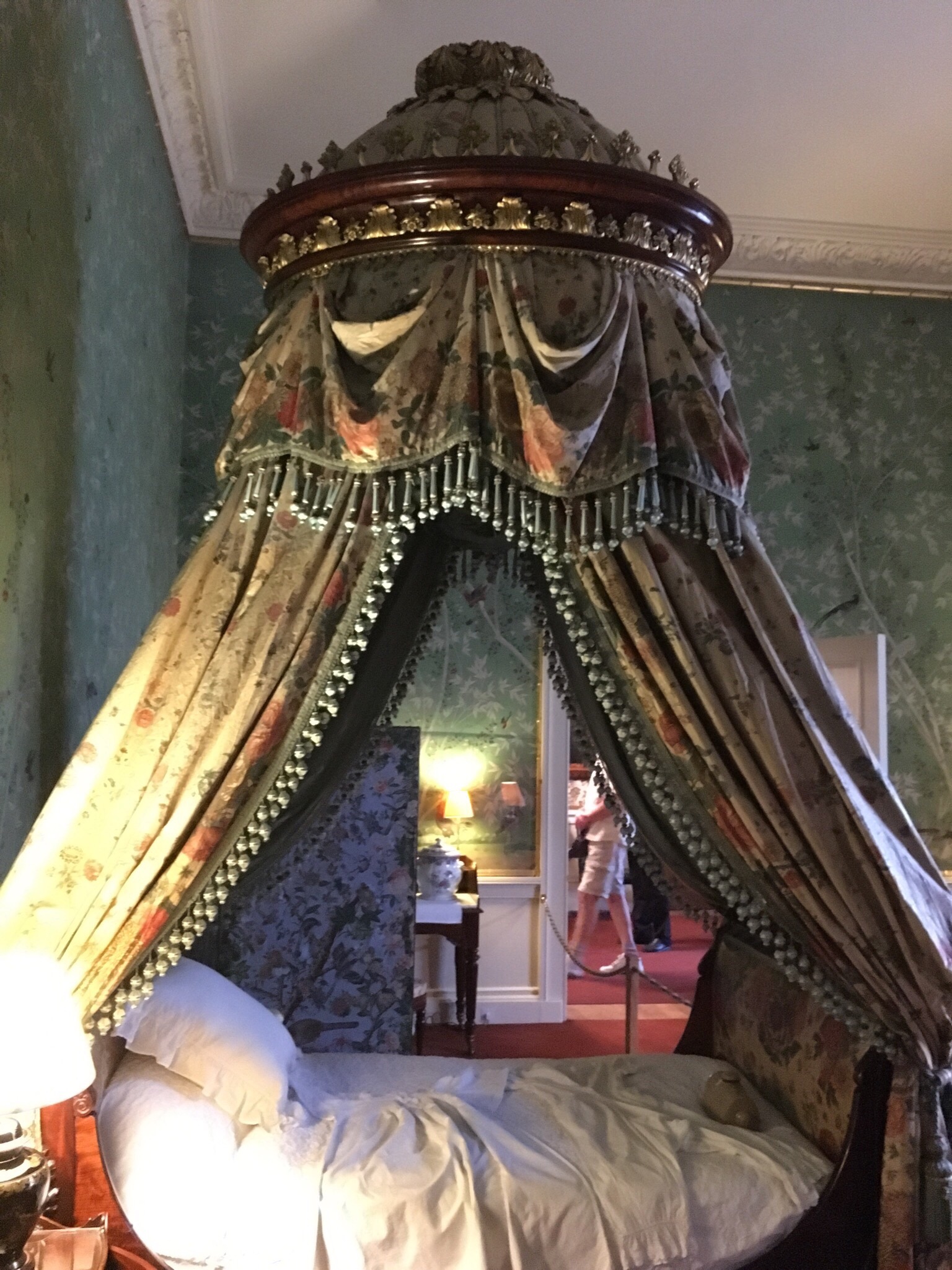
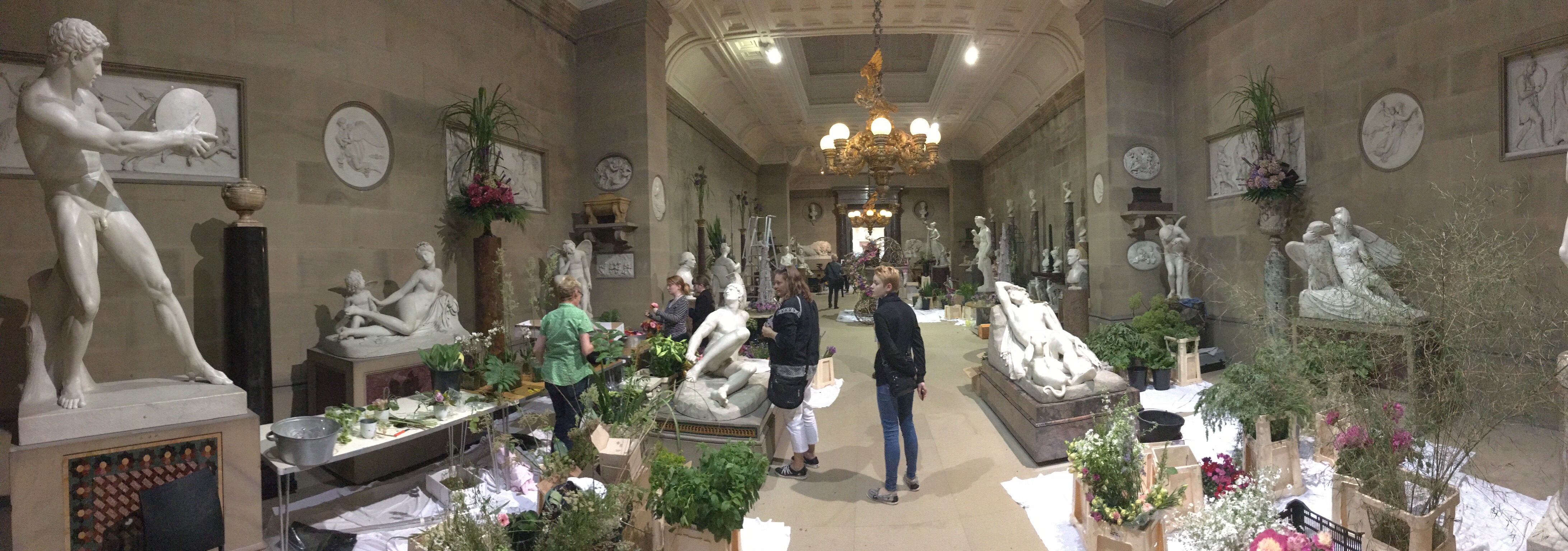
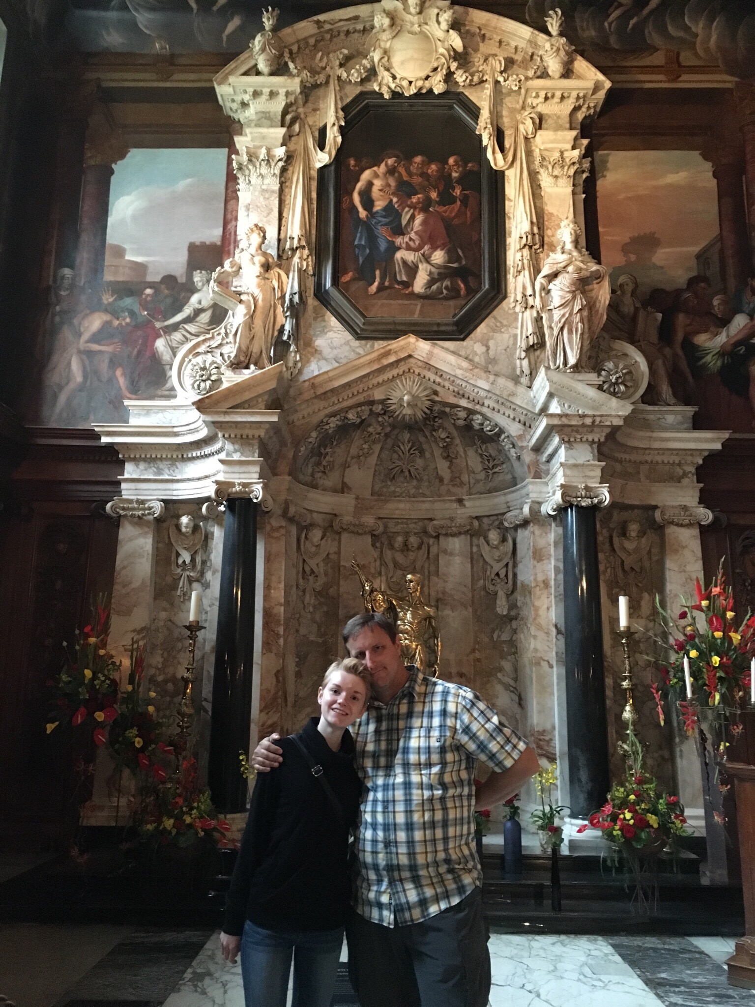
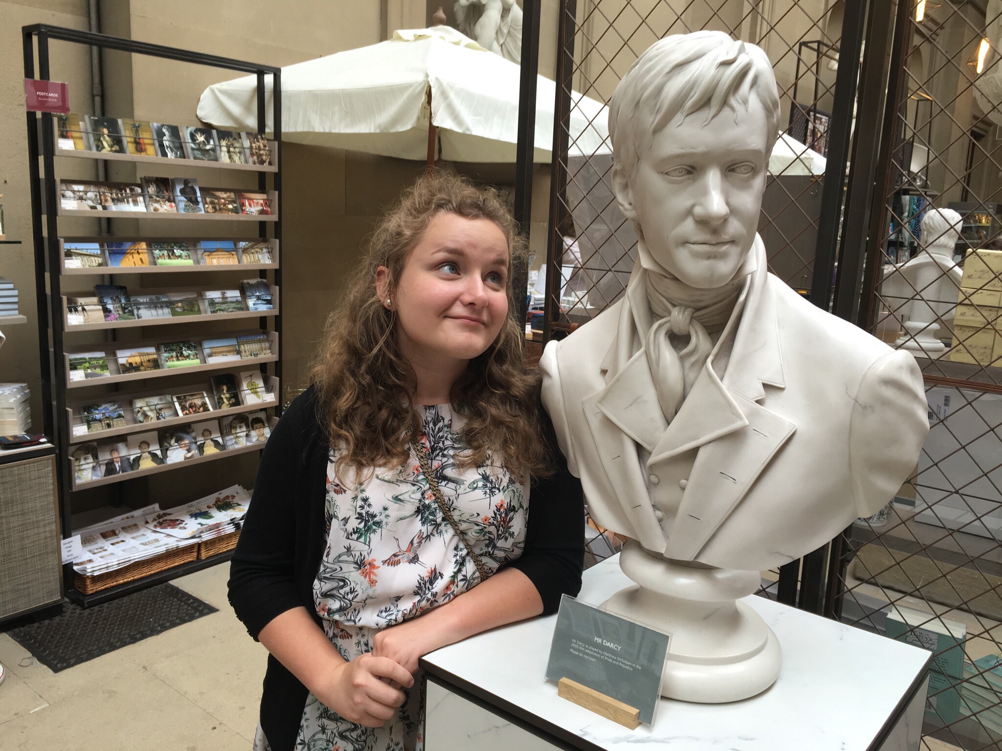
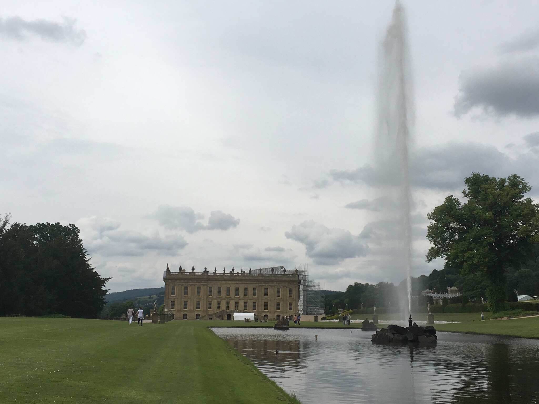
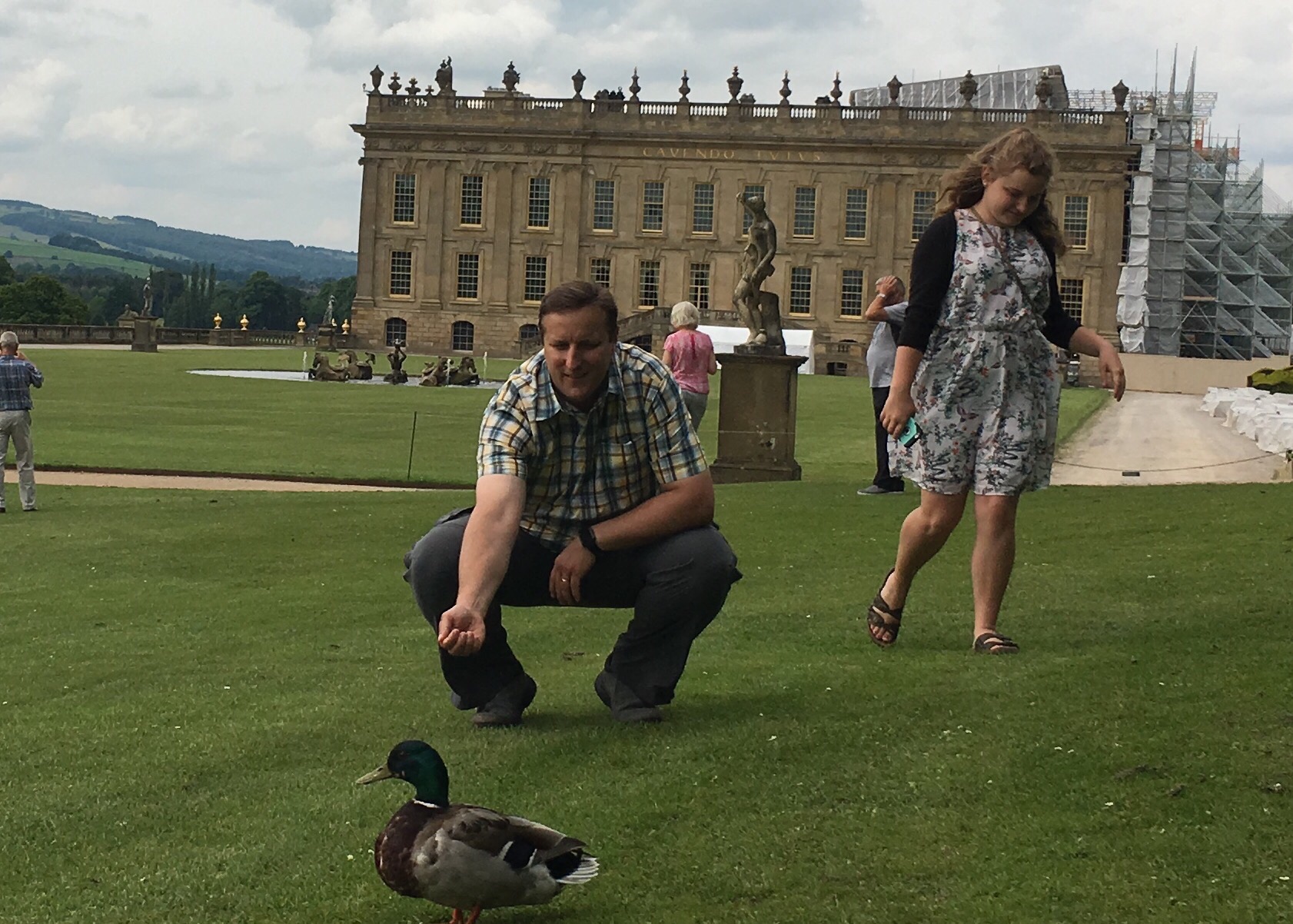
We were making good time, so we decided to balance our Pride and Prejudice tour by visiting Chatsworth House. While Lyme Park had served as Pemberley in the 1996 BBC movie, Chatsworth House served as Pemberley in the 2005 movie with Kiera Knightley. It is the home base for the titled Duke of Devonshire. Currently, it has been privately owned by the Cavendish family since 1549, and it houses the private art collections for the long family line. Several people who have lived in the home made multiple trips to Europe to collect interesting pieces and bring them home. The family still lives in part of the house, but the rest of the home is open to visitors during the day. We bought our tickets and walked the path that led through the house. In each room, we could pick up a laminated card that detailed what room we were in, what purpose it has served, and what art or interesting furnishings we were seeing. The whole place was really way over the top, and we ended up staying in the house much longer than originally planned.

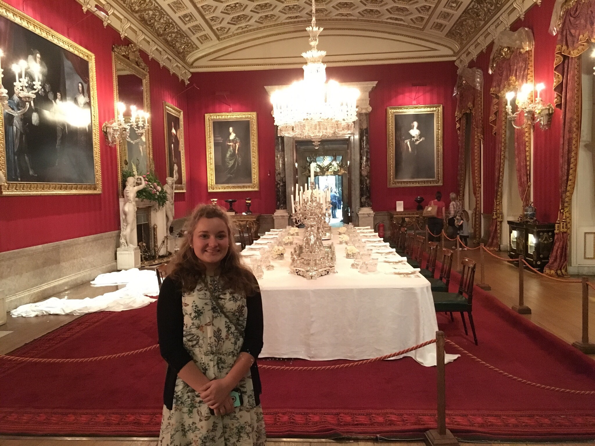
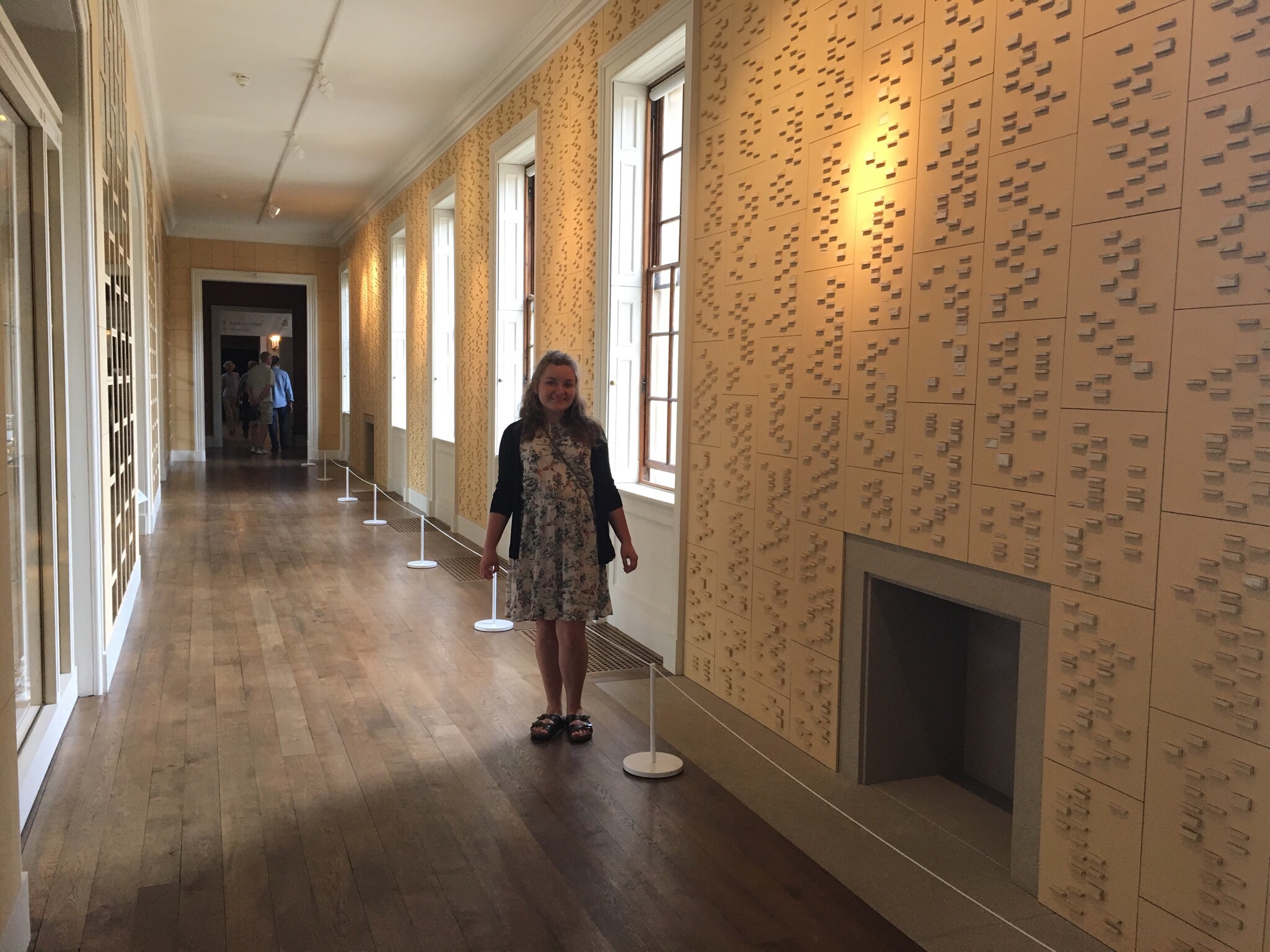
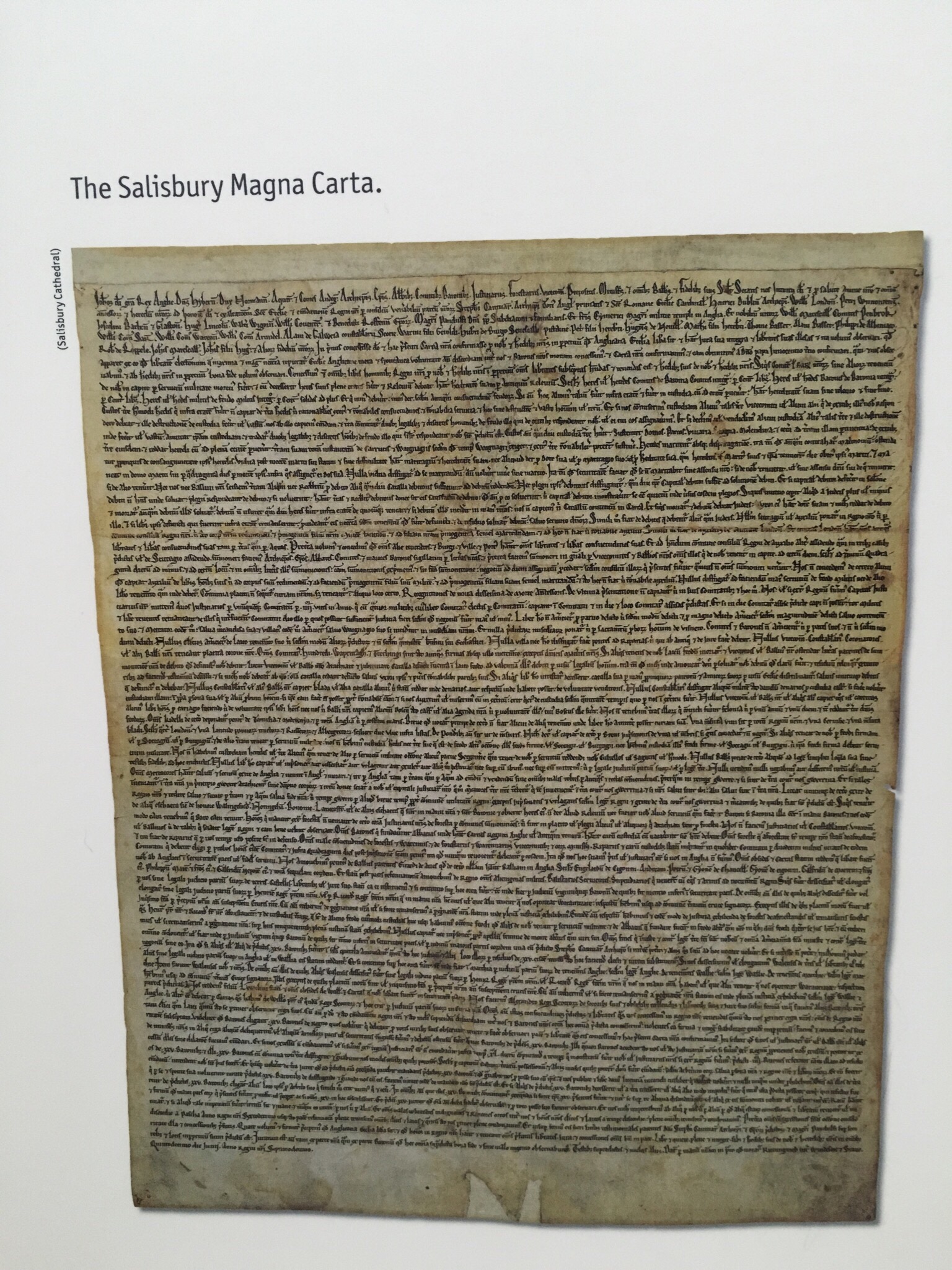
DNA sequence for the Duke of Devonshire’s family

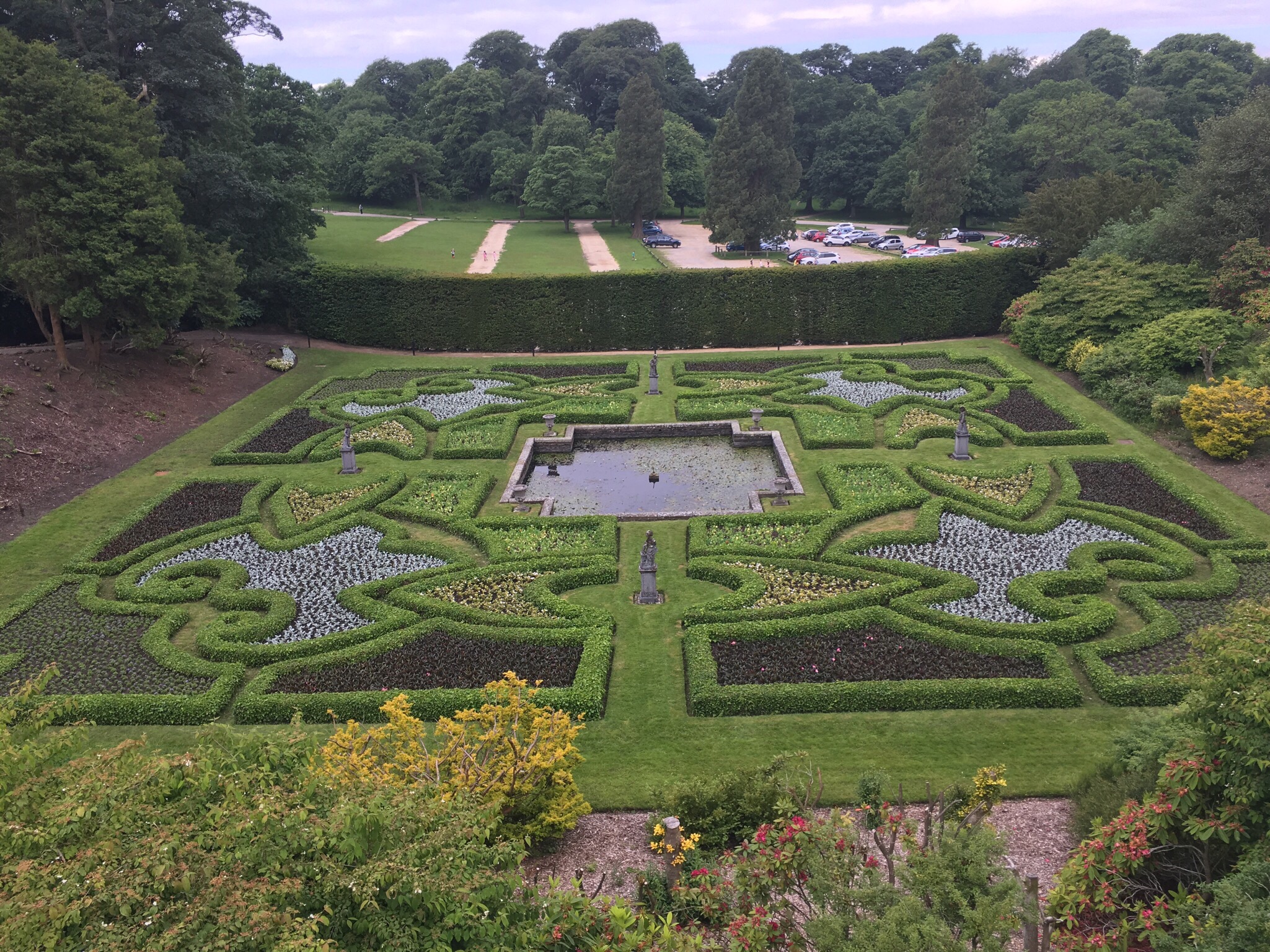
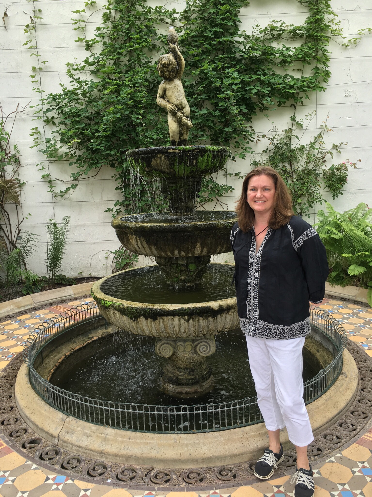
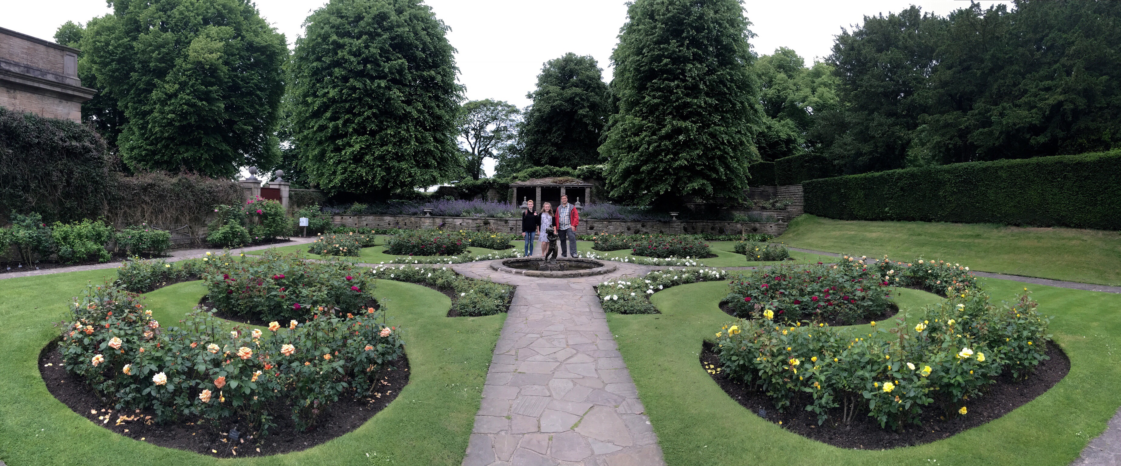
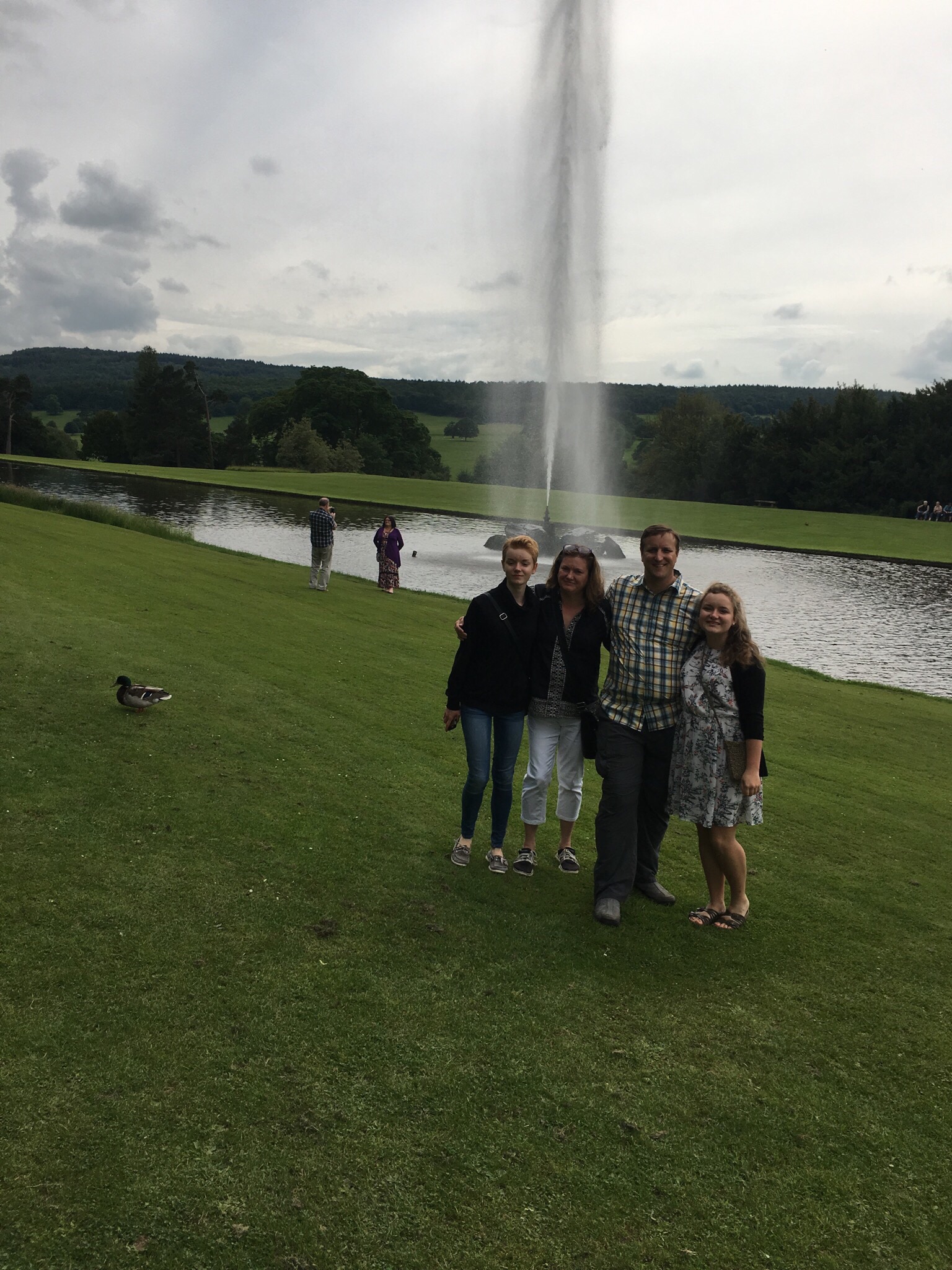
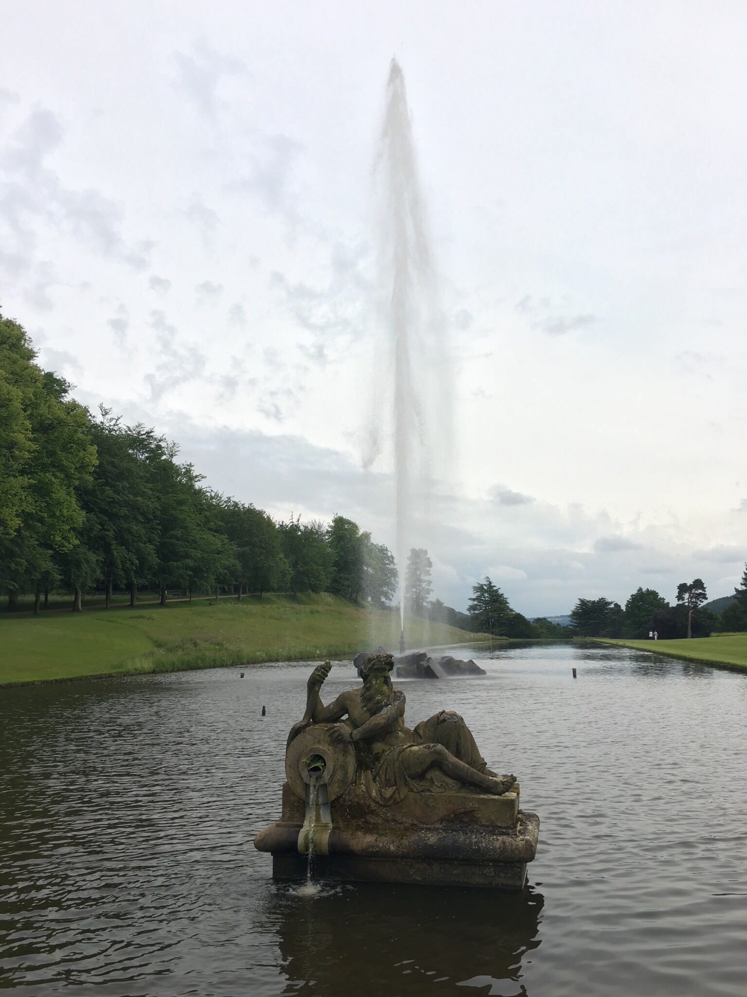
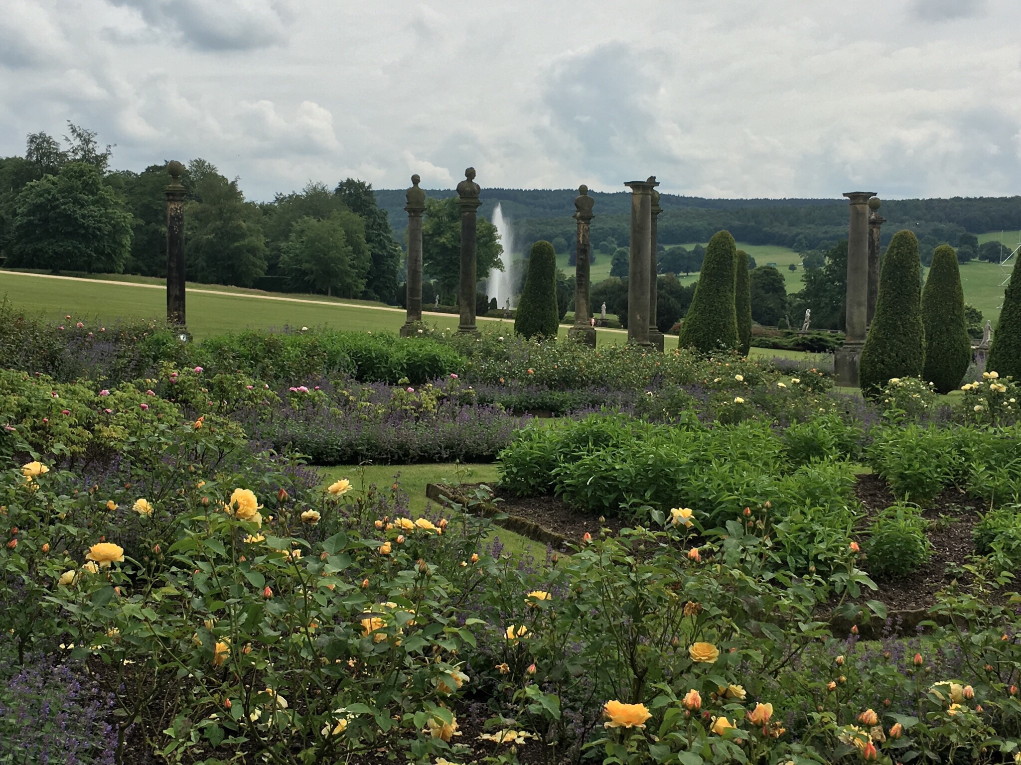
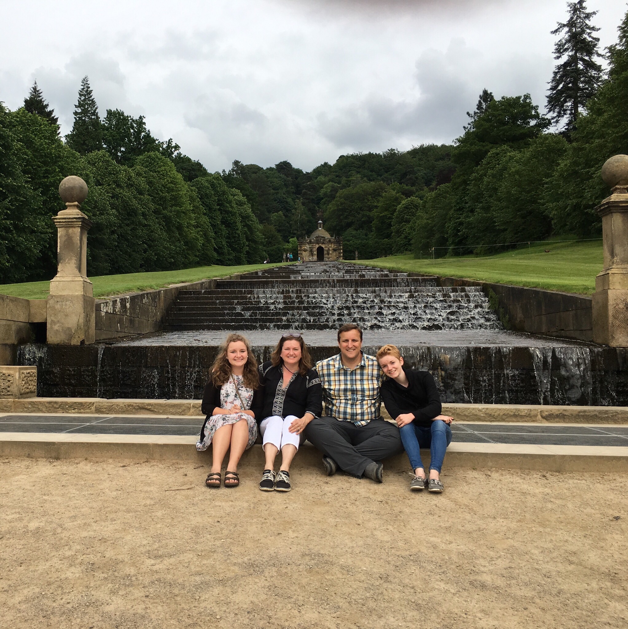
The gardens were also amazing. We had previously seen a documentary detailing how the grounds were engineered to use the power of gravity and water to create and run several waterfalls as well as the house’s incredible fountain.

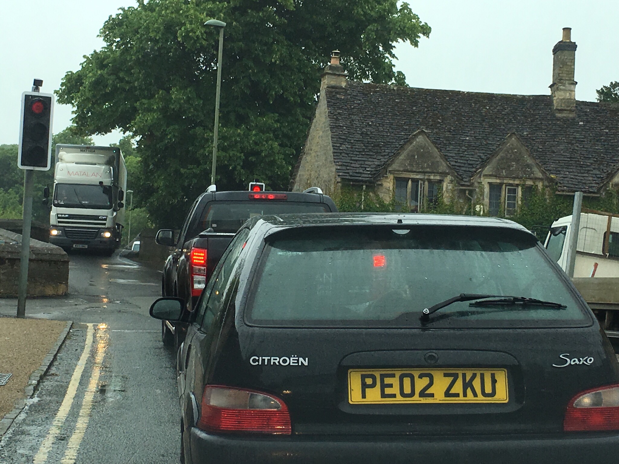
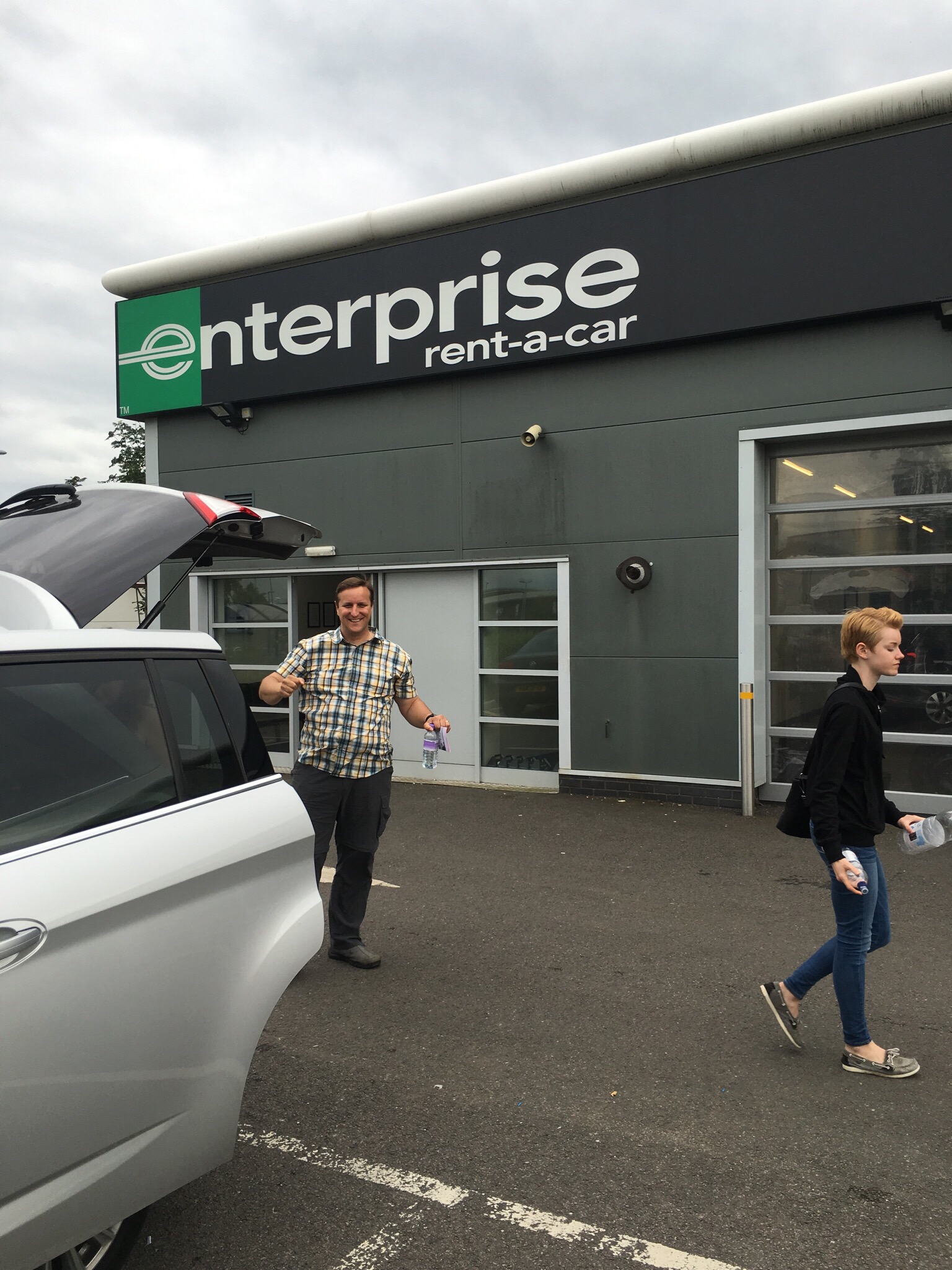
Chatsworth was only 15 miles from the Enterprise Rent-a-Car in Chesterfield, and the drive gave us one last twisty drive through narrow streets.

https://m.youtube.com/watch?v=tQOnF0G8R-4&feature=youtu.be

Returning the car unscathed was an awesome feeling.

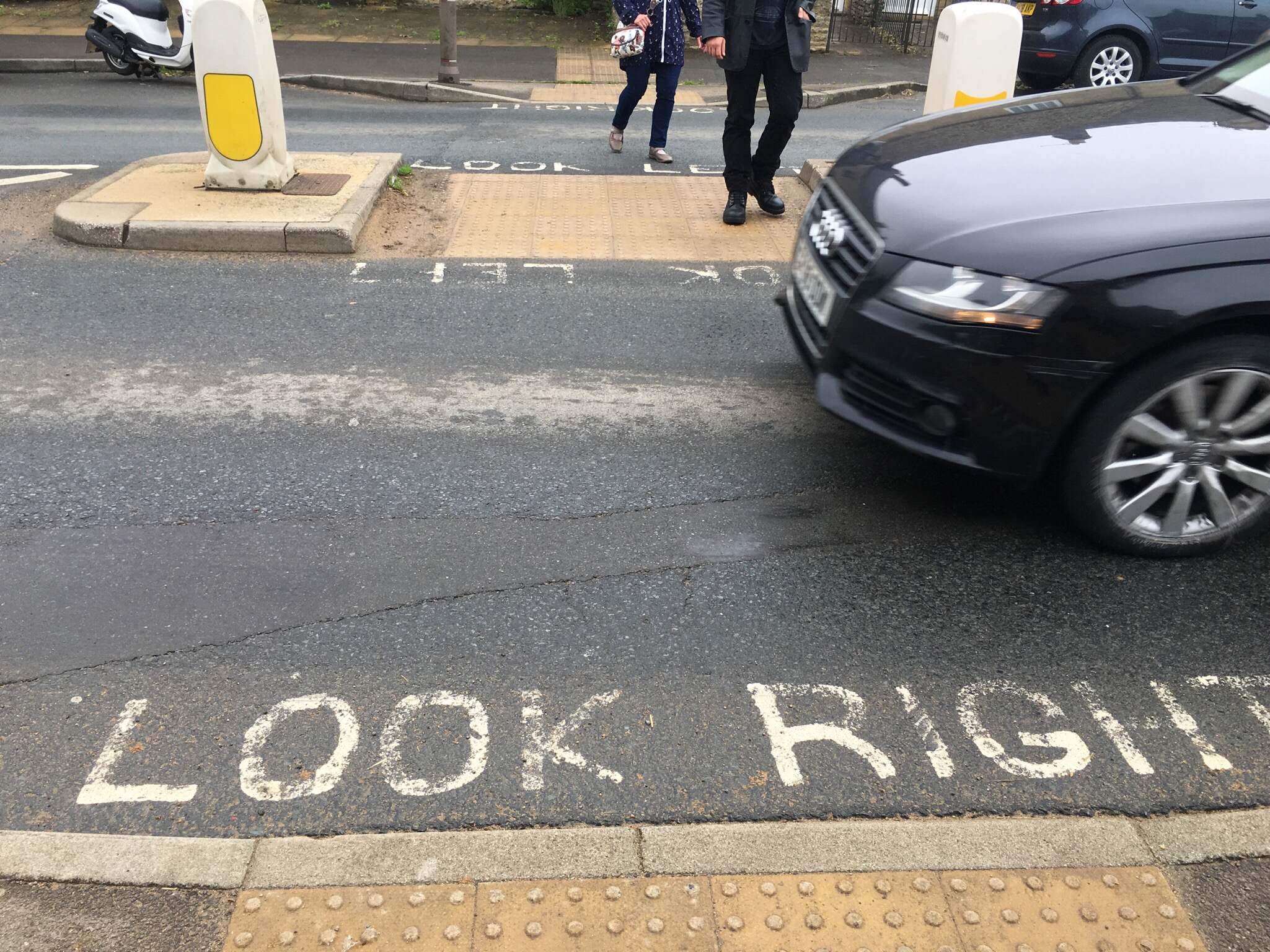
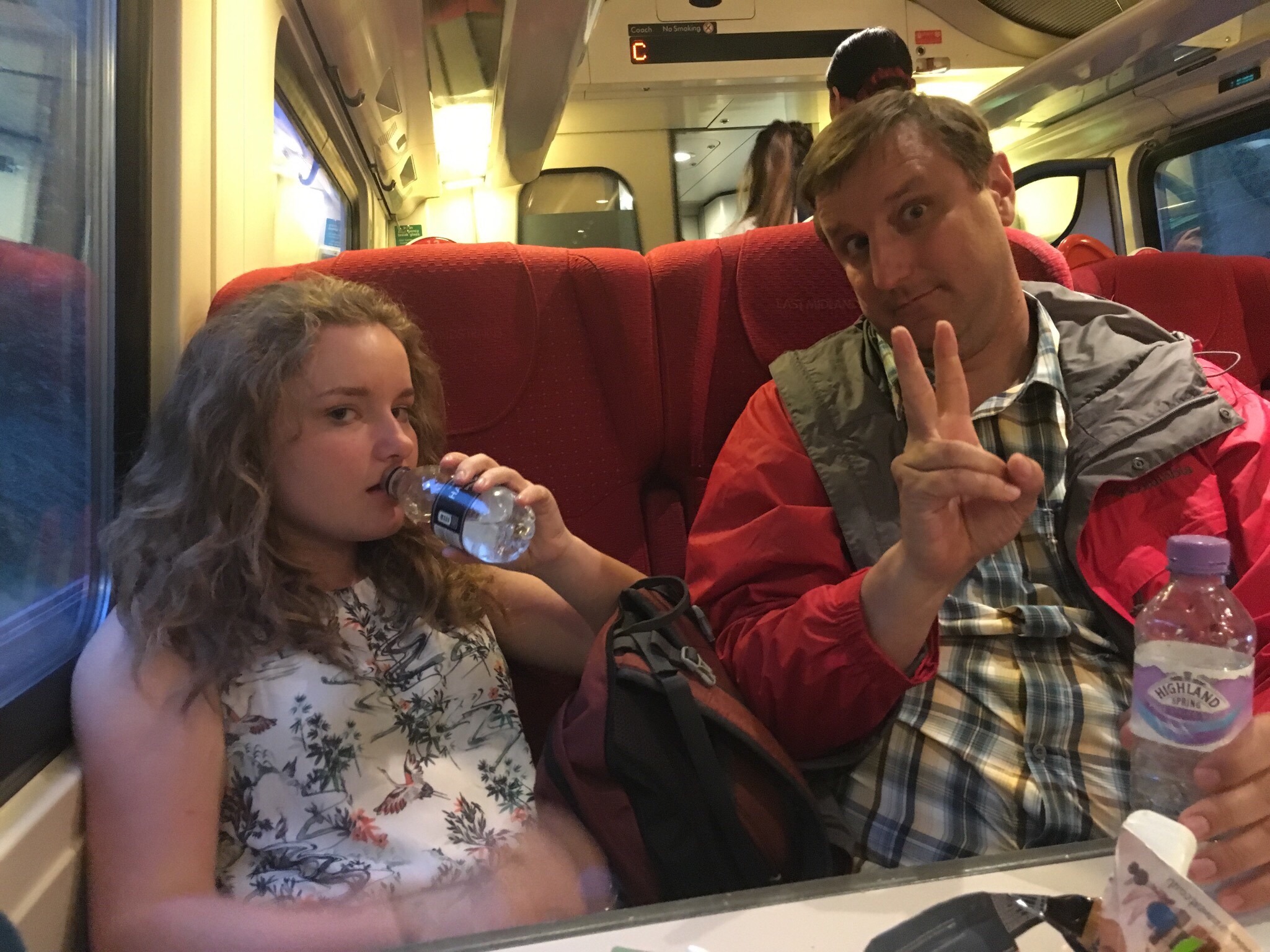
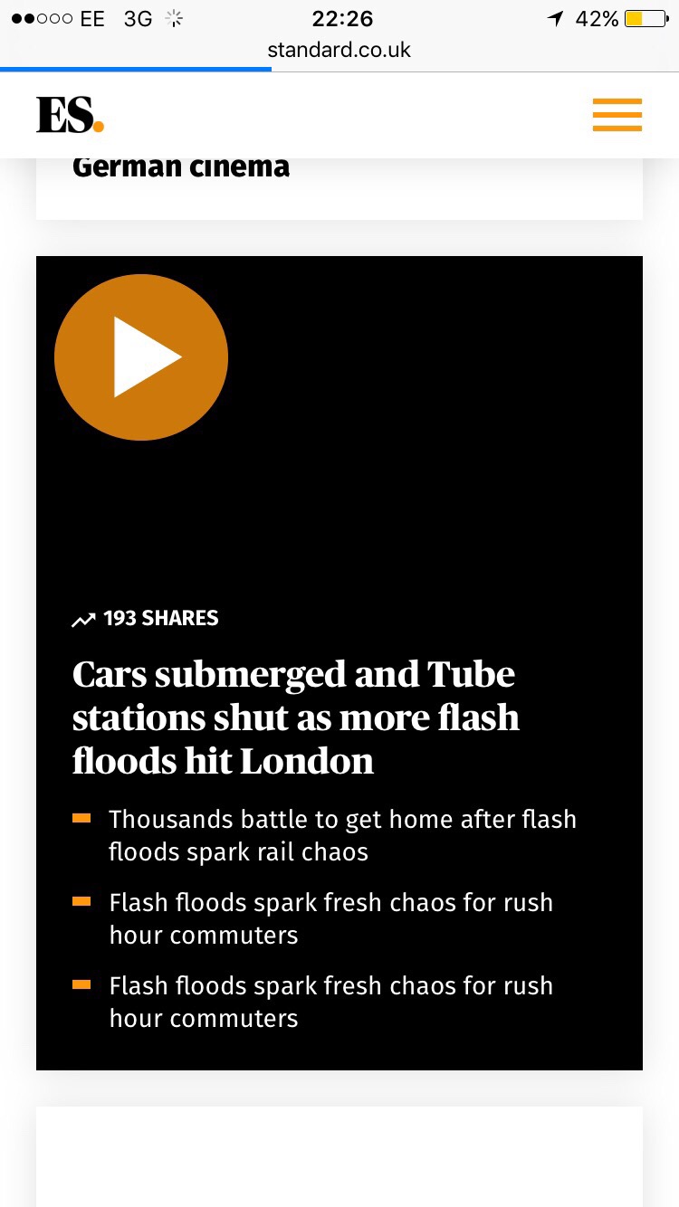
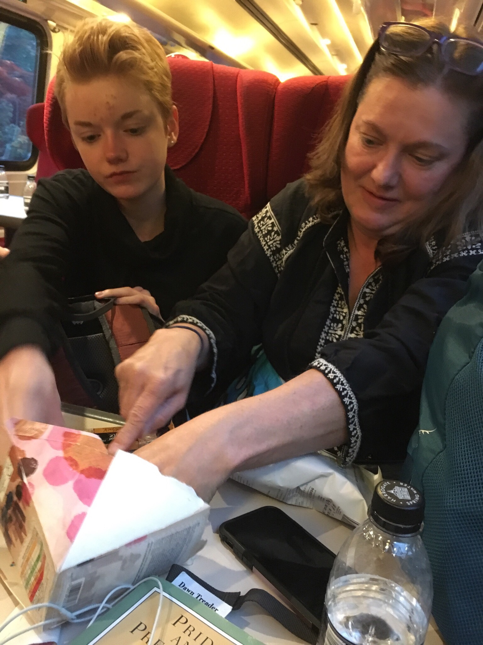
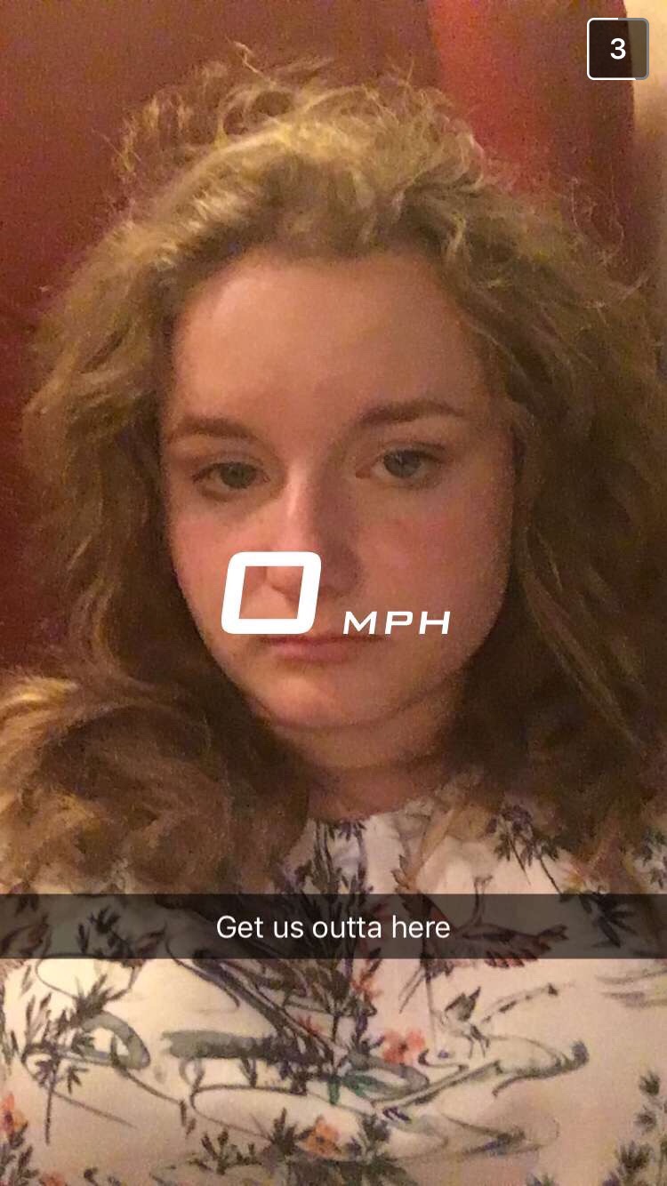
Enterprise dropped us off at the train station, and we were eagerly anticipating reaching London in just two quick hours. We had some busy days, and we were looking forward to grabbing dinner at the train station around 8 pm and then crashing until morning. Hah. We were not so lucky. Although we had amazing weather in the Peak District, London had torrential rains that flooded out several train and subway stations. This meant our train made it within a half hour of London and just. Stopped. . . . . . For four hours.  After the first delay, everyone collectively groaned. After the second delay, people swore under their breath and started calling friends to pick them up when possible. After the third delay, Mike raced a bunch of other people back to the food cart and bought whatever was left (we shared one sandwich, two bags of chips, a granola bar, and a pack of cookies). At some point in the third hour, people started realizing they were going to miss planes and even miss reaching their home polling station in time to vote in the EU Referrendum. By the time we finally started moving again, the train was a lot emptier and everyone was very tired and very resigned to being miserable.

We finally reached St Pancras International, London, around midnight. Six hours. It took us almost as much time to get from the Peak District to London as it did for us to fly across the Atlantic.

Tags: , ,

  • Digg
  • Del.icio.us
  • StumbleUpon
  • Reddit
  • Twitter
  • RSS

Cotswolds & Stratford Upon Avon

St. Hugh’s College puts on an excellent breakfast in the cafeteria. It was included with our room, so we ate with the students in the dining hall. The baked beans threw us a bit, but everything else was absolutely delicious.

Our plan was to drive up to Stratford Upon Avon, but instead of going via highway, we took smaller roads up through The Cotswolds, or “sheep enclosure in rolling hillsides.” The yellow limestone buildings surrounded by green fields and grazing sheep were beautiful. A 12th Century saying goes, “In Europe the best wool is English and in England the best wool is Cotswold.” The area is still peppered with tiny little towns that once served as marketplaces for wool trade. The bad news in that is that roads through those tiny towns never needed to accommodate today’s vehicles. Today we really felt the squeeze of the narrow roads. As Americans, we generally expect that on a two way road there will be room for two cars. Ha. Every 30 seconds, Mike was swearing as he had to pull up on a curb to let someone get around.

Not sure how that truck is going to get past me


Pretty much sums up every road we have been on

Our first stop was Bourton-on-the-Water, the “Venice of the Cotswolds” because of how the River Windrush gently meanders under bridges and through the center of town. I’m pretty sure Mike looks bored in every picture. 

Our next stop was Stow-on-the-Wold. We chose this town because it was along the road and because Elizabeth saw a Buzzfeed article listing favorite British tea rooms, and one of those was here.  

Letting out rooms since 947 AD

We stopped for a break at Lucy’s Tea Room and had tea and scones.  

Lunch was delicious

On the walk back to the car, we found an excellent church door. 

St. Edwards Church had a really cool door

We noticed these road markings on the way back to the car park. At first it looks silly, but we really did need that reminder.

Stratford Upon Avon was just a few miles up the road from Stow, and it was our next stop. As the city where Shakespeare was baptized, married, and buried, it was worth a few hours. Three cheers for Parkopedia, an app Mike downloaded that shows us where parking is available, how much it will cost, and then links it to our gps to direct us right to the spot. It is saving us a ton of time we would likely otherwise spend driving around. 

We had less than four hours, so we decided not to do the house tours. Instead, we saw the outside of the homes connected to Shakespeare and spent our inside time at Holy Trinity Church. 

Shakespeare’s birthplace


Theater for the Royal Shakespeare Company

Trinity Church. Where Shakespeare was baptised, married, and buried

Shakespeare’s grave


The baptisimal font likely used for Shakespeare

Family home of Anne Hathaway, Shakespeare’s wife

Our stop tonight was in Stafford, a small city an hour and a half north of Stratford Upon Avon. We had rented out a room with AirBnB, the first time we have used that service. Our rental was a two story garden house with a lot of room to spread out and relax for the night. 

Tags: , ,

  • Digg
  • Del.icio.us
  • StumbleUpon
  • Reddit
  • Twitter
  • RSS

Oxford

We got back from Stonehenge around 6 am, so we showered, ate leftover pizza, and set the alarm for 10:45. We beat our 12 noon checkout deadline by 2 whole minutes, and then we drove through McDonald’s for coffee. Lunch was sandwiches we had stored in a “cooler” we picked up from Sainsbury’s. 

We drove out to Oxford and checked into the Bed and Breakfast operated during the summer months by St. Hugh’s College. It was a lot cheaper than local hotels, and it was kind of cool to stay in one of the local dormitories.

Hugh’s College is one of the more than 30 colleges at Oxford University

Basic dorm rooms plus tea and cookies

We had free parking in the college’s kitchen parking lots, so we caught a bus and went directly to Christs Church College. Christs Church has a beautiful campus, but we wanted to see it first for its Harry Potter connections. The Great Hall was the inspiration for the Hogwart’s Dining Hall.

The Hogwarts Dining Hall was inspired by this beautiful room

There is a staircase leading up to the dining hall that was used during filming in the Sorcerer’s Stone as the students first arrive at Hogwarts.

We also visited Christ’s Church Cathedral. 

The gardens surrounding Christ’s Church College

The grounds within Christ’s Church; just outside the cathedral

People were invited to leave prayer cards . . .

After Christ’s Church, we wanted to see the Bodelain Library which is one of the oldest libraries in Europe. I thought we would reach it in time to see the reading room, but they closed early to host a wedding. 

Instead, we walked across the street to the Weston Library that was hosting some important Bodelain exhibits. Here we had the chance to see a copy of the Guttenberg Bible, another copy of the Magna Carta (not as nice as the one in Salisbury), and an original page from Mary Shelley’s Frankenstein manuscript. Julia is reading Frankenstein right now, so she was excited about this. Elizabeth was excited to see some original pages from Holst’s work on The Planets. 

The Weston Library was also hosting a Shakespeare exhibit, so we popped in there for a few minutes. 

Leaving the library, we walked over to the New College area. This campus saw some Harry Potter filming for a scene where Malfoy is turned into a ferret. The courtyard was closed, but the girls could stand under the arch nearby (the trees in the background are in the courtyard). 

We were hoping to have dinner at the Eagle and Child pub. J.R.R. Tolkien and C.S. Lewis apparently shared drinks there so often that they had an “always reserved” table. We arrived, however, after 6:00, and no guests under 17 were allowed soon after. Julia was bummed, but an Oxford resident overhearing our problem pointed us to the Turf Tavern, a pub purporting to be the place where Bill Clinton, during his Oxford years, often visited and “did not inhale” while meeting with friends. 

Bangers & Mash

Tags: ,

  • Digg
  • Del.icio.us
  • StumbleUpon
  • Reddit
  • Twitter
  • RSS

Salisbury & Glastonbury

We started the morning at Salisbury Cathedral. The original cathedral was built in 1092 a few miles away at a site called Old Sarum — a religious site used by Romans, Vikings, and various locals until it was irreparably damaged (possibly by a storm) and moved to the town’s current location. I had hoped to see Old Sarum yesterday. However, we were tired and driving was scary, so we had to take baby steps in getting around. We had to settle with the current cathedral only, but it was hardly settling. Salisbury Cathedral is absolutely amazing. It was started in 1228 and built in only 38 years. Its spire is Britain’s tallest. 

Salisbury Cathedral, exterior

Beautiful Cathedral, typical English weather

While we were visiting, an artist, Sophie Ryder, had many sculptures decorating the grounds. They were an interesting match for the grandeur of the grounds and cathedral. We would be wandering around the religious and thoughtful architecture and suddenly be staring at Midsummer-Night’s-Dream-Alice-in-Wonderland donkey/rabbit/human hybrids. 

The Cathedral’s interior:

Providing spiritual advice to King Henry VIII wears a guy out

One of the four surviving original manuscripts of the Magna Carta was on display and well-worth a look. We were not allowed pictures of the actual document, of course, but it was obviously the best-preserved of the remaining copies. We look forward to seeing a couple of the others while on this trip.  

The Magna Carta was protected from light inside the white tent

Replica of the Magna Carta that we could take pictures of

Leaving Salisbury, we drove out to Glastonbury for a slightly different church tour. I’m going to give a shout-out to Mike here for being a versatile driver and having nerves of steel . . . We never once ended up on the wrong side of the road, and he navigated the super narrow roads like a pro. My job was just to sit and worry and hold the GPS.  

Our first stop was the ruins of Glastonbry Abbey. We picked up a walking tour and learned some history from a “monk” who led us around the grounds.  According to legend, Joseph of Arimathea (the biblical figure who provided Jesus with a tomb) explored Northern Europe and found his way to Glastonbury. When he found a spot he liked, he drove his staff into the ground. The staff turned into a thorn tree, and the site was declared a miracle. Monks built a chapel around the tree, but the structure eventually burned. They began rebuilding the site with stone, but needed proper funding from the church to continue. In 1191, at a time when they would be desperate for funding to remain operating, the monks “discovered” a grave marked as that of King Arthur. Whether they really found such a grave or not, and whether or not that grave had any connection to the King Arthur of legend, that link kept the abbey solvent until Henry VIII had an argument with the abbey’s leadership and stopped all funding. 

The King Arthur legend survives…

We next took a bus out to Glastonbry Tor, a large hill that is prominent as you arrive from any direction. It is sometimes called The Isle of Avalon by historical texts as well as obviously fictional writings. We were all fans of the tv program Merlin, so it was fun to see a site that had often been used in the show to designate King Arthur’s kingdom.  

Starting up the path to the Glastonbury Tor

Windy and cold at the top

Looking up from inside

Coming down off the Tor, we realized we had gone down the wrong way to meet the bus, so we followed the road around the Tor after being told it would lead us to the Chalice Well, a site thought to have links to The Holy Grail and more Arthurian legend.  We really had only set out to see the Tor, so we were just wandering at this point and walking to other recommended sites.

When we came to a small door marked White Spring, we mistakenly thought we had found the site in the tour pamphlet that called itself the Chalice Well.  We ducked inside . . .and found ourselves in a dark room lit only by candles. A naked guy was submerged in a pool and was chanting.  Huh. This did not look like the spot listed in the tour pamphlet, and we were soooooo obviously in the wrong place. We backed out quietly and continued down the street. 

We looked it up later and discovered there were two wells within a short distance: one was heavy in calcite, and the other heavy in iron. Both were once considered to be powerful centers of healing. People bathe what are considered the healing waters of the calcite location, White Spring, and they drink from the iron rich Chalice Well. 

We found the Chalice Well gardens, and they were very pretty, so while we walked around a few minutes, we did not stay long. The legend here is that when Joseph of Arimathea brought the cup used at Christ’s last supper and washed it in the well, the water turned red. People were filling jugs with the water from the well and were meditating over the King Arthur inscription on the well cover. Our purpose to visit was for fun and curiosity, and our, “Yeah, Merlin!” mindset felt inappropriate contrasted with the seriousness of the other people there, so we just quietly had a look and moved on.

We next drove 5 miles up the road to Wells to see its cathedral which was built between 1176 and 1490. It replaced a smaller church built in 705. It had a very different feel and look to Salisbury. The choir was rehearsing while we visited, so we had the opportunity to wander quietly as we listened. 

Attached to the cathedral was an interesting placed called the Vicar’s Close. It is a short street (460 ft) and is said to be the oldest continually inhabited street in all of Europe (constructed in 1348). As we made the short walk, schoolchildren moved in and out of the doors because it is now a part of Wells School.  

We left Wells and checked into the Holiday Inn in Amesbury. Three miles before reaching the hotel, we passed by crews finishing setup for lights and crowds expected at Stonehenge. 

Stonehenge is usually roped off to most visitors and asks an entry fee. However, on the nights of the winter and summer solstice, people are welcome to gather at the stones. This seemed like an experience we could not miss if we were in the area, so after a quick dinner at Pizza Hut (Julia claimed it was way better than American Pizza Hut, but we claim its un-greasy crust and low amount of cheese sets it far below), we crashed at the hotel and set our alarms for 12:30 am. 

At 1:00, we pulled on jeans and coats and drove out to the Stonehenge Solstice car park. We were worried about fighting crowds to get there, but we suspiciously hit no traffic all the way from the hotel and up to the roped off parking area. We were also a bit worried that, once again, this might not be our scene (see naked guy in the White Spring above), but the group forming at Stonehenge seemed to be just about everyone (dudes in wizard costumes, little old ladies with walking sticks and fanny packs, partying teens and twenty-somethings, parents chaperoning their teenagers, hippy families with babies in backpacks, etc, so we decided to give it a go and walk out to see what was going on. It turned out to be a fun night. We all wandered around the inner circle of the stones for a while, then we all crashed out of the grass to rest for an hour, and eventually Mike and Julia went to the middle of the stone circle to hang out while Elizabeth and I stayed outside. Elizabeth and I got the first glimpse of the sunset, and Mike and Julia had a great time people watching from their location. For those who want to know: No, alcohol wasn’t a big deal, and security seemed to pretty quickly confiscate containers or escort obviously intoxicated people away. However, security turned a blind eye to the smoke billowing up from just about everywhere. As Julia said as we left, “No amount of soap or prayer is going to get the weed smell out of my clothes this morning.” I guess we’ll just file that away as an educational experience for the kids.

We found out later that crowds were down by half compared to previous years due to the National Trust asking for a 15 pound parking donation for the first time ever. The legitimate pagan groups who normally attend found other places to bring in the solstice because they refused to “pay to pray.” Many of the locals who typically come out just didn’t make the effort due to the high costs. Therefore, it felt like we were surrounded by a bunch of other tourists . . . because we were. It was still pretty cool, though. 

Tags: , , , , ,

  • Digg
  • Del.icio.us
  • StumbleUpon
  • Reddit
  • Twitter
  • RSS

Europe, 2016

We’re starting out on a long trip today, and we’ve decided to keep a photojournal on this blog site again in order to keep track of the quickly moving days. We will be doing a lot of moving around, so we cannot promise to keep things updated on a regular basis, but hopefully we will be able to get to it every few days.  

With our gear on our backs, house sitters in place so the dogs would not be lonely, and itineraries somewhat ready and planned, we woke up and finished packing. My dad drove us to the airport Saturday morning (thanks, Dad!). We flew out of Windsor because for some reason flights to London/Paris were half the price when compared to flying out of Detroit (??). 

Windsor Airport: Carrying everything we will need for 30 days

We arrived in Toronto and used our layover to walk around, grab dinner, and get tired. Our flight left around 10 pm. We did our best to sleep for the next 6 hours, but we landed at at Gatwick Airport totally exhausted.  After a mix-up with our original travel plan out of Gatwick, we Uber-ed a car out to Salisbury. Salisbury is 85 miles out of London and is one of England’s cathedral cities. 

First order of business: picking up the rental car. Here we were totally punked, and in our exhausted, half-awake state, we let the Enterprise Rent-a-Car guy tell us how “lucky” we were that we were being “upgraded” to a bigger car because the smaller cars were really popular and they were all rented earlier in the day. It wasn’t until we were in the car and freaking out on the half mile trip to the hotel that we remembered why we had rented a tiny car in the first place: roads are crazy small and narrow, and driving around a big car — and driving on the left for the first time — was terrifying. We drove past the hotel because obviously roads built prior to the 1200’s weren’t worried about wide vehicles and didn’t include parking spaces, turned hopelessly down a side street, then down another side street (really, it felt like being on a roller coaster that couldn’t stop), pulled over into the first open lane we saw, and miraculously entered a long-term city parking area . . . That looped around so we could see our hotel just passed a grocery store. How this happened, I have no idea. Honestly, we couldn’t have planned it better. A nice couple leaving the car park handed us their pass for the rest of the afternoon, and we were set until we left the next morning. Randomly finding that parking area was. Totally. A. Miracle. 


The King’s Head Inn

We grabbed dinner at the hotel (fish & chips and some Tikki Masala to cover the important English foods) and then everyone went back to crash while I walked around for a while to scout out where we were in relation to the cathedral. I was soon rained out, so I also went back to sleep. It turned into an interesting night: Sleep 4 hours, get up and have tea and cookies for two hours, and sleep another four hours.  In the girls’ room, Julia was also up in the middle of the night munching on almonds and weirding out Elizabeth’s dreams.  

Love the red phone booths!

Guess we can skip Buckingham Palace

  • Digg
  • Del.icio.us
  • StumbleUpon
  • Reddit
  • Twitter
  • RSS

August 2-3 (Glacier National Park)

Tuesday was our last day with the bike tour.  It was a rest day for riders, so we spent the morning and early afternoon helping Mike organize his equipment, set up his tent, and do some supply shopping. 


IMG_2229

The velo tour attracted attention in Missoula.  The newspaper put them on the front page and included a special feature. 


IMG_2233

The girls help Mike set up his tent


It was a three hour drive to Glacier National Park.  Julia entertained us by reading the Bear Safety brochure we’d picked up in Missoula.  The brochure said practicing bear safety procedures and “bear avoidance behaviors” could help “lessen the length and severity of maulings.”  Nice.  We left Missoula around 4 pm and reached the west entrance of the park just in time to see a “bearjam” (cars pulled over looking at a small black bear walking along the road).  In the spirit of bear avoidance strategies, we watched the bear long enough to confirm it was, indeed, a bear, and then moved a few miles down the road and set up at the Fish Creek Campground.  We could see a lake through the trees, so we packed up our dinner and ate along the shore.   

DSC05361

Chicken, chips, and peaches for dinner


panoMacLake2

Lake McDonald


DSC05383

Skipping stones (I love the swirly mist over the lake!)

We were on the road again by 8 am and moved to the east park entrance.  It is only 50 mile drive (done in 90 minutes) if you drive straight across, but that would mean driving the Going to the Sun Road and following vehicle length restrictions.  We still wanted to drive the road, but we needed to drop the camper first.  I give Julia a lot of credit for this morning.  She ate something that didn’t agree with her and was up sick most of the night (but thanks to Mike charging the camper batteries, we had running water and a working bathroom to make the night easier).  In the morning, though, she got dressed, grabbed the camper wastebasket “just in case,” and was ready to go. 

DSC05399

The Two Medicine area of the park.  We had to follow Hwy 2 around the south end to reach St. Mary/East Glacier.  Compared to going straight across the Going to the Sun Road, this added 30 miles to the trip but only added 20 or so minutes. 


DSC05406

Our KOA was just down the road from the east entrance. 


We had an evening tour scheduled on the old 1930’s red bus/car system.  The tour left from the KOA, so we asked the camp desk what we should see before the tour.  The woman told us she was very familiar with our tour and recommended we spend the afternoon seeing the Going to the Sun Road because our tour would take us to the Many Glacier area but may not get all the way down the road depending on time.  As it turned out, the tour did a large portion of the road and never got us to Many Glacier, so we should have spent the afternoon over there.  In the end, we did a quick drive down the road alone and then enjoyed the tour because we got to hear stories and information about what we’d seen.  It worked, but I shouldn’t have trusted the KOA to give me good tour information. 


DSC05409

We intended to use GNP’s trolley system to travel the Going to the Sun Road, but Julia had a sudden bloody nose while we were waiting (altitude?).  We decided it would be better to have our own vehicle, so we drove the truck.  Fortunately, Julia didn’t have any more problems, and we enjoyed stopping at the lookouts.


DSC05429

St Mary’s Lake (Wild Goose Island in the background)

DSC05588

Our tour guide later told us this tree has looked exactly like this since he visited the park with his family in 1970. 


DSC05432


panoglacier2

Driving the Going to the Sun Road near the Continental Divide


DSC05437

Waterfall near Sunrift Gorge


DSC05466


panojacksonglacier

Jackson Glacier


DSC05482

The sign says the glaciers will disappear by 2030, but this week’s news report says 2020. 


IMG_2273


DSC05584


IMG_2275

Logan Pass was as far as we drove


IMG_2278

Waiting for our evening tour


DSC05590

Our tour in one of the actual red tour vehicles used in the 1930’s.  They were recently sent to Detroit for a complete system overhaul.  In an innovation done by Ford, the red busses are now fueled by propane. 


DSC05614

After exploring Logan Pass, the girls return to our red bus tour. 


IMG_2303

A mountain goat wanders through the Logan Pass parking lot


panoLogan

Logan Pass

DSC05593


pano


In my original plan, we wanted to spend the next morning (Thursday) taking a hike to Grinnell Glacier (a hike that begins in the Many Glacier area).  That ranger-led hike, however, was currently shut down due to bear activity.  Deciding we weren’t crazy about hiking somewhere the rangers wouldn’t go, we skipped it to get started with our drive home.  It would have been nice to get on some of the trails, though.  Glacier is a massive park, and our quick drive just allowed us a small peek.  Note:  We learned later a man was mauled by a grizzly on Friday when he surprised a mother/cub somewhere in the Many Glacier area.  That made us feel very satisfied we’d made a good decision about saving the Many Glacier hike for another time. 


DSC05618

Returning to the KOA.  Clear skies meant a beautiful view of the stars.

  • Digg
  • Del.icio.us
  • StumbleUpon
  • Reddit
  • Twitter
  • RSS

Going East: ROAM July 29–July 31 (Cascade Locks, OR, to Lowell, ID)

Fair warning:  We’re having a difficult time getting any actual photos of riders while on route.  Pulling the trailer makes it dangerous to pull off on some of these roads where there is little or no shoulder.  Honestly, what the girls and I do all day isn’t very exciting.  We break camp, meet Mike at the lunch stop, and then move on to the evening camp.  We’re currently carrying some ROAM gear in the truck, but it’s back up stuff for the back ups, so it won’t be needed during the day.  Mike is carrying the FLIP camera on his bike, and he’s getting some video he hopes to upload soon.  When we leave Missoula, we’re also going to leave him Julia’s camera so he can take some pics of the velos while they ride.  Until then, here’s a quick summary of the days.  You can also check out the main ROAM event page.  Some of the other riders are keeping blogs that link from here:  http://web.mac.com/josef.janning/Roll_over_America/Blogs.html    


 July 29:  Cascade Locks, OR, to Hat Rock State Park (Umatilla, OR)

Distance = 139 miles

Stops = Rufus (OR)  & Arlington (OR)

The riders followed I-84 again for much of today.  They moved out of the mountains and trees surrounding Mt. Hood and entered more rolling territory.  There was an especially difficult climb just before the lunch stop in Arlington, OR.  Riders stopped for the night several miles east of Umatilla at Hat Rock Campground just across the road from Hat Rock State Park. 

IMG_2559

Morning:  Julia borrows Mike’s sunglasses as we pack him up and send him off on his first full day of riding.

IMG_2173

Today’s ride continues to follow the Columbia River, but the landscape changes from green to brown. 


We planned to meet Mike at the lunch stop in Arlington.  We thought we’d pass him on the route, but highway construction meant there were several places where riders had to get off and take detours for several miles and even one section where the construction workers had made a small path through the work for riders to pass.  He was off the highway in the morning when we passed, so we explored the area instead.  We had heard a town called Mary Hill had a Stonehenge replica, so we decided that might be worth seeing.  It is actually a WWI Memorial for local soldiers, but its size and detail make it a strange site on the side of a hill on the Washington side of the Columbia River. 


panoStonehenge1

Julia at the Stonehenge WWI Memorial


IMG_2181


IMG_2186

Peeking through the rocks, you can see Mt. Hood in the west.


IMG_2178

The Stonehenge story


panoStonehenge2

For a little roadside stop, this is pretty cool


IMG_2180


IMG_2581

Another view looking west

We reached Arlington ahead of the riders and looked around town. There was a little grocery store, a diner, and a gas station. There was a pizza place, too, but the locals said the owner only opened when he felt like it . . . could be 10 am, could be 4 pm. The bike SAG vehicles waited off the entrance ramp, so I stayed there for a while while the girls went down the street to the park. It was hot, and after a couple of hours they got cranky. We waited 4 hours for Mike and a majority of the riders to reach their “lunch stop.” This is when the girls decided this whole bike tour thing wasn’t going to be super exciting. They were bored, it was hot, and the Kindle died. After feeding Mike some lunch, dumping water on his head, and getting him moving again, we moved on to camp.


IMG_2587

Julia and the Kindle’s final hours (how will she survive the ride home?!). 


IMG_2600

Mike finally makes it to the lunch stop and collapses (I love Elizabeth’s complete disinterest). 


IMG_2604

A guy walking his dog told us Arlington is best known as the hometown of Johnny Carson’s Doc Severinsen.  I sent the girls on a hunt for the plaque, but they never found it.  We finally saw it while we were driving out of town. 


IMG_2197

Hat Rock Road, just after 8 pm.  We could see Mike and two other riders coming down the road.  The bikes are very quiet, so it’s a little eerie after dark. 


IMG_2198

Temperatures reached 98 degrees today.  It was a long, hot ride with no shade.  He made it to camp, but he honestly looked pretty miserable.  We fed him some spaghetti and put him right to bed. 


July 30:  Umatilla, OR, to Lewiston, ID

Distance = 158 miles

Stops = Walla Walla, WA  (morning break); Dayton, WA (lunch)

Today’s ride took US-730 to US-12 .  The route will now follow 12 for several days.  Strange to think if you stay on this road, you’ll come within several miles of our house.  Two big climbs were the highlight of the afternoon.  The second climb let riders coast into Lewiston, ID, for the night. 

After a stop in Walla Walla, we met up with many of the riders in Dayton, Wa, where they were parked up and down the streets searching for lunch. 

IMG_2200

The bikes get lots of stares in the small towns along US-12.


IMG_2202

We found kids selling snow cones in Dayton, so the girls took them to go

IMG_2611

When Elizabeth says, “Mom, there’s no garbage for the slushies,” I should not joke, “Just dump it out the window”  while the car is moving. This results in root beer slushie all over the camper.  Makes the dead bugs extra sticky. 


IMG_2607

The road ahead


Mike called after 9 pm asking for an escort into camp.  He was only 6 miles away, but he was riding with a partner who had few visible lights, and they were uncertain how to find the campground in the dark. 


July 31:  Lewiston, ID, to Lowell, ID

Distance = 101 miles

Stops = Orofino (ID) & Kooskia (ID)

Today the riders had an easier day with only 101 miles.  Those miles, however, were all uphill.  Temps reached 102 during some parts of the ride. 

DSC05347

Getting an early start:  Mike packs up and rides off just before 7 am.  He wanted to leave by 6, but he came in late the night before. 


DSC05348

Morning ride prep across the campground

DSC05350

Mike carries two bags inside the velo.  One carries gear (bike equipment, etc.), and the other carries personal stuff.  We peeked into the personal bag (sunscreen – SPF 100 – lunch, a Flip camera, gel packs, radio ear buds, cell phone). 


IMG_2627

Much of today’s ride followed US-12 along the Clearwater River.  The view was amazing as the road moved through the low mountains.  The downside, however, was that the shoulder visible in this photo disappears in many sections of road. 


IMG_2631

We amused ourselves by stopping along many of the Nez Perce and Lewis & Clark interpretive signs. 


IMG_2633

Our favorite stop of the day was at the Heart of the Monster.  Elizabeth knew the story and told it as we walked down a short path to an intercom that then repeated what she had already told us.  Essentially, tradition says Coyote facilitated the birth of the Nez Perce people by killing a monster and chopping its heart into many pieces and throwing them on a pile (seen on the mound in the background).  It was really a good stop which can be easily missed if you don’t know what to expect. 


IMG_2635

There were not a lot of towns along this section of 12, and the towns we did drive through were very small.  The biggest restaurant near the Heart of the Monster is in a little RV park that also houses the local Kiwanis meetings. 


IMG_2636

TakeOut BLT’s from the Sacajawea Cafe


IMG_2203

The first van arrives at camp and unloads gear (every rider was permitted one bag for the trip)


IMG_2204

Uphill all day!  Mike arrives in camp. 


IMG_2225

Three Rivers Campground & Resort:  Not sure what qualifies this place as a “resort,”  but the river area was quite pretty.   We were told the nearest laundry is still 60 or more miles east, so riders washed the essentials in the sinks. 


IMG_2212

Mike cools down and tosses Julia in the pool


IMG_2215


IMG_2216

Julia joins the riders for a soak in the hot tub.


IMG_2219

Corn on the cob & enchiladas

panoThreeRiversCamp

ROAM’s section of the campground


IMG_2217

Our camper had the only working outlets, so it had to charge everyone’s phones, laptops, cameras, and bike batteries.  We took this picture early on, but I should have taken another after dark when the power strips snaked all over the outdoor mat.  I have no idea how that fuse held together.

  • Digg
  • Del.icio.us
  • StumbleUpon
  • Reddit
  • Twitter
  • RSS

Portland: July 27 & 28 (Portland to Cascade Locks, Oregon)

One more day until the ride!  Time to run a bunch or errands and make sure we are ready to roll.  Julia stayed with Mike to work on the bike while Elizabeth dragged a bag of laundry and a shopping list into my truck.  Of course, laundry and shopping is boring, so we added a few small “food errands” into the route just to mix it up a little. 

DSC05295

Food Errand #1:  We stopped by the satellite store for VooDoo Donuts and picked up a snack (the lemon cruller had a very sharp lemon taste that was amazing!).  We liked their pink VooDoo van in the parking lot. 


DSC05296

Food Errand #2:  My cousin recommended her nephew’s pastry shop, and because it was so near VooDoo, we had to make a stop to say hello and have gelato and yummy baked goods (can we call it second breakfast?). 


DSC05297

Pistachio gelato was reallllly good!  The goat cheese & herb croissant was even good enough to guilt me into saving the bacon maple donut from VooDoo until the next day (and it made me feel not so bad about eating twice in one morning!). 


DSC05298

Food Errand #3: After making stops at Camping World and then spending two hours feeding change into laundry machines, we had clean clothes and needed to get back for lunch.  We got a little lost on the way, however, and drove past a little taco hut.  El Tacoriendo looked a bit beat down and had colorful language spray painted on the side, but it was getting a lot of local traffic.  The owner made the tortillas while I waited for my order.  Really good and inexpensive ($1.25/taco). 


IMG_2131

We returned to find Mike still working on the bike


IMG_2133

It was dinnertime before the bike was ready to ride.  We spent the rest of the night at a ride meeting. 


Thursday, July 28th:  Ride Day!!!!!!!

DSC05309

The Day’s Inn Parking Lot is a little crowded


DSC05301

At 9:00 am, the riders do last minute checks on their bikes


DSC05302

The girls wish Mike good luck


DSC05308

A home-built velo


DSC05306

Flames!!  Some of the bikes have fun paint jobs


DSC05307

Just produces a lot of sweat on warm days


IMG_2164

This sign is on the MAX Train (not a velo).  The girls and I rode out from the EXPO Center to the downtown rally point to watch the riders leave.  We curiously noted we’d purchased tickets for the train each day; however, no machine or person ever checked to see if we’d paid.  The tickets stayed in our pockets.  This is the first public train we’d ever been on that apparently runs on the honor system. 


DSC05316

The riders (including Mike) arrive at the Tom McCall Waterfront Park near the circular fountain

DSC05323

The bikes make a colorful show and begin to attract attention


DSC05325

Channel 8 arrives, and bikers riding along the waterfront path pull off to check things out


DSC05341


DSC05329

A view of the park from the skywalk in the World Trade Center. 


DSC05337

A representative from the mayor’s office declares it “Velomobile Day” in Portland!

While the riders showed off their bikes and chatted with interested Portland pedestrians, I found the WTC plaza filled with food carts and farm market produce.  The girls and I picked up lunch and ended up with one basket of fish & chips, 2 gyros, a falafel, and a basket of blackberries.  After today, we’re back to PB&J’s during our camping time, so we’ve been splurging a bit while in the city. 

The ROAM bikers leave Portland on July 28, 2011


After watching the bikes leave, the girls and I joined other supporters in a train ride back to our vehicles (and now I’m watching everybody get on and wondering if they paid for their tickets ‘cause nobody is going to ask and how is it possible all Portlanders are super honest?).  At 1:39 pm, we were in the truck and I took the exit for I-84 East.  We are now moving east, and every mile is one closer to home. We again saw the sign urging us to “Keep Portland Weird,” and I noted we could do our part by leaving Julia behind, but she just smirked and  otherwise pretended she didn’t hear me.  We said goodbye to Portland and decided we enjoyed it but will miss VooDoo Donuts and the food carts.   I agreed on both choices for “will miss most,” but I get my own choice for “won’t miss at all.” My Android phone’s GPS app!!!! We refer to the voice as Jeeves, and while ‘ole Jeeves usually does a good job, he doesn’t know Portland at all. Soooo many times this last week I’ve looked for a specific store and ended up in the middle of a bunch of warehouses or on a residential street. Even leaving town today, the GPS map pointed me south while the voice told me to go north. Hopefully, Jeeves is better with the rest of Oregon.


IMG_2167

After making it through Portland, Mike arrives at the first meeting stop.  From Lewis & Clark, the group moved onto Interstate 84.  They met up again later when the Oregon Department of Transportation stopped traffic along the interstate in order to let the velomobiles navigate a very narrow quarter-mile tunnel (older tunnels with no shoulder would be very dangerous for a velo).   


IMG_2168

Water break


panoCascade

Cascade Locks KOA:  Final stop for the night.  Distance today:  45 miles

  • Digg
  • Del.icio.us
  • StumbleUpon
  • Reddit
  • Twitter
  • RSS

Portland: July 26 (Downtown)

Time to get downtown!  After some logistical planning, we figured out a way to leave Mike home with the truck while the rest of us spent a day in town.  We wanted to take our time, but Mike had plans to work (his job) for a better part of the day and then work on his bike later.  If he needed to run errands or get parts, a partially assembled bike wasn’t going to work.  Our solution?  He dropped us off at the Portland MAX station in the morning and we rode the rail system into town. It is completely above ground, so we could see the neighborhoods pass by. 

IMG_2066

Riding the EXPO yellow MAX line into Portland

As new tourists, we had few definite destinations, but our first stop was Powell’s City of Books, the largest new and used bookstore in the world (cue the angel chorus here, ‘cause we found our promised land!).  The store covers an entire city block and is 3 stories high.  It was totally amazingly awesome!  We love Dawn Treader in Ann Arbor, but here the used books sit right next to the new ones, so it’s super easy to find things!

IMG_2067

All set to head into Powell’s!


We’re gearing up for a long ride home, and the girls had a list of books they wanted to read.  If they could find it here used for less than I could buy it on the Kindle, we picked it up. For less than $30, I think we bought 6 books.  Elizabeth currently has a taste for dystopian teen lit, and they had a special display just for her. 

IMG_2068

Then it was my turn to roam the stacks, and I had so much fun I forgot to take pictures! Despite its size, the store feels cozy and has lots of little places to sit and read.  I could easily spend many hours and a lot of money here, but we forced ourselves to move on after an hour. 

Coming out of Powell’s we decided to walk the block and discovered Mio Gelato was having an anniversary celebration:  $1 for a scoop!  We couldn’t possibly turn that down, so after picking up one chocolate, one tiramisu, and one crème flavor, we walked and ate our way past the entrance to Chinatown and into the Old Town area. 

IMG_2069

Mio Gelato

Cool Fact:  Beneath the Chinatown/Old Town streets, there are tunnels that were designed to move goods from the docks and into basement storage rooms of the local bars and businesses way way back in the day.  Legend says they were also used back in the 1800’s to kidnap unsuspecting bar patrons and haul them off to years of slavery aboard ships bound for the Pacific.  The downtown information booth lady had flyers for tours of these Shanghai Tunnels, but she told us most of it was “just stories. . . but you never know.” 

IMG_2075

Chinatown

We came to Old Town for donuts: Delicious, goopy, and heavy donuts in a store that was fun, silly, and definitely a bit risque.  We waited in line for maybe 20 minutes before even getting in the store.  We ordered some of the signature donuts and sat down at a picnic table to eat (some names of the donuts were not kid-friendly, but my kids either didn’t notice or knew enough to ignore them!).   

IMG_2077

Notice the pretzel stuck in the little voodoo dude’s chest; this is the donut Elizabeth knew she had to have

IMG_2076

Waiting our turn (each person gets her own turn in the store)

IMG_2081


IMG_2551

The inside decor


IMG_2084

Our box of donuts:  Two jelly-filled voodoo dudes, one crème-filled eyeball guy, and a maple-bacon donut


IMG_2083

Yep, that’s right.  A maple-glazed donut with two strips of bacon


IMG_2085

Everybody had to try a bite, and wow – it was not gross.  It was unexpectedly wonderful. It seemed everybody was eating these things, and now we knew why.  


IMG_2088

Elizabeth getting to the guts of her voodoo man


IMG_2078

We needed a walk after the donuts, so we walked toward a central gathering area to do some people watching.  We liked this sign. 


IMG_2090

This sign made us wonder.  If you have to specifically ask, what are the odds people will listen?


IMG_2091

Pioneer Courthouse Square:  Sometimes called “Portland’s Living Room,” we found some good tourist maps here, picked up some brochures, and found a place to rest. 


IMG_2552

Oh, and we needed to balance all the sugar so we grabbed a cheesesteak from Philly Cheesesteaks and Burgers, a cart located on the square.  For $6.25 it was big enough to split 3 ways and it was delicious! 


IMG_2094

The girls found this guy with an umbrella statue hilarious for some reason


IMG_2099

A little bit of Ida (Michigan) right here in Portland!

Highlight of the day:  While we were hanging out in the square, I got a text from a fellow Ida grad who now lives in Portland saying he could meet up for a while.  Joseph (forget that you just had another birthday ‘cause you will always be Joey to me) Klei not only came by to say hello, but he led us to some great coffee and then took us around town for 2 hours and showed us all the stuff we wouldn’t know to see on our own.  Thanks, Joey!  It was fun to catch up, and you are an awesome host for your wonderful city! 


IMG_2102

Along the waterfront, standing where the Saturday Farmers’ Market would be, looking across at Ankeny Square


IMG_2118

Teaching the girls urban surfing on the downtown trolley


IMG_2121

Portland State University Campus


IMG_2556

Portlandia: A freakishly large copper statue (second in size only to the Statue of Liberty)


We were also treated to a great view of the city from the 30th floor of “Big Pink” – a high rise building with pinkish-tinted windows – inside the Portland City Grill

panoPortland

Looking out at the southeast section of the city, the mound of green toward the left is Mt. Tabor, an extinct volcano.  It’s been extinct for 300,000 odd years, but it’s still a volcano.  They built the city around a volcano, and that suddenly makes these Portland folk seem much more hardcore than the stereotypical bicycles and flannel would suggest. 


panoPortland2

It’s more distant, but just to the right of center here is Mt. St. Helens. 


After many thanks to J. Klei for his company and walking tour, we made it back to camp around 5 o’clock.  Mike had just finished up his real work for the day and was starting on the bike.  The girls helped him piece some things together, and Elizabeth helped him replace a chain.

DSC05287

Getting some help with the velo


DSC05286

Un-greased bike chains hanging all over the place


DSC05289

Putting on new chains


Mike worked on the bike until almost midnight.  There is now only one day of prep time until the riders leave.  We all took a break in the evening and rode over to the Day’s Inn where the event organizers had an info meeting and passed out shirts and stickers. 

DSC05293

Ready to ROAM!


DSC05294

One conference room filled with velos!


We still have a lot to do before the trip moves east and the riders begin pedaling.  Mike has to finish a few adjustments on the bike, I have a meeting about my role as a support vehicle in the first week of the event, and we have to do more mundane things like laundry and grocery shopping.  It was a great day in Portland, though, and we’re almost ready to move on.

  • Digg
  • Del.icio.us
  • StumbleUpon
  • Reddit
  • Twitter
  • RSS

Portland: July 24 & 25 (Columbia River Gorge)

What to do on a beautiful summer day in Portland?  The sky was blue, the sun was shining . . . and from our current home along the Columbia River there was a beautiful bike path with views of the river, Mt. Hood, and several other mountain peaks.  The girls and I planned to do some walking while Mike made some adjustments and upgrades to his bike. 

Then we unraveled the tie straps and Mike used his pocketknife to cut the zip ties holding the bike onto the truck’s hood rack.       

DSC05201

Taking the velo off the car

. . . and suddenly we found ourselves in the waiting room of Kaiser Permanente Northwest Hospital Urgent Care because Mike sliced his hand with the pocketknife’s blade. 

We debated the need to go in, but in the end, Mike tried to work the brakes on the velo and found he couldn’t do so without opening the wound.  He had a lot of work and a long ride ahead.  Stitches seemed easiest.  In the end, Mike had to insist he couldn’t rest the hand for at least five days before the nurse agreed to stitch him up. 

             DSC05205     DSC05206

Self-posed portraits depicting the lack of urgency in Urgent Care              (almost 3 hours)

DSC05282

3 stitches


The girls look ridiculously pitiful in the hospital photos, but they truly had to work at those while I handled a ton of phone calls.  Mike’s mom just happened to call while he was off being stitched.  Of course, no mother likes to hear her son is in the hospital all the way across the country, so that sparked a flurry of texts and calls from family back in Michigan calling to find out how serious Mike’s “accident” was.  In the end, he only needed 3 stitches and he was fine.  We did laugh, though, because a couple of years ago Mike started out another camping trip needing stitches on the first day.  Those first aid kits I pack just don’t serve his needs lately. 

Once he could work, he immediately took the bike apart, de-greased a bunch of chains, worked on the pedals . . . it was a productive afternoon and evening.  However, the girls and I never got out for our walk.  We decided Monday HAD to be better.  We were wavering between a long day trip to Mt. St. Helens or a shorter trip out to the Columbia River Gorge.  In the end, the gorge won out so Mike could spend half a day working and still spend some time with us. 

We set out for the gorge area around 2 pm.  Our first stop was the Larch Mountain Overlook.  On a clear day, we’re told you can see 5 different mountain peaks from the summit.  As we drove up, we almost turned back, but breaks in the cloud cover made us finish the drive.  Unlike our hike of Hurricane Ridge, however, we never broke through the clouds, so at the summit we didn’t see any mountain peaks; in fact, we could barely see each other. 


IMG_2025

The parking lot at Sherrard Point.  Empty today because you can’t see anything!


That was just the beginning of the drive along Old Historic Rt. 30, a narrow and twisting highway that runs along the Columbia River.  We had no map, so we just stopped at most of the overlooks and waterfalls along the way. 

Our first stop was at the Women’s Forum Overlook.  If you look on the right side of the photo, you can see Crown Point, our next stop on the drive. 

IMG_2019

The Columbia River Gorge: Just before Lewis & Clark reached the Pacific, they came through here


DSC05213

The Woelmers in front of some “Gorge-ous” scenery

DSC05209

Painting at the overlook

DSC05212


IMG_2026

Our next stop, as promised, was Crown Point.  Here the beautiful Vista House once provided shelter or assistance to people traveling the road.  Today it has displays, a gift shop, and restrooms. 

DSC05215


Our first waterfall was Latourell Falls.  It was just a short walk down a mostly paved path, but it was tall and pretty with a lot of water. 

IMG_2036

panoLaurtelle2


DSC05232


IMG_2039


Bridal Veil Falls runs just beneath the highway, but you can only see it by walking a 2/3 mile round-trip trail up and down a hilly path.  It wasn’t as tall as the first, and it was very different. Mike liked how it didn’t have much of a free-fall and actually bounced over small rocks most of the way down. 

IMG_2043


panobridal1


Wahkeena Falls gets thumbs-up from tired hikers because you can practically see it from the car.  The gorge walls are high here, and the water just seems to come from everywhere making a random path down the mountain.

IMG_2045


DSC05259


panoWahkeena


Our final waterfall of the day was Multnomah.  As we parked, the nearby railroad sign told us exactly where we were.  This is a fabulous waterfall with multiple layers and a bridge dividing the view.  There is a lodge here serving food and snacks for people who just want to spend a while staring up at the water. 

DSC05281


IMG_2061


panomultnomah2

Multnomah: The view from the main observation area


panomultnomah1

Multnomah: The view from the bridge

IMG_2057

Multnomah Falls

IMG_2059

Julia along the path to the bridge

  • Digg
  • Del.icio.us
  • StumbleUpon
  • Reddit
  • Twitter
  • RSS

Going West: July 21, 22, & 23 (Cannon Beach, OR to Portland)

We were on the road again today:  A slow drive south.  It’s just over four hours from Kalaloch, Wa, to Cannon Beach, OR, but it took a little more than five because traffic essentially stopped once we left the lonelier roads of Washington and made our way through a lot of tiny little towns along the Oregon Coast.

IMG_1981 

I drove, the girls read or played games, and that was about it.  We did spend some time, though, trying to recall all the strange things Julia has said on the trip.  Her little brain is usually whirring away, and sometimes she comments on her own thoughts (which is weird for those of us not sharing a topic plan with her brain). 

Here are our top three:

3.  “OK.  Number one.  Lions don’t live in the jungle.”  (said while we were quietly walking along a beach – and not talking about lions)

2.  “Mom, what’s a moon dance?” (this one I kind of followed because we just passed a fancy sign for a Moon Dance Bed & Breakfast)

     “It’s like when the moon shines on the water and dances around all shimmery in the waves.” 

     “Oh.” (giggle) “I was pretty sure it wasn’t what I thought it was.”

And our favorite:

1.  “You know, there are a lot of differences between the ancient zither and the modern zither.”  (said in the restroom of a Chinese buffet)

Anyway, we love her.  She’s awesome. 

We set up camp, drove into town to fetch some groceries, discovered Cannon Beach is really more of a good place to buy exotic kites or glass sculptures and not really a supermarket kind of town, located a tiny little surf shop that sold milk and bagels, walked down to peek at the beach while we waited for take-out fish & chips, devoured our fish (from Mo’s), went swimming in the campground pool, and crashed out asleep until morning.

Friday we slept in, ate Pop Tarts to wake up (decided to save the bagels for lunch), and packed a bag for the beach.  We’d heard Ecola State Park was one of the prettiest on the Oregon coast, so we wanted to check it out.  We might have been tired, but Ecola just didn’t do it for us.  It was the busiest beach than we’d been on so far.  There were lots of surfers gearing up in full wet suits and dozens of people climbing all over the small number of rocks accessible at low tide.  We found a few starfish and other colorful critters, but we didn’t find them in nearly the numbers we’d seen at Rialto or Ruby. 

DSC05140

Watching the surfers on Indian Beach, Ecola State Park (Elizabeth says, “That looks dangerous.”  Julia says, “That looks awesome!”)


IMG_2529

Julia says, “I wonder if those guys can hang 10 – that’s the hardest move on a surf board because you have to keep all ten toes just off the board.”  When asked how she knows so much about surfing, she says, “I read it on the back of a shampoo bottle.” 


DSC05166

Rocks at Ecola State Park


DSC05167

More rocks to climb


IMG_1991

You can see Tillamook Rock Lighthouse off to the right


DSC05143

Elizabeth is cautious and is never pleased when the “path” is really a bunch of pointy rocks, but she ventured out more than usual today


Before bailing on Ecola State Park, we drove to the lookout point to see the view of Cannon Beach itself.  It’s busy . . . and touristy . . . but a cute little town with a gorgeous beach than empties out as you move from the town center. 

panoCannon

Looking down at Cannon Beach from Ecola State Park.  The town is near Haystack Rock – the largest rock toward the end of the beach on the right. 


DSC05175


DSC05183

The other side of the viewpoint trail looks down on what they call “Sea Lion Rocks,” but there were sadly no sea lions today. 


We drove up to Seaside (about 10 miles north) for lunch and laundry.  The only exciting thing about Seaside was finding the “Holladay” road sign along our route (for those who don’t know, I was a “Holladay” before I was a “Woelmer,” and it’s rare to find it with the correct spelling). 

DSC05184

Back in Cannon Beach, we parked downtown and walked for a couple of hours.  We visited Haystack Rock on the coast, and we then walked through the cutesy shopping streets and found some yummy ice cream at the Picnic Basket.  We also visited a little dog specialty store, but it just made us miss our puppies, so we didn’t have the heart to buy anything.  After another evening of swimming and relaxing, we called it a night. 

DSC05185

Haystack Rock, Cannon Beach, OR


DSC05190

I liked watching the waves come in


Saturday was spent breaking camp, driving to Portland, setting up, and fetching Mike from the airport.  Our big family outing?  Picking up groceries.  We welcomed Mike “home” with deli chicken and a list of things that needed fixing on the camper (I think he worked on the table, the hot water heater, leaky pipes, a dead fuse, the furnace cover, and the stove edge before he called it quits). I am both sad and relieved that my “wandering time” alone with the girls is over.  I was sure we could manage, I was excited about seeing a new part of the country (I love love love the Olympic Peninsula!), the girls were great, and we had some solid mom/daughter time; however, I would have liked to have shared some of the destinations with Mike – it was like our daily puzzle was missing a piece.  I was happily surprised, though,  how quickly both girls fell into routine jobs and responsibilities along the way.  Just yesterday, the cover for the hot water heater came loose.  I had plans to fix it before we left camp, but Elizabeth secured it with duct tape before I had the chance.  She just didn’t want it to get lost.  That seems trivial, but they really did step up with Mike not here. 

IMG_2014

With us five minutes, and we put him to work


That being said, we’re sooooo happy to have him here.  It feels like a long time away, and we’re going to have some family time until we have to leave him part way through his bike trip (we’ll follow him over the Rockies and leave him somewhere in Montana).  The bikers all arrive Tuesday and begin the ride on Thursday.  Until then, we hope to see a few things in the area and spend some days just hanging out.

DSC05199

  • Digg
  • Del.icio.us
  • StumbleUpon
  • Reddit
  • Twitter
  • RSS

Going West: July 20 (Ruby Beach, Kalaloch Campground/Beach)

The tide charts told us we could sleep in today!  Low tide didn’t arrive until after 10 am, so we actually started our day with bacon and eggs before driving the 10 miles north from our campground in Kalaloch.  Kalaloch is a beautiful place, and it’s the only one in Olympic NP that can be reserved ahead of time.  It was full for our entire stay.  It also has no services, so the setting trumps any need for comfort. 

It was overcast (again), and it was still on the cold side (50’s), so we packed extra jackets and set out.  My fear is the pictures from Ruby will look too much like those of Rialto.  Big rocks, tide pools . . . but there are differences.  Ruby Beach felt more rustic and wild than Rialto.  There is a parking area, but accessing the beach means a 10 minute walk down a muddy path, across a bunch of logs, and over a small stream.  If you’re out here at 10 am, you’ve worked to be here. 

For the first hour, we didn’t have much company.  Several families wandered around, but that was it.  There was no major destination like Hole in the Wall from the previous beach.  Instead, you simply wandered from rock to rock exploring the pools and stones.  Because it wasn’t something new this time, we had more fun with it and the girls got silly.  It was a great morning. 

panoRuby1

Arriving on Ruby Beach


IMG_1898

Ready to wander!


IMG_1888

The tide pools were not disappointing!


panoRubyStar


IMG_1890


IMG_1893

If it can be climbed, Julia’s ahead of us giving it a try


IMG_2439

The girls noticed the small things today


IMG_1901

Stompin’ the waves


IMG_1913

Getting ready to tackle one of the larger rocks

IMG_2411

Things that squish and ooze – some of our favorites!


IMG_1907

Taking a break


IMG_1917

If someone is around to take our picture, we don’t pass up the chance


IMG_1938

I love that they make each other laugh

IMG_1939

IMG_1941


IMG_1926

Elizabeth captures this shot moments before I get completely soaked


IMG_1915


panoRubyKids

Moving between beach outcrops can take some time


IMG_1934

Snacks refuel a good walk

IMG_1952

Little rivers appear from seemingly nowhere


IMG_2472

By the time we returned to the main area of the beach, the small creek was up to our knees (or you could just walk across the log)


panoRubyMomLiz

Resting before the last walk back to the car


IMG_2408

Julia, of course, finds one more set of rocks to check out


IMG_1954

Leaving just before 1 pm, more people have arrived, but it is still easy to feel very alone on this beach


IMG_1959

Driving back to the campground, how can you not take the road promising a big cedar tree?


IMG_2493

Yep – it’s a big tree.  Here we stand inside part of the trunk


IMG_2487

A wider view of the tree’s trunk


Julia said, “Mom, going on vacation with you is a lot like school, only there are no weekends to sleep in.”  Well, she might be right.  I like to keep moving and not waste time when we’re somewhere I haven’t fully explored.  Today, though, the whole afternoon was wide open and I promised a big day of doing nothing.  The sun actually came out for a few hours, so we packed up a bag and took the campground path to the beach. 

DSC05118

The night before, Julia made herself comfortable on some driftwood

IMG_2504

Today she joined us on the beach blanket and found the Brothers Grimm stories on my Kindle.  She entertained us with those all evening around the campfire.

IMG_2507

A beautiful place to read

IMG_2520                              IMG_2512

The girls took pictures of me and my “hasn’t had a shower in almost 4 days” hair


IMG_1964

After dinner, we came back to the beach.  It was no longer sunny, but it wasn’t raining yet.  The girls collected sand dollars. 


IMG_1965

Julia chased some sea gulls


Our neighbors left us their firewood, so we made a big fire to keep warm and make s’mores. 

IMG_1972     IMG_1974

I know she was hoping to capture the smoke, but it doesn’t quite show up.  However, lesson learned.  No matter how cold you are, when Elizabeth yells, “Mom!  Your flip flop is steaming!” it is time to back away from the fire before your shoes melt. 


Kalaloch is one of my favorite campgrounds.  It is really, really big (more than 200 sites), but the trees and ocean absorb a lot of sound.  No electricity, no water, no showers, no wifi, and no Verizon service does make for a quiet camping experience.  Tomorrow we leave the west side of the Olympic Peninsula and move to the more resort-like west coast of Oregon.  I initially planned our stays in these rustic campgrounds out of necessity because I wanted to take time to visit the beaches.  In retrospect, it was an excellent decision.  I’m anxious to reconnect with Mike and others at home (even after just a few days!), but these were simple, beautiful days I got to spend with my girls. 

IMG_2525

Kalaloch Campground (site #B15) from the back

IMG_2526

Our campsite from the front (the sunlight behind the trees is coming from the beach)

  • Digg
  • Del.icio.us
  • StumbleUpon
  • Reddit
  • Twitter
  • RSS

Going West: July 19 Part II (Hoh Rainforest)

Rialto Beach was just the start of our day.  Returning to Mora Campground, we quickly packed up, drove into Forks, and headed south on hwy 101.  Our destination was the Kalaloch Campground about an hour away, but a slight detour east to see the Hoh Rainforest would break the trip into two 40 minute legs. 

The Hoh is a temperate rainforest area and, while not hot and muggy like the “rainforest” name suggests, it gets almost 200 inches of rain each year.  The area is beautifully green and makes for great small walks. 

Driving into the Hoh is striking because most of the area between the national park and the ocean is used for logging and is in various stages of harvest and growth.

DSC05112

Signs like this line the peninsula highways.  Some are obviously placed by the park and others by logging companies.  We even saw one explaining a large expanse of bare mountainside as victim to hurricane-force winds that necessitated an unplanned harvest. 


It doesn’t make for a pretty landscape, but turning back into the park toward the rainforest the trees suddenly triple in size, everything feels darker, and it is quieter. 


IMG_1837

The moss takes over a phone booth (there’s no actual phone – who needs a phone booth anymore?)


IMG_1839

I’d been driving the girls nuts for days taking pictures of pretty moss, so we knew immediately which trail we’d be taking


IMG_2361


IMG_2347

In a grove of maples (they looked nothing like any maple tree I’d ever seen)


panoHoh

A better look at the maples

DSC05076

We noticed fallen branches became part of the mossy groundcover


DSC05087

So many colors of green!


DSC05092

Moss AND fungi  –  can you beat that?


DSC05106

The tree Julia is leaning on fell along the path and had to be cut in several places to make the trail accessible.  Its fallen trunk runs for more than 200 feet along the trail!


IMG_2329

More pretty moss (there are more than 250 species of moss in the park!)


panoHohNurseTree

The girls sitting on a ”nurse log” – a tree that fell and provided the perfect environment or the two larger trees to grow. 


IMG_2365

I love it, but I can’t decide if it’s beautiful, creepy, or both


DSC05089

When you pressed the wood on this fallen log, it was spongy and oozed water


IMG_2384

A stream along the path:  Moss hangs overhead and plants grow beneath the water.  We overheard a ranger tell someone silver salmon are often seen here, but we didn’t see any.


DSC05073

From the ground, it’s a long, long way up


IMG_2383

Julia liked the bark flecks on this log, so she tried her hand at some up-close photography


IMG_2362

The end of the walk

  • Digg
  • Del.icio.us
  • StumbleUpon
  • Reddit
  • Twitter
  • RSS

Going West: July 19 Part I (Rialto Beach)

Today’s post is split because we have too many pictures! 

For our first stop, we followed the park ranger’s advice and timed our morning visit to Rialto Beach about an hour before low tide.  This gave us time to hike down to “Hole in the Wall” – a rock formation that looks just like it sounds.  The collection of rocks here made for some fantastic tide pools.  As Michiganders, we’d never seen anything like it. 

Two thoughts: One,it was awesome and completely worth the early hour.  Two, it was pretty amazing to have so few people joining us for the walk.  When we started out, there was only one other family on the beach (for miles!).  By the time we turned to head back, there were a dozen or so groups there.  Not bad. 

Oh, and we were a little bummed the skies were so grey, but the two hours of sun yesterday were apparently a rare thing.  It mostly hasn’t stopped raining/drizzling/misting since we arrived in Washington almost a week ago. 

So here’s our morning walk:


IMG_1761

Rialto Beach:  Almost like having the Pacific Ocean to ourselves


pano

Picking our way through the rocks


DSC05002

Looking out at the waves


DSC05014

Watching water cut paths in the beach. 


DSC05020

Our first starfish!


IMG_2270

A cozy tide pool


IMG_2305

 A chilly – but happy – morning

Rialto Beach Tide Pools

In the video above, we were exploring a tide pool.  Julia attempted a video as well, and you can hear her narration in the background. 

IMG_1788


IMG_1801


IMG_2280

The Hole in the Wall area was rich with life


DSC05022


DSC05056

You have to watch your step here!


DSC05049

At high tide, the passage is almost covered and cannot be passed.  At low tide, it leads to some of the best rocks for seeing starfish and anemones


DSC05063


DSC05027


DSC05053


panoRialtoBeachWalk

Walking the beach

panoRialto1

Hole in the Wall is toward the right


DSC05071

A long walk deserves a rest

  • Digg
  • Del.icio.us
  • StumbleUpon
  • Reddit
  • Twitter
  • RSS

Going West: July 18 (Forks/LaPush/Rialto Beach Day 1)

After leaving Port Angeles, we followed Highway 101 to the west side of the Olympic Peninsula. We made some last-minute phone calls home because we knew our campsites would have limited or no Verizon signal. As it turned out, we spent 3 days with only occasional phone service, no internet, and (as the girls like to remind me) no electricity or showers. For 3 days, we were really camping.

We passed Lake Crescent, known for its deep blue water, and snapped a few pictures.

DSC04909

Elizabeth, Lake Crescent

We camped at Mora Campground, part of Olympic National Park. The setting was beautiful, but all were rustic sites. We chose site #11. It was at the end of the road and had some privacy. We didn’t have many neighbors. It was $14 for the night, and it was only 1.5 miles away from Rialto Beach.

DSC04994

Mora Campground, Olympic National Park

We ate a late lunch at Rialto and walked the beach a little. It was almost high tide, so the waves nearly covered the walking area. We saw enough to know we wanted to come back.  The ranger we met walking the beach pointed us to the tide charts and suggested we arrive in the morning with time for a mile walk before low tide.

DSC04929

Rialto Beach (on a rare sunny day!)

 DSC04936

Driftwood Posing


DSC04948

Rialto Beach (in the background, you can see the cliffs it shares with First Beach)


DSC04950

She dropped her camera in the wet sand and I got it fixed again


DSC04951


Our next stop was La Push. You could see it from Rialto, but you have to access it from a different road about 5 miles east of our campground. Here the road forks; one road takes you to Mora and Rialto, while the other takes you to La Push and First Beach. La Push/First Beach are part of the Quillayute Indian Reservation.

DSC04953


First Beach was a good place to start our stops that tied in to the Twilight novels. We’d seen a few things in Port Angeles, but here we were in the heart of the story. We had nothing planned for the afternoon except to drive around and check things out, so this became our Twilight afternoon.  I ok the books for middle school, but if you’re in my house you have to listen to my speeches about how Bella is a terrible heroine, how she’s a lousy role model, how Edward is a creepy/controlling boyfriend, etc.  If you’re willing to listen to all of that, then let’s have fun with it.  At La Push (where Twilight’s werewolves live), we saw First Beach and took pictures of the rocks where the characters go cliff diving.

panoFirstBeach


IMG_1746

While Rialto was rocky, First Beach was sandy and busy with families

There are actually signs posted everywhere with the warning, “Although Twilight’s characters dive from these cliffs, please do not attempt. They do not go straight down and the water is shallow.”  We walked the beach, climbed on the rocks, and bought batteries for our flashlights.  In the camp store, I paid while the girls wandered outside looking for the advertised “Bella’s tree.”  I asked the clerk what Bella’s tree might be, but she just shrugged and said she was “more of a Harry Potter fan.”  So there you go. 


DSC04978

Where the werewolves get their caffeine fix

The girls did find something titled “Bella’s Bulletin Board” where fans had posted messages. 

IMG_1751

One of the notes posted to “Bella’s Bulletin Board”

Leaving La Push, we crossed the “treaty line” where Twilight’s werewolves and vampires dare not mix. We spotted some far crazier Twilight fans who paid for a bus to drive them around to all of this stuff.

IMG_2202


DSC04980

Fans take pictures of a little house with the sign “Jacob Black’s Cabin”


Then we drove into Forks where Twilight-themed stores line the road and maps will point you around to all the important landmarks. Mind you, the movie didn’t film here, so these are simply the places where the events in the books might have happened. I have to hand it to Forks.  It’s a tiny little place with not a lot going on.  It looks like mostly a logging town area.  These movies will be over sometime in the next year, and the popularity of the books is bound to fade.  They’re cashing in while they can. 

DSC04993

. . . ‘cause, you know, vampires don’t sleep


IMG_1754

In downtown Forks, competing stores sell werewolf/vampire memorabilia


IMG_2218

In front of the high school, we had to wait behind 3 other cars to get out and take a picture


IMG_2205

Photo opportunities everywhere


IMG_2223

Bella’s dad was a police officer, so cars drive in and out of the parking lot snapping pics of the cars (apparently replicated for the movie)


DSC04985

“Bella’s car” is permanently parked outside the Chamber of Commerce


DSC05072

The tshirt Julia is wearing (I heart sparkly vampires) is one Elizabeth meant to give a friend last year before we found out it was too small. We brought it along just for pictures (note: we somehow forgot the spaghetti pot, but we remembered the shirt – go figure).

Forks has a lot of tourist activity, and it was mostly middle-aged moms and their daughters. It was actually quite weird. Still, we had fun driving around and laughing at the silliness of it all (one house advertised that they sold “Twilight firewood” (???). The town is getting some business out of the whole deal, and the good people of Forks seem to have a sense of humor about it. For example, one guy mowing his lawn motioned my car over to point us to the building with a parking space sign for Dr. Cullen. Apparently, it’s a common site to see cars full of girls circling the hospital with cameras hanging out of the windows. He knew exactly why we were there. 

DSC04983

The sign used to be outside the ER, but that was obviously too disruptive.  It’s now on the back of the last outpatient building.


IMG_1753

A little bed & breakfast added this to the front of their mailbox and made themselves part of the unofficial Twilight tour.  Good marketing. 

It did bother Elizabeth that the mailbox with “Cullen” (the vampire house) was right next to the police station. That was apparently too far from the story to work for her. Oh well. It was a fun day and we ended it with s’mores back at the campground.

DSC04995

If you’re going to read the series, you can’t beat the location . . .


IMG_1760

Crashing out after a long day

  • Digg
  • Del.icio.us
  • StumbleUpon
  • Reddit
  • Twitter
  • RSS

Going West: July 17 (Hurricane Ridge, Olympic National Park)

Three miles. Three hours. The Hurricane Hill hike in Olympic National Park is absolutely unbelievable. Driving in from Port Angeles, there is only one road to the Hurricane Ridge Visitor’s Center. It winds uphill for 15 miles.

pano6HR

Driving up to Hurricane Ridge

This is where most people stop, watch the deer roam the parking lot, throw a few snowballs, take a few pictures, and drive back down. It was impressive to be above some of the clouds, and we were ready to hike.  We were more prepared this time than we were for our hikes at Mt. Rainier.  We brought water, we picked up lunch at the Wal Mart Subway store on the way in, and we had warm clothes with us (we packed hats, Julia and Elizabeth wore my coats, and I wore the extra flannel shirt and jacket we’d brought along for when we meet up with Mike). 


DSC04842

The Visitor’s Center:  We didn’t know we had to drive further to reach the trail!

DSC04844

A deer checks out our truck

IMG_1693

A morning hike is going to require some coffee


pano7HR

Where’s that heat wave we keep reading about?


Those hiking the hill drive another 1.5 miles to a parking area. Today the lot was full and we had to park an extra quarter mile down the mountain. The walk up to the trailhead let us know immediately we were in a higher elevation. We were breathing harder and our hearts were pumping faster.

The hike is a paved trail (mostly) and winds through alpine meadows, snow covered pathways, and steep ridges. I could have used those hiking boots the dog chewed up a few weeks ago.

DSC04850

A glimpse of the alpine meadows we couldn’t see at Mt. Rainier


DSC04856

Starting down the trail


DSC04901

Just when you think the road should end . . .


DSC04902


DSC04904


IMG_2123

Half way there!


We walked slowly and stopped to watch the animals. The people leaving the trail told us they saw 3 bears, and that made us pause for a minute before they explained they were small black dots on the distant hills. We only spotted one all day, and while it doesn’t show up on our pictures, we could see through the binoculars it was definitely a bear!  Better yet, he was at a suitably happy half-mile distance – my favorite way to see a bear. 


DSC04868


IMG_2143

Julia loved the walk because she has a thing for small, furry, pudgy mammals. Today her favorite was the mountain marmot. She counted more than a dozen and took lots of pics of all of them.

DSC04869

It’s a marmot!


Marmot along the Hurricane Ridge trail


It took us more than an hour to reach the top (in the video below, watch for the marmot chilling out on the rock when I pass by the snowy side of the mountain – we didn’t even notice him until much later!). The view was amazing, though. We actually had 20 or so minutes at the top before heavy fog rolled in and the mountains disappeared completely. For a brief time, we could see the distant Strait of Juan de Fuca (we could actually see across the water, which was more than we saw standing on the beach yesterday!).

Hurricane Ridge: The top of Hurricane Hill


We ate lunch, shooed the chipmunks away from our backpack, watched the marmots, trailed some deer, and then headed back down. As Elizabeth reminded us, we had leftover fudge from Seattle waiting in the car!  Down was definitely easier than up, but going up was worth every step.

DSC04875

Tired hikers at the top!


DSC04893

Julia


IMG_2151


pano8HR


pano2HR


IMG_2161


IMG_1716


IMG_1723

From here you can see the Strait of Juan de Fuca

DSC04887

On a clear day you should see mountain ranges, the ocean, and other landmarks.  Today, we only caught glimpses of these during breaks in the fog. 


IMG_1702

The snowy parts were more difficult on the way down


DSC04896

Looking back at the top


DSC04905

Looking down at the trail ahead


IMG_1724

We did it! 

If you look at the hill to the right of the post, the top of the climb was the cluster of trees about halfway between the post and the photo edge.

  • Digg
  • Del.icio.us
  • StumbleUpon
  • Reddit
  • Twitter
  • RSS

Going West: July 16 (Sequim/Port Angeles/Dungeness Wildlife Refuge)

It has been raining or cloudy since we reached Mt. Rainier several days ago. Today we moved camp from Poulsbo (on the Kitsap Peninsula) to the Sequim/Port Angeles area (on the Olympic Peninsula). Traffic was ridiculous because it is Sequim’s biggest tourist weekend of the year: the annual lavender festival. The girls gave me the thumbs-up to pass by all the lavender farms, so we skipped it. It rained off and on the entire hour’s drive, and it was cloudy/foggy/misty the rest of the day. After setting up the camper in the KOA, we drove out to the Dungeness National Wildlife Refuge. For $3, a ranger lets you and whoever is with you hike down to the beach. From there, you’re on the Dungeness Spit, a thin band of sand and plants running almost 6 miles out into the ocean. One side was closed for nesting habitats, but the open side had a steady group of people walking the shoreline; however, the crowds thinned quickly as you moved away from the trailhead. It was 5.5 miles out to the lighthouse, but we only had three water bottles and a bag of Swedish Fish.  We had no plans to make it very far.

DSC04779

The half-mile walk to the beach trail


DSC04821

The Dungeness Spit is a narrow strip of land; you can see the walking beach on the left and the nesting (off-limits) beach on the right


The girls had never before seen the ocean, and, well . . . I’m not sure you could say they saw it today. The heavy mist made it difficult to see more than waves and sand. We’ll call it an introduction. We arrived two hours before high tide, so the waves continually forced us to higher ground.

The girls react to the waves


DSC04816

Playing in the surf


DSC04801

Julia and her walking stick


DSC04793

Elizabeth stayed out of the water as much as possible. 

She spent her time taking pictures of dead sea creatures. 

We’re going to have to visit a beach at low tide so she can maybe see some crabs/starfish that aren’t in pieces or smelly. 


IMG_1683           IMG_1680


IMG_1679

Climbing around on the driftwood


DSC04805

Julia explores the water


DSC04810

Cold!


DSC04791

Sometimes those waves come in fast!


DSC04812

More driftwood


DSC04780

The walk back to the car:  Lovin’ the moss


After the beach, we drove into the closest town, Port Angeles, looking for ice cream. It was a downpour as we drove around to find parking, but the sun actually came out as we ate our cones and walked a couple of blocks.

IMG_1686

Any Twilight reader knows Port Angeles is where those crazy kids from Forks go out to eat or shopping for prom dresses. We took a few pics and visited the Twilight-themed store. I have no idea what else in town might be noteworthy. We’re guessing the costumed gentlemen outside the Twlight store selling tour tickets might be able to tell us, but we weren’t feeling it enough to actually sign up.

DSC04823

You won’t see this restaurant in the movie (most of it was shot in Portland), but this is the Port Angeles Italian restaurant Stephenie Meyer

imagined as Edward and Bella’s first date.  


DSC04828

A photograph of the author from a location visit hangs

in the window next to the menu.


DSC04826

They even added Bella’s dining selection to the menu (mushroom ravioli)


DSC04830

Port Angeles


DSC04829

Ice cream near the downtown fountains


DSC04831

The local bookstore can give you your Twilight fix


DSC04822

We were surprised this store was busy


We were back at camp with enough time to fix a decent dinner (spaghetti & steamed veggies). Girls spent time reading before getting some sleep.

  • Digg
  • Del.icio.us
  • StumbleUpon
  • Reddit
  • Twitter
  • RSS

Going West: July 14 & 15 (Poulsbo, Bainbridge Island, and Seattle)

The long drive to Washington has us all feeling sluggish. We’re finally out of the car, but all we want to do is rest. We did spend Thursday morning sleeping and reading, so that helped. We’re also feeling a little sad because my parents were planning to join us for a few days this weekend, but circumstances are such that they can’t travel right now. I know they’ll read this, so they should know we love them, we’ll miss them terribly, and we hope to see them as soon as we get home.

Thursday afternoon we stuck close to our home base in Poulsbo, a small town on the Kitsap Peninsula (just across the water from Seattle). Poulsbo was settled by immigrants from mostly Finland and Norway, so the downtown has a Scandinavian theme.

DSC04752

Exploring the little town of Poulsbo

DSC04754

Walking the waterfront and hanging out with the little Viking statue dude

The shops are cute, and we spent some time in a used book store. Elizabeth’s friends talked her into reading Twilight for the trip, so she needed the second part of the series. Julia is out of new reading material and has been driving us nuts re-reading Harry Potter 7 out loud. Elizabeth scored a copy of New Moon for $5, but Julia couldn’t find anything that struck her – mostly because SHE’S not tired of reading HP7, and she doesn’t mind driving us nuts all day.

We drove around Poulsbo and Bainbridge Island for a while and then got back to the camper in time for showers and dinner.

IMG_1665

Not sure if this made us feel safer or not


DSC04750

Our campsite at Eagle Tree RV Park, Poulsbo


Friday morning we woke up early and drove down to the Bainbridge Island Ferry where we could take a quick 20 minute ride to Seattle. We dropped the truck at Quality Auto Service for an oil change. This accomplished a couple of things: the oil needed changing, so it wouldn’t kill any of our day to do it, and I felt safer about the bike being strapped onto the truck in the auto shop than if it sat in the ferry terminal all day. We’d have to pay for parking anyway, so it was a win-win.

The ferry is a great way to see Seattle by water. It’s free to walk on from Bainbridge Island; you only need to pay to ride back (for the three of us it was $18). Ferries leave every 20 minutes or so, so we walked right on. Twenty minutes later we were in Seattle.

DSC04757

The ferry does great things for your hair


DSC04760

Walking the deck: Bainbridge Island to Seattle


We didn’t have a map, and we had no grand plan of what we wanted to see. We’d looked at suggestions online, but the girls couldn’t agree on much. In the end, we went straight to the Pike Place Market. We saw the fish throwers, bought doughnuts, sampled everything they’d let us taste, and bought some “Oh My God” peaches and some Rainier cherries (Sosio’s Fruit – looked it up on Yelp and they seem to be the only ones selling that variety of peach?). We walked the market street, too, and shared a tamale. Basically, this was the start of us eating our way around Seattle.

IMG_2029

Julia samples the salmon (and then finds a trash can to spit it out)

IMG_2034

Doughnuts!


IMG_2032

Pike Place Market (exterior)


IMG_2036

The Starbucks flagship store


After the market we walked back to the waterfront and down to a sculpture garden. The girls were very unimpressed with the art – especially a box with a bunch of rubber hands reaching up (weird).

IMG_2040

Waterfront park (you can see Bainbridge Island on the left)


IMG_2041

Sculpture Garden (this one is called “Eagle”)


IMG_2044

The freaky sculpture with the rubber hands


Then we walked uphill to the Space Needle. There are taller buildings in town, but this is the recognizable skyline point, so we went up and looked around.

IMG_2046

Walking to the Space Needle


IMG_2061

Checking out the view

This gave us a good sense for where we wanted to head next, which was an outdoor area where they were hosting “Bite of Chicago” and a lot of street vendors and more food.

DSC04772

Watching the Puget Sound DockDogs splash and fetch

(made the girls miss our big ‘ole puppies at home!)


DSC04777

Crashing out in the park after lunch


After a late lunch and a rest we decided to walk back toward the market area. The girls were getting tired of walking, but they’d been having fun texting their dad all day.  Mike saw the Harry Potter movie last night and continually texted them inaccurate “spoilers” that just made them more anxious to see the movie.  We walked past the theater where I had reserved tickets for the evening (Cinerama). They had a show starting in a half hour, so we exchanged our eve tickets for matinee seats (and even got a few dollars back in the deal). The theater was one of the older ones in the area with a giant screen that curved around the walls. It made the 3D effects extra cool because sometimes those dementors would sneak up on the side and you had to turn your head to see them.

IMG_2071

Sooooooo excited about Harry!

The movie was –of course – fantastic. Neville is my favorite character from the last book, and he had me crying all the time. Watching the movie perked Julia up a lot, and we spent another couple hours wandering the shops of the waterfront, grabbing some fish and chips, and debating the motivations of Snape, the Weasleys, the Malfoys, and the Dumbledores.


IMG_2078

Dinner at the Crab Pot (and watching a crazed seagull

torment the poor guy at the next table)


IMG_2073

Walking through the market in the eve, we watched the fish vendors

close up for the night


I know we didn’t see close to all there is to see in Seattle, but we had a relaxing day and enjoyed it. How can you not enjoy a day that begins with market donuts and ends with fudge on the ferry ride home?

  • Digg
  • Del.icio.us
  • StumbleUpon
  • Reddit
  • Twitter
  • RSS

Going West: July 13 (Mt. Rainier to Poulsbo, WA)

Today we moved camp from the Rainier area north to the Kitsap Peninsula. Our only scheduled stop was at Wolf Haven International – Julia’s only requested stop on this trip. She’d read about the place at school and often checks the web site to see the wolves. She loves wolves right now, so is a natural stop for us. My GoogleMaps gps dropped us along a road with no apparent signs. We were also out of Verizon range, so we had to drive a mile or so just to get coverage and ask for directions. Turns out, we were only a mile off, so we found the place pretty quickly.

IMG_1933

The entrance to Wolf Haven International

We were a few minutes early for the noon tour, so we had time to walk the meadow area and visit the wolf graveyard where volunteers have placed memorials for the wolves once cared for in the sanctuary.

DSC04739


DSC04741


The meadow area is currently used as a relocation opportunity for a little creature called a pocket gopher.  They had a few educational flip signs posted along the walkways, so we got to see a picture of it.  Definitely not cute. 

IMG_1612


Wolf Haven has two parts. One portion is open to the public and provides tours several days of the week. This is the front area where a tour guide will lead groups quietly around a series of caged wolves grouped in pairs. These wolves were all born in captivity and were eventually cast off by zoos, research facilities, or uninterested owners. The wolves here were often neglected or abused and require medical care and healing. They will probably never leave the facility, but they are cared for until their death.

DSC04746


DSC04748


IMG_1962

The second portion of the facility is in the back and houses small packs meant to further the species. These packs are eventually released into the wild. Because of this, they have no contact with humans. Cameras watch the animals, but even their caretakers use loud noises to scare them off before entering the caged area and dumping animal carcasses every few days (they have an agreement with the local gov’t to receive any large roadkill).

It was kind of sad to see the wolves all caged up, but these are animals that wouldn’t survive otherwise. One of their newest wolves arrived 9 months ago and has already gained 30 pounds.  His new home isn’t as open or large as that of the special survival packs, but it is larger than the 2×3 cage he’d lived in before coming to Wolf Haven.

Our volunteer tour guide was very passionate about the group’s work and drives 3 hours round trip a few times a week just to volunteer his time. He wasn’t shy about voicing his opinion on pending legislation in Washington and Idaho concerning the hunting of wolves, and he had a number of sad stories about people who insisted they could handle wolves as pets and then had to give them up when the wolf became an adult and insisted on being the alpha member in the house.

Our tour ran a half hour longer than expected, and the girls both started to lose interest in all the legal and political discussions. I thought it was interesting, though, and it was worth a stop just because I’d never seen anything like it.

DSC04749

Julia finally gets to see her wolves.  She took more than 150 pictures.


DSC04742

The girls thought I was crazy, but I thought the restroom sign wall was pretty


We reached our destination, Poulsbo, WA, in the late afternoon. We set up quickly and then headed into town to do laundry and grab some groceries.

  • Digg
  • Del.icio.us
  • StumbleUpon
  • Reddit
  • Twitter
  • RSS

Going West: July 12 (Mt. Rainier)

Mt. Rainier National Park – in the daylight – is absolutely fantastic. We drove along the southern road. We came in through the Steven’s Canyon entrance and went west. There is only one road, and it didn’t look like it would take long to do. I told the girls we’d do one hike, stop at the visitor’s center, and then set up camp for the night. That little project took us 7 hours! There is just so much to see and so many little turnouts. We didn’t come close to seeing everything, but we got a good feel for the park.

We started the day exploring our campsite. Our site backed up to a small gorge and a creek, so we made our way down to the water.

IMG_1563

Behind our campsite (Ohanapecosh)


IMG_1561


IMG_1566


DSC04632

Trees outside our camper


Leaving Ohanapecosh, we drove a few miles back to the Steven’s Canyon entrance and officially entered the main park road. The first stop was a hike to the Grove of the Patriarchs – an old growth forest with some magnificently large trees. The path was only a mile long, but it included a walk along the river, a bouncy one-man bridge, and several places to stop and sit among the tall trees.


DSC04638

On the trail to the Grove of the Patriarchs

DSC04641

Sitting in an uprooted tree


DSC04643

Grove of the Patriarchs


IMG_1883

Only one person at a time on the bridge


IMG_1903

Giant cedar tree


IMG_1573

Looking up


DSC04675

Even the walk back to the car had camera-worthy scenery

We weaved along the road and stopped at a few pullouts to take pics and eventually eat lunch. Then we got back in the car and started to climb.

DSC04689


DSC04690

From this stop, you can make out the switchback road on the other side of the gorge that will take us up to the Paradise visitor’s center


The lush green colors of our campsite gave way to areas where snow still covered everything. The Rainier area apparently had 200% normal snowfall this year, so park land that is normally wildflower meadows and hiking trails during July is now just a frozen block of snow. We saw a few guided hikes preparing to set out in full snow gear and spiky boots, but normal trails simply couldn’t be followed. There were a few families scooting their way up the snow pack and having snowball fights, so we walked up about 50 feet just to say we did.

DSC04696

A stop near Louise Lake

DSC04692

A snowy waterfall along the road


DSC04698

Paradise in July!


DSC04699

Not much in the way of flowers this year


DSC04703

Slipping and sliding up the path to where the hiking trails should begin


The visitor’s center was interesting because we’d never visited an active volcano before, and the displays discussed small and notable activity of the volcanoes in the area. We talked with a couple from Pullayup who live just a few miles outside the danger zone on the map. They told us that about 10 years ago there was an exceptionally warm day in the spring. The melt and runoff made the streams run fast enough to set off the warning sirens on the mountain (volcanic debris would move this fast in event of an eruption). It was the middle of the night and several news stations heard about the sirens. Nobody in the outside communities knew what was going on for several hours until it was determined spring flooding was the reason for the alarms. That was the only slightly scary time they could remember.

Once we left the visitor’s center, we moved back downhill and spent some more time exploring the short walks and overlooks.


DSC04718


DSC04721

A rocky riverbed near Longmire

DSC04724

Julia explores the rock piles


DSC04722

A homemade bridge takes hikers across the river to the trails


DSC04733

Our campground tonight was Mounthaven Resort – only a half mile outside the park. We booked it because I thought we would want electricity and water after a night without. It was hard to give up last night’s beautiful setting, though. Sitting side by side other campers – even with tall trees behind us – just wasn’t the same. We also still had no phone or wifi, so it felt like we were still rustic camping. I’m going to note here, too, that I noticed our hot water heater is leaking, so I shut the water off unless we absolutely needed it.

DSC04734

Mounthaven campground


DSC04735

We are still a long way from what you could call “town,” and we’re still living out of the canned/boxed food we brought along. We need some protein and something green (the tuna casserole with peas I made for dinner just didn’t cut it). I made a quick drive up the road to search for a Verizon signal so I could call Mike and make him aware of our leaking water situation. I’m sure the poor guy would love us to call with only good news sometime. Tomorrow’s goal will be to find a grocery store and call Mike just to tell him about what we’ve seen instead of what we need to fix.

  • Digg
  • Del.icio.us
  • StumbleUpon
  • Reddit
  • Twitter
  • RSS