Tuesday, July 6, 2010 (Escalante–Grand Staircase)

High Points:  Devil’s Garden & the whole drive down Hole in the Wall Road

Low Points:  No trail markers or trail maps for anything inside the Grand Staircase area; Dust . . . everywhere


Buster was not loving our hotel stop last night.  He couldn’t figure out what was going on.  He wanted to go out every two hours, which should have been awful, but for two of those trips I had an amazing view of the Milky Way.  Stars everywhere . . .

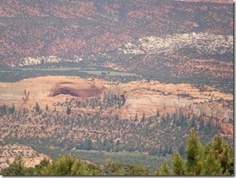
We started today not sure what to do.  The major hike we’d come this way to do, the Calf Creek Trail to the Lower Falls, was under construction and closed while federal stimulus money upgraded the trails (I didn’t realize how needed this might be until we tried following another trail later in the day).  There were other, longer hikes, but we hadn’t planned for them and weren’t sure the kids could handle it.  We asked around for suggestions and one guy told us to find the Devil’s Garden of the Grand Staircase Monument area.  We were driving that road anyway, so it sounded good. 

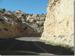
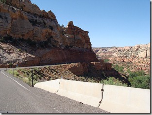
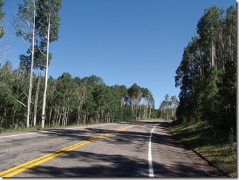
Route 12, by the way, was once again a fantastic drive.  More crazy curves, narrow roads without barriers that plunged into nothing, and descents with 14% grades. 

DSC03058

A curve along Scenic Route 12

DSC03060

Note no road barriers along the curve

DSC03050

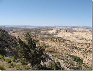
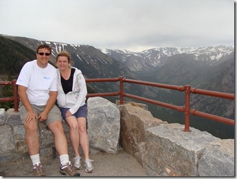
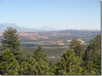
A scenic overlook near the summit

The Capitol Reef area was north, and now we were entering the Grand Staircase – Escalante Monument, a newer national land area designated in 1996.  DSC03105
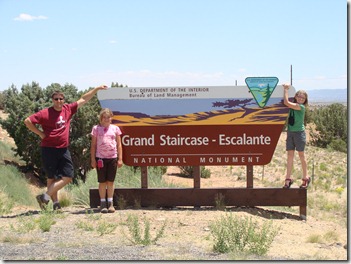
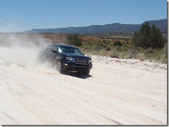
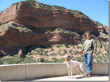
After our scenic drive, we found the turnoff to Devil’s Garden, a dirt clay road called “The Hole in the Wall Road.”  When the Mormons first cleared it and passed through back in the 1800’s, they expected to take 6 weeks and instead took 6 months.  That should have been a good warning, but the Devil’s Garden was 12 miles down, so with our pop-up camper in tow, we started to slowly make our way there.  8 miles in we had yet to see another car, the road was getting worse, and the camper was becoming a problem.  When we saw a small turnout, we dumped it alongside the road (hoping nobody else wanted to hitch it up and pull it down this road either). 

DSC03102

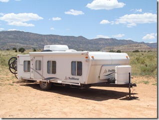
Ditching the camper so we can make better time:  It’s weird to think, “God, I hope nobody steals our house.”

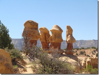
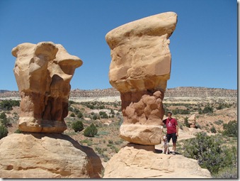
We really picked up speed without the camper, and the Devil’s Garden was a great time.  The dog could run loose, and we all enjoyed climbing around on the Hoodoos, these super fun rock formations. 

DSC03083

A line of Hoodoos!!

DSC03082

The Woelmer girls climbing on the rocks

DSC03089

Mike and Buster exploring one of the balancing rocks

DSC03079

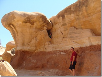
Mike watches Julia climb around in a small cave

DSC03092

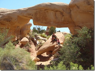
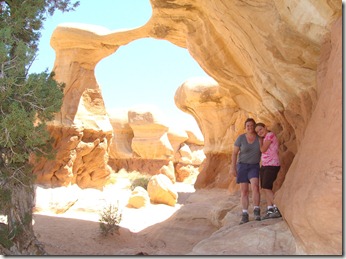
Christine and Elizabeth under an arch

DSC03090

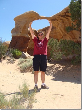
Don’t let go!

We explored the area for a while and played around in the tunnels and arches.  Problem was, that stop was so cool we didn’t want to leave.  The brochure we picked up at the hotel said there were two slot canyons another 10 miles down the road, and we decided to check them out. 

I wonder how many bad travel decisions begin with the words, “Well, as long as we’re here . . . “

I don’t think many people venture past Devil’s Garden.  The road crews sure don’t.  It was bad before, but it soon got insanely worse, with the road washed out in areas, washboard for most of the trip, and covered in half a foot of sand the rest of the way.

DSC03094

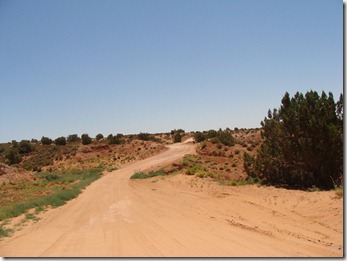
The start of The Hole in the Wall Road, the only way into the Grand Staircase area and, according to the pamphlets, “Impassable when it rains.”

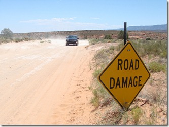
When we passed a sign that said Road Damage, it was like, “Really?  How the heck can they tell?” Mike seemed to be having a blast checking out exactly how much the truck could handle. 

DSC03101

DSC03098

Finding the trailhead for the slot canyons took us down a dirt trail that obviously doubled as a cattle path (there were corrals off to the side).  Inexplicably, the only other car there was a little VW Bus – that thing must have wings ‘cause I don’t know how it got there if it didn’t fly.  One of our brochures said the canyons were less than a mile away from the trail post, so while I stayed with the dog (we of course picked the only trail off limits to dogs) Mike and the girls loaded up with water and chocolate bars from the coolers and ventured out.  They were soon back, however, because the trail disappeared before they even came close to the canyons.  The clouds looked like rain, and that would wash away the footprints Mike had been following, so they came back to the car and we started the long drive back to pick up the camper.  If we had more than an eighth of a  tank of gas and some water, it would have been fun to explore the road all day ‘cause there are a ton of small turnouts with different things to see, but we hadn’t planned on going more than 12 miles, so according to all the official signs that warned “YOU CAN DIE HERE WITHOUT ADEQUATE PREPARATION,” we needed to find town. 

It was a true adventure, and even when the road was awful, it was great to look at.  We arrived in the closest town, Escalante, out of water and snacks and with only 20 miles before we ran out of gas.  We also needed a serious car wash.  What we didn’t know until we popped up the camper, though, was that we’d spend more than an hour later in the evening scrubbing a good layer of dust off of everything inside both the camper and the truck bed. 

DSC03109

Everything . . . and I mean EVERYTHING . . . was covered in dust

DSC03112

The girls scrub it all down

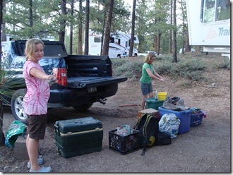
An hour after leaving Escalante, we scored a campsite inside Bryce National Park, the girls started scrubbing down everything we own, and we grilled some burgers for dinner.  Mike and the girls took a quick peek at one of the trailheads, and they went to bed anticipating some great hiking tomorrow. 

DSC03110

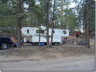
Our campsite in Bryce Canyon National Park

  • Digg
  • Del.icio.us
  • StumbleUpon
  • Reddit
  • Twitter
  • RSS

Monday, July 5, 2010 (Drive from Heber City to Boulder, Utah)

High Point:  The drive along National Scenic Byway 12

Low Point:  Dinner at the Boulder Mesa Restaurant

Today was another 5 hour drive.  At this point in the trip, it’s about all everyone can handle before we start hearing, “Hey!  You’re taking all the room!” or, “That was my water bottle!” or, “I drove last time!” (yep, even the grown-ups can get in a mood).

Usually, even when we hit the occasional fantastic vista, we holler into the backseat, “Hey!  Put down the (DSI, computer, mp3, book, etc.) and look at this!”  This is followed by an overly dramatic “Whoa!” or “Ahh!” . . . a short pause . . . and then a resuming of the (DSI, computer, mp3, book, etc.).  Until this afternoon, I was convinced they could no longer be moved by something as simple as pretty rocks. 

Then we moved into some gorgeous country.  As we came closer to Capitol Reef National Park, we really started seeing unimpeded areas of colorful rock hills – striped in beiges, reds, and greens with well-defined layers.  It was impressive enough that we looked it up.  According to the park website, “The Waterpocket Fold defines Capitol Reef National Park. A nearly 100-mile long warp in the Earth’s crust, the Waterpocket Fold is a classic monocline: a regional fold with one very steep side in an area of otherwise nearly horizontal layers.”  So there you go.  It jumps out at you and ripples across the valley.  Fantastic to see as you round a curve and see new sections of it you didn’t know would be there. 

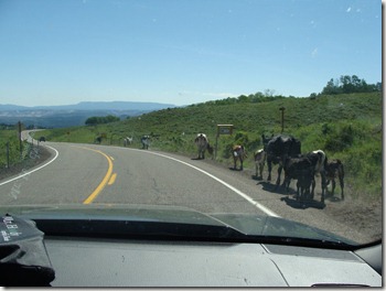
The best came when we hit Torrey, UT, and started driving highway 12, a scenic byway.  We were again climbing, and (I know it sounds trite) the overlooks were amazing.  We started pulling out every few miles just to look.  For a good half an hour, we weaved our way up and around through Aspen forests, red rocks, and wandering cows (free-ranging in the mountains – we’re not sure how they don’t get hit all the time by cars coming around sharp curves). 

DSC03009

Overlooking the edge of Capitol Reef National Park

DSC03007

As we climb higher, red rocks give way to pine forests again

DSC03014

Even higher, Aspen trees crowd the roadside

DSC03021

Cattle wandering along the road.  We put the camera away before they eventually crossed right in front of the car

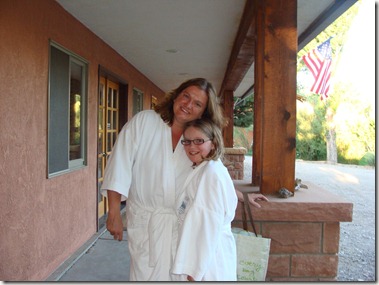
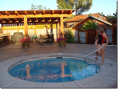
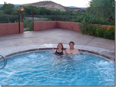
This drive divides the northern section of our trip and the southern section, so while planning, I had assumed we would be more than ready for a relaxing night in a hotel with dinner out.  We had a room reserved at the Boulder Mountain Lodge, a mountain spa hotel along the scenic 12 road that is connected to a highly-rated organic restaurant.  Funny, though, that for some reason, we don’t have that “need-a-shower-been-camping” feel.  Except for one time when we got into the truck in the middle of the hot afternoon and decided it smelled like old feet and had to ride with the windows down for a while, we don’t feel desperate for a hotel.  If we could have cancelled the reservation, we probably would have done so and found a spot in one of the many national forest campgrounds along the road.  In the end, it was an unnecessary but okay stop.  We liked that they welcomed dogs, everybody enjoyed the hot tub overlooking the mountains, and it was fun to chill out in front of a tv for the first time in weeks.  We didn’t like that the Wi-Fi access was hit or miss, the air was thick with mosquitoes, and our dinner at the Boulder Mesa Restaurant next door was a disaster (overpriced, no shade on the patio, ants crawling up your legs while you ate, slow slow slow service).  The only thing that saved the dinner was when the waitress poked her head onto the patio and said, “I’m real sorry we’re slow, but we all just got hammered in here.”  Julia whipped her head around, dropped her jaw, and looked shocked, whispering, “Did she say they all just got hammered?!  Doesn’t that mean they’re all seriously drunk!?”  So . . . vocab lesson of the day.  “Hammered” does not mean the nice older woman taking your order is passing around the whiskey in the kitchen. 

DSC03027

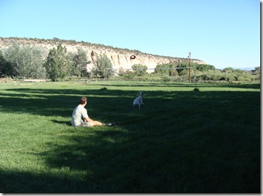
The front yard of the Boulder Mountain Lodge.  Mike and Buster play a little frisbee (and get eaten by mosquitoes — who knew they’d follow us from Michigan?)

DSC03029

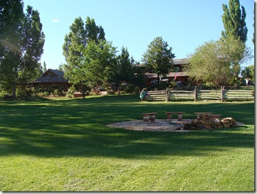
The fire pit area

DSC03031

Christine and Julia head to the hot tub

DSC03033

The girls test the water

DSC03043

Christine and Mike soak up some bubbles

Looking ahead, the hiking area we had planned to explore in the morning is currently closed for a month for trail work, so we won’t be exploring the Calf Creek Falls part of the Escalante region. I’m spending the evening looking at maps to see what else we have time to see.  

  • Digg
  • Del.icio.us
  • StumbleUpon
  • Reddit
  • Twitter
  • RSS

Sunday, July 4, 2010 (Drive to Utah)

High Points: Finally finding a campsite! Clean laundry!

Low Point: Not being anywhere near the city we’d planned on stopping

Today there isn’t much to say.  We woke up, sorted laundry, packed up the truck, and started driving south.  We have two days to reach Boulder, Utah – about a 10 hour drive.  There is only one problem.  When we planned the “big picture” of the trip, we thought it would be cool to be near a bigger city on the 4th of July so we could join the local festivities/see fireworks.  Salt Lake City/Provo were the right distance to split the trip.  Provo advertises a huge “America’s Freedom Festival” which sounded like a good bet.  We hadn’t considered that the 4th was a Sunday, however, and apparently the largely Mormon Utah population doesn’t organize fireworks, etc. for that day.  We found fireworks on the 3rd or the 5th, but Park City seemed to be the only place in the state having a celebration on the 4th of July.  We gave up the idea of visiting one of the big cities and instead planned to get a national forest campground near Park City and head to town. 

We were, of course, naïve to think we’d find a campsite anywhere on July 4th.  I started calling around, and they all laughed.  They we found out the whole Provo/Park City area is considered a watershed, so we couldn’t have the dog in a state or national campground anyway.  Unless we wanted to park and sleep in a Flying J truck stop (and we did consider it), our best bet was a private campground.  I started calling the night of the 3rd and came up empty.  As we drove on the 4th, I kept calling and finally found an RV park with an open spot in Heber City – about 17 miles SE from Park City (but more than a half hour drive in the hills) and 40 miles from Provo. 

Oh well.  No fireworks, but it was a place to park and sleep.  We had a lot of laundry to do anyway.  The re-routing took us down hwy 89 through the far SE section of Utah.  We kept weaving between Utah and Wyoming all afternoon.  Somewhere along the way, the forests of Wyoming disappeared and gave way to rolling red hills dotted with green sagebrush and small trees. 

DSC03002

Mike and Buster at a rest area in northeast Utah.  Our first real glimpse of red rock mountains. 

DSC03001

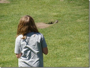
Julia watches a ground squirrel-type thing (don’t think it’s a prairie dog) at a rest area

Our campsite wasn’t bad.  It wasn’t near much of anything, but it was quiet, had a game room, and had a laundry. 

DSC03004

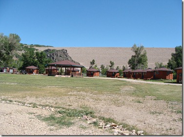
The only campground in Utah (from what we could tell) that had open campsites on July 4th:  Our campsite at River’s Edge at Deer Park in Heber City looked out at a group of yurt cabins.  Behind them is a huge dam holding back a popular fishing reservoir

We did 7 loads of laundry before dinner.  Mike took Buster out along the back side of the camp and played a little frisbee next to a creek.  Quiet night. 

  • Digg
  • Del.icio.us
  • StumbleUpon
  • Reddit
  • Twitter
  • RSS

Saturday, July 3rd (Breakfast Cruise & Rest)

High Point: Breakfast Cruise

Low Point: Chilly weather today (we changed our minds about a swimming trip to String Lake)

No sleeping in today ‘cause Mike and the girls were scheduled to take a breakfast cruise on Jackson Lake at 7:30 am.  We somehow got up and ready by 6:20 and drove off to the Colter Bay Marina.  I picked up a breakfast burrito from the restaurant and then hung out with Buster and watched the boats come and go.

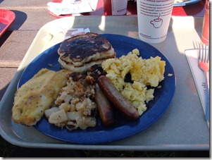
The boat trip toured the lake and gave some local history and stories before docking at Elk Island for a picnic breakfast of lake trout, hash browns, eggs, pancakes, and coffee.  The cooks said Julia looked tough, so they let her ring the dinner bell.  Everybody returned to the dock with full tummies and lots of new stories (a favorite about a guy who got off his Harley D motorcycle to take a picture of a bison but didn’t realize the bison would be agitated by the motor of the bike – he was okay, but the bison crushed the motorcycle which, it turns out, insurance did not cover for “buffalo attack”).

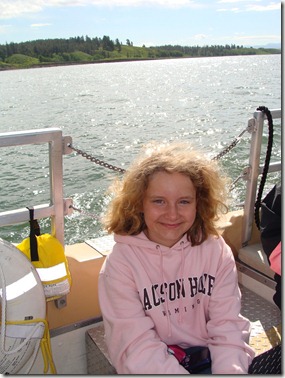
DSC02992 Elizabeth on the ride to Elk Island

DSC02985

Campfire Breakfast

The rest of the day was a much-needed day of rest.  Everybody took naps, and later Mike checked the brakes on the camper while everyone else read books (Julia read Maniac Magee twice and Elizabeth read The Hunger Games).

DSC02995 DSC02993

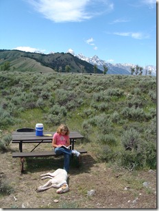
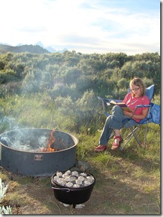
Julia reading by the fire                 Elizabeth with a book and the dog

DSC02994

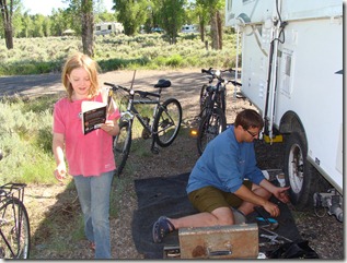
Mike checks the camper brakes to make sure we’re set for the next

leg of the trip

We had some time for dinner, so we experimented with the cast iron dutch oven. We had a pumpkin bread mix and a can of apple pie filling.  Adding a little applesauce and letting it cook for an hour, we ended up with an amazing dessert that doubled as breakfast the next day.

This was our first real “boondocking” camp stop, and it went really well.  We refilled the water tank once, and that gave us enough water for dishes and periodic showers; also, the batteries, once partially charged, gave us enough power to run the lights occasionally and run the heater at night.

These mountains are gorgeous and we’re going to miss them.

DSC02970

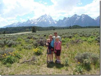
The Woelmers say good-bye to the Tetons!

Tomorrow we head for Utah . . . without camping reservations . . . on the 4th of July.

  • Digg
  • Del.icio.us
  • StumbleUpon
  • Reddit
  • Twitter
  • RSS

Friday, July 2nd (Hiking in the National Park)

High Point: Hiking the Tetons

Low Point: The crowds near Hidden Falls

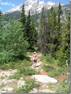
Today we wanted to do some hiking before picking up the dog, so we headed over to the Jenny Lake area where a 3 mile hike takes you around the lake and up into the mountains to Hidden Falls and Inspiration Point.  We had the option of paying a ferry to let us skip the first 2.5 miles, but we figured the girls could handle the walk and we wanted to actually be on a trail.  It was a beautiful path with some ups and downs but nothing too strenuous.

DSC02932

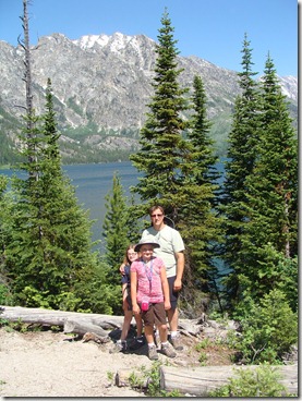
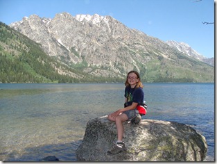
Looking out at Jenny Lake from the Loop Trail

DSC02933

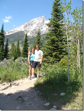
Mike & Christine:  Jenny Lake Trail

DSC02936

Elizabeth:  Making her way toward through the woods

DSC02935

Julia resting along Jenny Lake

They recommend bear bells or a radio to make noise while in bear country, but we didn’t need one ‘cause we had Julia.  She spent the hike in a rambling, stream-of-consciousness review of the major plot points from the 7th Harry Potter and the entire Percy Jackson series (back and forth and in no particular order).

Get Microsoft Silverlight

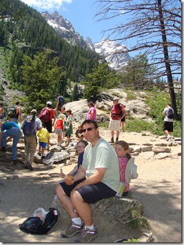
We saw a few people along the way, but not too many until we reached the Falls area where the boat dropped off dozens of people and the trail suddenly became a superhighway.  We had lunch at Inspiration Point where you could look out at the mountains and lakes.

Get Microsoft Silverlight

Hidden Falls

DSC02950

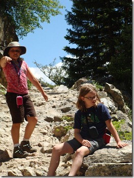
The last half mile before Inspiration Point can wear you out!

DSC02954

Lunch!

DSC02955

Are we inspired or just tired? Lunch at Inspiration Point

Get Microsoft Silverlight

We did take the ferry back so we’d have time to drive through some other parts of the park before getting Buster.

The last time we visited, we stayed at the Signal Mountain Campground, so we drove through there and looked around a bit before driving up to the Signal Mountain Overlook, where the mountains and trees motivated us to steal Julia’s mp3 and turn off her Wicked sountrack and rock out to some John Denver Rocky Mountain High.  It’s awesome watching your children try to pretend they’re not with you even when nobody else is around.

DSC02968

The Signal Mountain Overlook

DSC02964

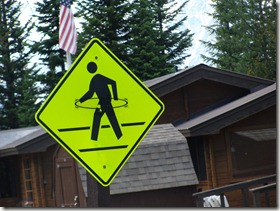
Signal Mountain Campground Fun Sign of the Day:

Are we supposed to watch out for people with hula-hoops?

Back in town, Buster was happy to see us.  We had tacos for dinner and went to bed early again.

  • Digg
  • Del.icio.us
  • StumbleUpon
  • Reddit
  • Twitter
  • RSS

Thursday, July 1st (Jackson Hole & Whitewater

High Point: Whitewater!

Low Point: Breakfast before grocery shopping (Lucky Charms with no milk)

DSC02920

Mike needs a caffeine fix = coffee pot fail

DSC02923

On our way to Jackson Hole:  How long will they block the road?

We really need to do some shopping.  Breakfast was Lucky Charms with no milk.  Mike attempted to run the coffee pot through the battery on the car, but that didn’t work so well.  Then he went rummaging through the coolers for some orange juice and came up empty.  I found him sitting at the picnic table eating his cereal and drinking a beer.  Definitely time to refill the coolers.

Today we started the morning dropping Buster off at the Happy Tails Pet Resort in downtown Jackson.  After hitting Anderson’s for groceries, we had a picnic in the park of fried chicken and potato salad and then walked around town for a few hours.

DSC02917

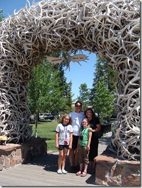
The antler arch in downtown Jackson

DSC02919

Touring the shops

At 2:30, we arrived at the Mad River Boat Trips office for WHITEWATER!  The temps were in the high 70’s, but the water was only around 50 degrees, so we were outfitted in wet suits (which are really unforgiving and I swear look good on almost nobody out of their teens).  Our 8 miles down the Snake River covered class I, II, and III rapids.  The trip was a blast – we had such a good time.  Mike and I paddled, Elizabeth hung on for dear life, and Julia sat right up front and kept telling us what to expect:  “I see some awesomeness up ahead!  Oh yeah – come and get me waves!”  At one point, the guide announced we were at a suitable spot to jump out and swim if we wanted.  At first, nobody moved ‘cause the water was so cold, but Julia stood up and yelled, “If it’s a once in a lifetime, I’m goin’ for it, baby!”  before plunging in to the water.  Later on, we did let her know that she’d eventually be old enough to choose her own vacations and could come back if she wanted, but it was good to see her taking advantage of the situation.

After a stop along the way for hamburgers and sweet corn (note:  they FEED you on the 3:00 trip, but not the earlier trips.  Same price — ???), we finished our river run with some good class III rapids, including one called Lunch Counter where they took our photo.  The pics are cool, so we’ll likely order some online.  Without those, it’s difficult to describe the complete terror on Elizabeth’s face during the entire ride – how someone can be smiling and freaking out at the same time is unbelievable).

  • Digg
  • Del.icio.us
  • StumbleUpon
  • Reddit
  • Twitter
  • RSS

Wednesday, June 30 (Drive to Grand Tetons)

High Point: Lunch at the Mexican Burrito Bus outside of Yellowstone

Low Point: Coming into Jackson from Hwy 22 over the mountains

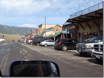
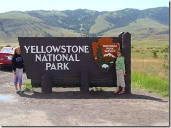
Today we left the Yellowstone area and traveled south into the Grand Tetons.  Leaving Gardiner, we stopped for a few pictures of the main street and the park entrance.

DSC02899

Mike packing up the bikes/Our view from Rocky Mountain Campground

DSC02903

Downtown Gardiner

DSC02905

Starting our last drive through Yellowstone

Nice little town, and the campground worked out really well when we wanted to leave the dog behind for the day, so it was a good choice.  We didn’t find anything similar near the Tetons, however, so our plan is to get as close to Jackson, WY, as possible where Buster can hang out in doggy day-care while we play.

Our day’s destination, then, is the Gros Ventre Campground within Grand Teton National Park – only 12 miles or so from town but with rustic camping only (no water/electric).  Temps were going to be in the 40’s overnight.  Not a big deal usually, but our camper battery seemed to be dead and Mike and I forgot to pack our sleeping bag.  Instead, we’re sleeping under an old quilt of Julia’s decorated with colorful, dancing monkeys.  Not very warm.  Therefore, today’s big adventure found us wandering through Idaho in search of what Mike read would work best  = 2 golf cart batteries.  The easier option, of course, would be to buy a sleeping bag, but for some reason that’s the back-up plan.

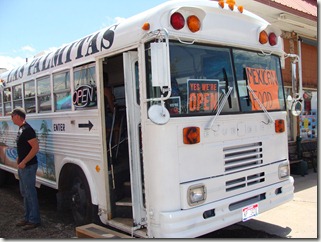
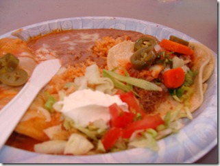
The good part of the detour was that we stopped for lunch in West Yellowstone at a place called Las Palmitas, or what we came to call “The Mexican Burrito Bus.”  There were lots of local workers waiting in line instead of tourists, so we had a hunch it would be good . . . and it was.  Really good food.

DSC02907

Our lunch stop in West Yellowstone

DSC02909

They don’t serve chips & salsa, so no salsa review, but lunch = yum!

The detour also led us to the low point of the day:  Coming at Jackson Hole from the west over the mountains along Hwy 22.  We just followed the GPS route and ended up taking perhaps the worst route for anybody pulling a trailer.  Straight up.  Straight down.  Campers were bailing left and right along the way.  We made it, but barely; you could smell the brakes by the time we reached the end, and I’m pretty sure my fingernails left marks on the door grips.  Before we left Jackson, Mike was worried enough he actually took the camper apart to have a look at the brakes.  All good.

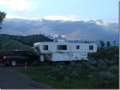
With two new golf cart batteries to power the heat, we set up camp in Gros Ventre in a spot where you could see the Tetons peeking over the sagebrush hills (sagebrush creeps me out, by the way – anything could hide in there).

DSC02911

Setting up camp in the Gros Ventre Campground, site #71

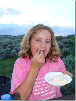
The campground was first-come, first-serve, so after getting a battery we didn’t spend time grocery shopping.  Dinner was canned ravioli and tuna casserole, but nobody complained. Nobody went to bed hungry either, ‘cause Mike brought out the ice cream ball.  This time we added to it a couple of over-ripe bananas and some rocky road fudge we picked up back at Devil’s Tower.  It was like homemade Chunky Monkey – our best effort yet!

DSC02912 Bananas and fudge ice cream

Bedtime came when the sun went down.  Until then, I could sit and look at these mountains forever.

  • Digg
  • Del.icio.us
  • StumbleUpon
  • Reddit
  • Twitter
  • RSS

Tuesday, June 29, 2010 (Gardiner & Chico Hot Springs)

High Point: Happy Birthday, Mike (we gave him a good hiking hat). Looking up at the mountains while resting in a hot spring pool

Low Point:  Getting ready to camp without hookups and knowing the camper isn’t working correctly; Having to break the news to the girls that all the “moose” they thought they saw in Mammoth yesterday were really elk.  The moose count is back to 6. 

Before they went to bed last night, the girls asked when they would get a day off.  Elizabeth explained that she has been seeing so much it is all “hard to process.”  Julia described it as being “like Buster at dog training” because he’s exercising a little but “his brain is working hard.” The kids are tired. 

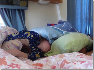
DSC02879

Even the sun coming through the windows doesn’t wake Julia up

That fact, combined with Mike’s plan to work again most of the day today, led to a more relaxed pace.  We didn’t drive into the park, and we didn’t tackle any great hikes.  Instead, we slept in really late, had breakfast around 11 am, and let the girls just hang out playing on their DS’s. 

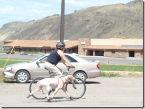
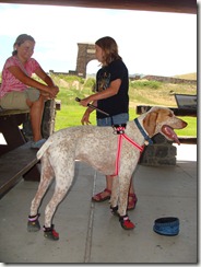
Around noon, we decided to give Mike some extra quiet time, so the girls and I hooked the dog to the bike and went down to the school again to run him around.  When he was settled down and tired, we parked the bikes at the edge of Gardiner’s touristy row of shops and took turns hanging out with him on the benches while the other two of us looked at postcards and magnets. 

DSC02886 DSC02881

Running Buster around the Gardiner school parking lots and resting in the public park (you can see the Yellowstone entrance arch in the background)

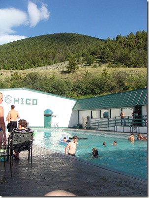
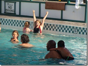
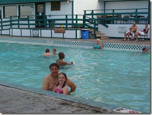
When Mike finished working for the day, we packed everyone up and, on the recommendation of a friend who visited nearly 20 years ago, set off for Chico Hot Springs, a resort 30 miles north of Gardiner.  It is a cute little collection of horse barns, restaurants, day spas, and hot spring pools.  For around $20, the whole family could swim in the pools for the day.  A big swimming pool was running at 93 degrees, while a smaller pool was 103 degrees.  The water comes in right from the spring and is regulated slightly by a cold water faucet that adds water when needed to keep the temps fairly constant.  It was a neat experience soaking in the pool and looking up at the mountains just on the other side of the wall.

DSC02893 

DSC02895

DSC02896

Julia jumped into the hotter pool once but decided it was too much “like falling in a geyser” and hopped right back out.  We’d skipped lunch AND it was Mike’s birthday, so we decided to forget the late camp dinners for tonight and instead eat at the poolside grill where Mike had bbq ribs and the rest of us shared a pizza.  Swimming in a natural hot spring was a new experience, and the history attached to this place goes back to the late 1800’s, so that was fun to read about.  Also, I’ve never seen so many people decked out in swimsuits and cowboy boots, so that was worth the trip.  When I’m sharing water with dozens of other people, though, I prefer it to be heavily chlorinated, so I’m not sure I’d go out of my way to go back. 

When we did return to camp, it was for an easy night of watching movies on the laptop and doing some laundry.  Hopefully, everyone will have more energy in the morning. 

Gear check:  Mike is looking into how to handle the next 4 nights because temps are dropping into the 40’s and the camper battery that should be able to run for several days is only lasting an hour – a problem ‘cause this won’t let him potentially run the heater.  I know I shouldn’t whine ‘cause we’ve camped in the Tetons before back when we had only a tent and it was just fine.  That was our honeymoon, though, so maybe I just don’t remember it being cold! Anyway, we’re boarding the dog for two days (1 night) in the town of Jackson, so it makes sense to be on that end of the park. We’ll be camping without hookups at the Gros Ventre Campground in Grand Teton National Park.  No electricity or water, so I expect us to emerge from the woods sometime this coming weekend really needing an internet fix and a hot shower.  It will likely be July 4th before we post another blog entry.   

  • Digg
  • Del.icio.us
  • StumbleUpon
  • Reddit
  • Twitter
  • RSS

Monday, June 28, 2010 (Yellowstone Canyon and Tower areas)

High Points:  The moose count is now up to 38 still at 6! Seeing the Lower Falls

Low Points:  The 328 stairs that lead back up from the Lower Falls observation point along the Uncle Tom Richardson Trail.  Also, it looks like the refrigerator just will not run on LP until we get it serviced.  Fine for when we have electric, but now we’ll need to move to coolers whenever we want a more rustic campsite. 

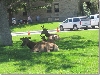
Wildlife Update:  A whole bunch of moose elk just hanging out in Mammoth.  More than likely, our count is off ‘cause some were still there on our way back; we probably counted them twice.  

IMG_0206

Moose Elk relaxing on the lawn near the Mammoth Visitor’s Center

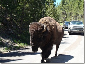
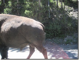
While leaving one of our hikes today, a couple of bison wandered within a foot of our car.  I had the window down to take a picture.  I got the first shot.  Julia, in the backseat, also had her window down, but she froze when the animal got close to her.  She regained her wits in time to catch the second picture – the bison’s backside walking off. 

DSC02844

Bison (taken by Christine in the front seat)

IMG_0220

Bison (taken by Julia in the back seat)

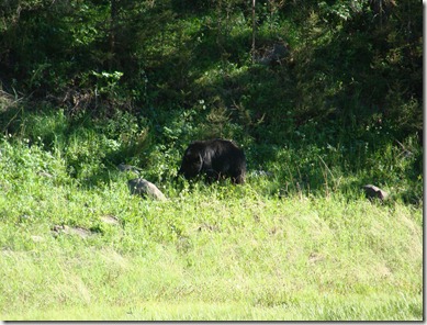
Toward evening, we were just approaching the Mammoth area when we spotted a cluster of photographers.  They had better zoom on their cameras, so their picture of this black bear is probably more impressive than ours. 

DSC02876

Black Bear (he’s there somewhere!)

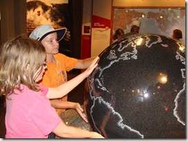
Waterfalls & Canyons:  Mike was working today, so he stayed behind in the camper and kept the dog company.  The girls and I packed up, grabbed a to-go sandwich from the Food Farm, and drove toward the Canyon area of the park.  Our plan was to make this a shorter day than usual but still see some waterfalls and canyons.  Canyon Junction has a great visitor’s center focused on the supervolcano nature of the park, so the girls walked around in there for a while before moving to the trails.  The ranger at the desk recommended two hikes to the Lower Falls.    

DSC02835

Checking out the supervolcano map

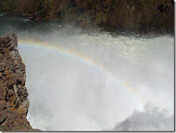
At the first turnout, everybody grabbed hats, water, cameras, sunglasses, and binoculars.  They were ready to go.  We headed down what we believed to be a strenuous trail (based on the ranger’s advice).  The trail ended about 50 feet down the path at an overlook for the Upper Falls – a small waterfall not too far off the road.  Apparently, I had the wrong trailhead.  Oops.  The kids labeled this one the “Granny Trail” and we went back to the car to try the next road.  On the drive, we decided the rainbow made the stop worthwhile even if it wasn’t our intended destination. 

DSC02840

A rainbow accents the Upper Falls

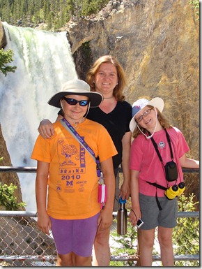
The next road took us where we wanted to go: a trail named for “Uncle Tom Richardson” who designed the steps and used to lead tours of people down to the falls.  The walk down was easy . . . it is the more than 300 steps almost straight back up that hurt.  It didn’t actually take you all the way to the base of the falls, but the view was impressive.  A tour walking by said that the falls are just 60 feet shy of being twice the height of Niagara.  I found that hard to believe ‘cause they didn’t look that tall, but I think the height is hard to measure on sight because the bottom half is difficult to see. 

DSC02846

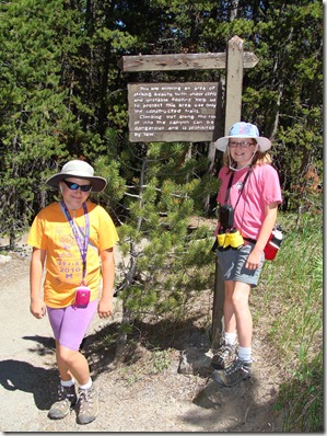
My awesome little hikers ready to hit the trail!

DSC02849

Lower Falls viewpoint

The video was taken about halfway down.  You get a good look at the Falls, a rainbow, and the many, many stairs we still needed to walk down (and up). 

Lower Falls Trail

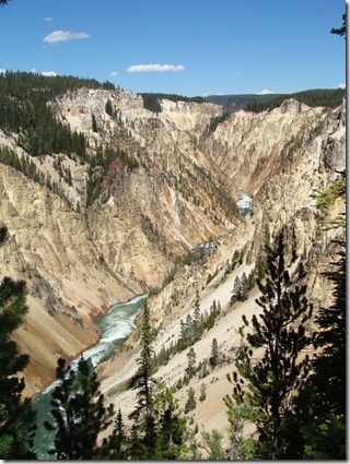
On the way back up the trail, we took a side path that gave you a nice look at what is called the “Grand Canyon of Yellowstone.” 

DSC02853

Canyon view from along the Lower Falls Trail


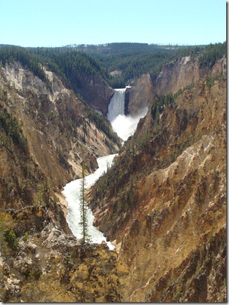
The stairs made us feel like we had put in a good hike, so we chose to drive instead of hike the mile down the path to Artist’s Point – the place where most of the postcard-type pictures are taken of the falls.  We sat here for a while ‘cause the view was fantastic. 

DSC02857The view of Lower Falls from Artist Point

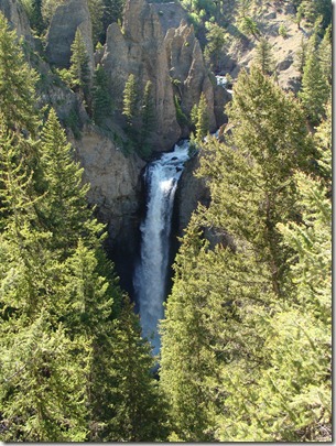
We spent more time than we planned walking those simple trails, so we didn’t make the planned second difficult walk we started the day thinking we’d finish (another walk down to the falls).  Instead, we drove back to Mammoth by way of Roosevelt/Tower so we could see what was up there.  Tower Falls was not as grand as the Lower Falls, but it was still very pretty and a quick trip off the main road. 

DSC02870

Tower Falls


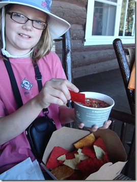
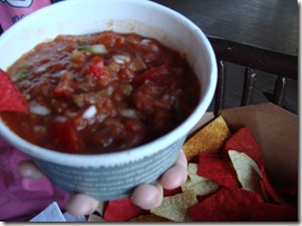
Salsa Test! Our final stop for the day was the Roosevelt Lodge, once built to commemorate the visits of a former president and now a restaurant and set of overnight cabins.  We noticed chips and salsa on the menu and just had to stay for a minute.  We got them to go and ate out on the big front porch where you can relax in old wooden rocking chairs and watch the trail rides come out of the mountains for the day.  The chips were dusted with chili powder, so that definitely enhanced the taste.  The salsa itself was fresh and loaded with peppers and onions.  The girls loved it:  Julia gave it a 5 and Elizabeth gave it a 4 (out of 5).  I agree it was good, but it was VERY mild without a lot of spice.  The girls loved it ‘cause they could “taste the vegetables.”  A good snack before heading home for another late dinner. 

DSC02873

DSC02874

Chips & Salsa:  Roosevelt Lodge


Final Note: I was most happy that I found a great place in Gardiner to exercise the dog today.  Just outside the gates to the national park (just about half a mile from our campsite) is the K-12 town school.  There is a nice loop a bike (and dog) can follow through the parking lot, around the road alongside the track, between the track and the city park, and back through the parking lot.  There were several other families out there with their dogs, so I ran Buster around half a dozen times and let him really open up in the straight-aways.  While we biked, I could see a mother and baby elk walking along the hillside next to the road. 

  • Digg
  • Del.icio.us
  • StumbleUpon
  • Reddit
  • Twitter
  • RSS

Sunday, June 27, 2010 (Yellowstone Geysers & Traffic Jams)

High Points:  6 moose, 1 almost-visible grizzly, erupting geysers

Low Points:  Traffic, Traffic, and still more traffic


Today we made arrangements for the campground to walk and water the dog while we explored the section of Yellowstone between Norris and Old Faithful.  That’s only 60 miles of driving (30 to Norris, and then 30 between there and Old Faithful).  Knowing that, we half expected to get a little further and maybe make it as far east as the West Thumb area.  The first 30 miles to Norris went easily.  We saw our first two moose of the day, and we saw our first bunch of crazy people chasing moose through the fields with their cameras.  The only crazier human/animal situation came on the way home when Mike and Elizabeth spotted a grizzly bear off in the trees; although they were disappointed they didn’t have a good camera shot, at least one guy wasn’t giving up and started creeping up on it to get a good picture.  People are not too bright.  We even heard one young teen ask her mom today if everything in Yellowstone was for real or just man-made.  I suppose if you don’t believe the bear will act like a bear, you don’t mind chasing it through the woods (or propping your baby up on its back for a photo like we heard a ranger say he’s seen some people do – yikes!).


DSC02787

DSC02830

Moose wandering across the road and into the fields cause the first animal traffic jam of the day

Anyway, the day started well as we drove toward the geysers.  We made a quick stop in the Norris area to use the restrooms and let Mike pick up a book he wanted titled Death in Yellowstone, a ranger-written collection of all 300 deaths that have happened in the park.  There is some construction going on between Norris and Old Faithful and the signs all warn to expect 30 minute delays.  We got our 30 minute delay . . . and then we hit a second traffic jam and sat for another 45 minutes.  The kids were losing patience because we’d promised less driving today.  It was already 2 o’clock in the afternoon, so we broke out the picnic lunch and ate it while we sat there. 

DSC02793

Lunch Break!

Mike started to entertain everyone with stories from his death book about all the ways you can get boiled, gored, or mauled in the park.  Julia made him stop so she wouldn’t get nightmares.  In her words, “Dad, I thought I’d be glad to see you reading an actual book – you know, one that’s not about computers, but I changed my mind.  Stop it.”  It wasn’t a horrible place to be stuck ‘cause we could watch the a group of people fly fishing along the river.  We never did find out what the second, longer traffic jam was all about.  All of a sudden, we were just moving again.  Best we can tell, we were just at the trail end of a long animal-watching backup. Lesson learned: 20 miles on the map could mean 25 minutes, but it could mean hours.  Bring snacks.

Our first stop was a side drive through Firehole Canyon where you could pull out and see a small waterfall.  At the end of the drive was a parking area for those who wanted to swim in the river.  The ranger was turning people around today, though, because the river is too high and is considered dangerous.  


DSC02790

Firehole Falls


Our second stop was the Fountain Paint Pots, a series of bubbling mud, pools, and springs visible from a half-mile boardwalk.  Some of them are fairly new, too, because a whole area opened up during an earthquake in the late 1950’s.  Bubbling mud always gets a good reception, but the Artists Paintpots from yesterday were honestly more impressive. 


DSC02795

Fountain Paintpot Trail: One of the colorful pools along the boardwalk


Our third stop was the Midway Geyser Basin to see the Grand Prismatic Spring.  This was another half-mile walk along a series of steaming, colorful pools.  The kids liked that they could see animal tracks in the spring areas.  Mike kept us updated on whether or not anyone had ever met a grisly end in any of these pools.  He’d just told us about a guy who jumped headfirst into the Celestine Pool (back at Fountain Paintpots) to rescue his dog when we passed by a ranger talk and heard the same story. 


DSC02804

Grand Prismatic Spring: a large area of bubbling water and colorful bacteria.  Even the steam was shades of blue, green, and pink.  Here along the boardwalk, you could see animal tracks in the orange crust along the water pool. 


We finally arrived in the Old Faithful area.  We had been driving and/or walking geyser trails for 5 hours already, and the kids were tired.  We found a spot on the observation platform and waited about half an hour until it blew. 

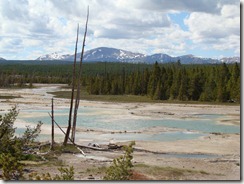
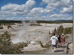
That perked them up a bit, so we hit the mile-long Geyser Loop Trail.  We were told these small geysers go off intermittently so we couldn’t be guaranteed to see anything.  We got lucky, then, because at least 3 of the small ones put on a show for us during our walk.  Some of them were right near the boardwalk, so you could really see the colors in the water and the thin layer of crust around the outside that fools many people into thinking it is safe to walk on. 

DSC02819

A good look at the danger of walking near the hot spring areas:

The ground is really a thin crust above what can be deep, boiling pools


DSC02824

Geyser Loop Trail: Old Faithful Area

DSC02816

Walking the Geyser Loop Trail: Old Faithful Lodge in the background

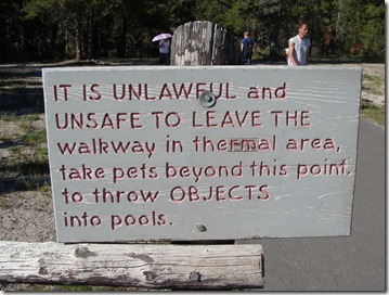
An odd highlight of the trip came for the girls who love weird signs.  This one seems to imply that you should NOT throw anything into the geysers; instead, you should bring your dog along and have him do it for you. 

DSC02812

Hot springs, Fido . . . very dangerous . . . you go first.

We were dreading the drive home thinking it might be as long as the way down, but we breezed right through all the areas that had been difficult earlier in the day – even when there was wildlife to see. 

We arrived back at our camp around 9 pm to find a family with a renovated Airstream camper had pulled in beside us.  He gave us a little tour, and Mike was enjoying the irony that this guy had an Airstream (the campers I really like) but he was itching to get a look at our TrailManor (which he really likes).  He was hauling 9 kids and all their gear, though, so he needs all the extra room his current camper gives him.  Next time I’m complaining about the noise in the backseat of our truck during this trip, I’m just going to imagine this guy riding around with 9 kids all asking if they’re there yet. 

Final note:  Buster did great and didn’t give the dog sitters a difficult time when they came to walk him.  They said he was a great dog.  Yeah Buster!

  • Digg
  • Del.icio.us
  • StumbleUpon
  • Reddit
  • Twitter
  • RSS

Saturday, June 26, 2010 (Yellowstone Mammoth and Norris Areas)

Time for a change of pace.  Time to slow down and start planning our visit to Yellowstone.  So happy to be out of the car for a full day of driving!  Seriously, if you have never driven in a car for 5 straight days with kids, you likely can’t appreciate the mileage they can get out of a road map and the pronunciation of the word “butte.”  We are more than ready to move on and see something new!

Saturday started with some necessary errands.  We needed to exercise the dog and we needed groceries, so we hooked Buster to the bike harness and biked everyone over to the Food Farm (the only grocery in town).  I picked up some things while everyone else pedaled up and down the main street. After a lunch of hamburgers and tater tots, Buster took an afternoon nap while we drove over to the Mammoth Hot Springs area (about 5 miles from our campground but almost 15 minutes to drive).

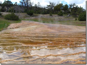
Mammoth looked nothing like it did during our last visit! The towering hills of colorful pools facing the road and boardwalks are currently dry. The ranger explained that geothermal features go through changes in which active areas move around. Therefore, to us (and many others apparently) the area seems to be drying up. The current active areas were mostly along the upper terrace levels, and we eventually found those and were quite impressed. The girls enjoyed keeping track of the heat in the water based on the color of the pools (the hotter colors are blue and green).


DSC02752

DSC02751

The geothermal areas of Mammoth

DSC02745

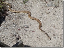
A Bull Snake looking for some shade near the hot springs

DSC02750

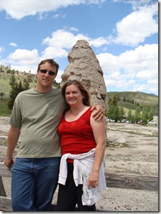
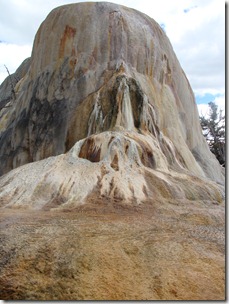
Mike & Christine in front of Liberty Cap, a 37 foot hot spring cone

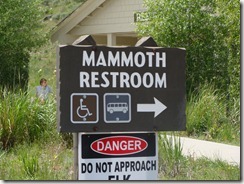
While driving through Mammoth, we had to keep our eyes open for the “Mammoth Restroom” sign. It is included in one of the girls’ Sign-Spotting books, so they knew it had to be there. As we rounded the hotel and restaurant area, we spotted our sign and probably looked ridiculous leaning out of the car windows to take a picture of the restrooms!

DSC02742

The restroom sign the kids rode in the car 5 days to see!

Driving south out of Mammoth, we followed the road down to the Norris Geysers. We took the half mile boardwalk around the Porcelain Basin where we took lots of pictures of the Black Growler Steam Vent and many other bubbly and colorful pools. Julia was a grossed out by the smell but toughed it out. We had the option of seeing the biggest geyser in the park, Steamboat Geyser, but it hasn’t erupted since 2005, so we skipped it and headed back to the car.

DSC02764DSC02757
View from the boardwalk along the Porcelain Basin

DSC02755     DSC02756

The geothermal feature above was slowly making its way into the road.

DSC02769

The view from the Artist Paintpots overlook

Our next stop was the Artists Paintpots. This was a half mile walk up a ton of stairs to an observation deck where you could hang out and watch puddles of mud bubble and spray. It was definitely very cool and got thumbs up all around as the best thing we’d seen all day. We were hoping the mud wasn’t too hot because some of the “burps” were pretty explosive and were spitting mud as far as the observation deck!

Watching the pools of bubbling mud: Artists Paintpots

On the way home we slowed for a wildlife traffic jam and Mike snapped a picture of an elk near the roadside. A few miles further we also saw a bison just standing next to the road. If he wanted, Mike could have reached out and touched it from the car window, but that didn’t seem like a great idea.

DSC02778

Elk

DSC02779

A bison just outside the car window

After a long afternoon of geysers and hot springs, everybody wanted ice cream. Mike made a trip back to the Food Farm to pick up supplies to get his ice cream ball started. We added the blueberries leftover from breakfast and the girls rolled the ball back and forth while I made a quick dinner of chicken fajitas.

DSC02781

Chips & Salsa from the Food Farm

We also had another task at dinner: The Food Farm made their own salsa, so we bought a small container and the girls did their taste test. Result = 3 out of 5 stars. They claim it was spicy but without a lot of flavor (?). They didn’t like how watery it was, but it was definitely pretty good. They ate almost the whole thing, though, so I think if it had just a little more cilantro it may have been bumped up to a 4.

               DSC02782DSC02783

The ice cream was a hit, though. Turned out great!

  • Digg
  • Del.icio.us
  • StumbleUpon
  • Reddit
  • Twitter
  • RSS

Friday, June 25, 2010 (Beartooth Highway, Yellowstone)

We took it easy this morning and let everybody catch up on some sleep. Buster woke the girls up when he started growling at some deer walking by, but we threw him in bed with us so everybody could get an extra hour of sleep. When we finally got moving, we hung out on the rocks along the river, threw the Frisbee for Buster, and Mike took everybody on a bike ride to see the other camping areas. One was near a lake and had a huge rock the kids could climb up and slide down. From there, it was mostly downhill back to our campground, and it must have been impressive to Julia to speed along on her bike along a road with mountains stretching up high on both sides. She got back to the camp and announced that you could “really feel alive” with the wind hitting your face. It was such a pretty campsite nobody was in a hurry to leave, so we didn’t pull out until just after noon.

DSC02702

Julia spending part of her morning by the water

DSC02703

Elizabeth in the campsite

The Beartooth Highway: The rout between our campground near Red Lodge and the next town, Cooke City, is 67 miles of sheer insanity. We went from a bottom creek bed to almost 12,000 feet — from a temperature of almost 80 degrees to 47 degrees at the top where we were throwing snowballs at each other. The road climbed . . . and climbed . . . and twisted at nearly 90 degree angles . . . and curved through snow drifts standing higher than the truck on both sides. Sometimes guardrails, but sometimes not. At one point, we got out at an overlook to see the view and a woman was bending over sick from the elevation. At a point closer to the top, two people on motorcycles had apparently misjudged a curve and were stretched out on the road in sleeping bags with people giving their head wounds first aid. Like I said, craziness. It was a fantastic drive, though, and I’m just glad Mike was the one behind the wheel.

DSC02710

View from the Beartooth Highway Overlook:  Our campsite was somewhere along the river at the bottom, and we’re still not quite at the top! 

DSC02712

Mike & Christine shivering on the overlook.  When we left camp, the temperature was in the 70’s.  Here it was dropping into the 40’s!

DSC02714

Julia ready to get back in the car!

DSC02716

The grown-ups had to pull over and make snowballs.  The kids wouldn’t get out of the car once we were above the snow line.

Driving the 67 miles took nearly 3 hours, so we were really late for a lunch stop when we finally reached the first picnic area inside Yellowstone where we got the grill out of the truck and made a quick lunch of hot dogs and Fritos.

Our camp stop for Yellowstone was in Gardiner, MT, just north of the northwest entrance to the park, so from Cooke City and the northeast entrance, we drove through Lamar Valley, the Tower Roosevelt area, and the Mammoth area. The Lamar Valley is an area of Yellowstone Mike and I hadn’t seen during our first trip in 1995. It doesn’t look anything like the rest of the park. It’s just big and broad areas of grass and river beds below trees at higher elevations and the mountains in the distance.

DSC02736

Entering the Lamar Valley

DSC02738

A herd of bison in the distance

The girls were excited to spot pronghorns, bison, mule deer, and even two moose as we drove through the valley. We were anxious to set up camp, though, so we didn’t make other stops.

Gardiner is small enough town that, much to Mike’s disappointment, is not even big enough to have its own hardware store. He has some repairs he’d like to make to the camper, but with the closest hardware 52 miles away, those might have to wait. Our “campground” here is a concession to the fact that the dog is with us and he is not welcome outside the parking areas while in Yellowstone. Dog boarding facilities, while easy to find for our other stops, are harder to locate for the Yellowstone area. Rocky Mountain Campground, a big parking area for RV’s set on top of a hill overlooking the entrance to the park, lacks the scenery of our previous stops, but they provide pet sitting if needed, so that’s where we ended up for this leg of the trip. It was nice to unload everything and get the cooking area organized. We ate the last frozen/thawing dinner from the coolers (enchiladas) and cooked up the apples left over from the lunch basket with some sugar and cinnamon. Mike had his first coffee in five days, and everybody got ready for bed showered and feeling good. The girls played with their DS’s and worked on their journals before turning in.

Final note:  When we pulled into our campground, the man who escorted us to our space asked from which direction we’d come in.  We told him we came in by way of the Beartooth.  He looked startled, looked at our camper, shook his head, and said, “Seriously?!  What fool told you to do that?”  He did agree it was an awesome drive. 

  • Digg
  • Del.icio.us
  • StumbleUpon
  • Reddit
  • Twitter
  • RSS

Thursday, June 24 (Devils Tower, Little Bighorn Memorial)

Checkout at the KOA was scheduled for 11, so we had a quick breakfast of the donuts we’d bought at Wall Drug and headed out to the tower to do the mile long walk around the base. Buster stayed in the camper and slept in.

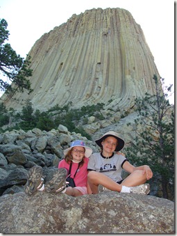
DSC02684

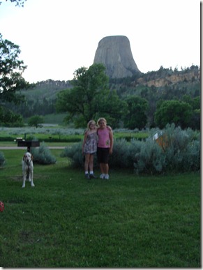
Julia & Elizabeth climbing in the rock field beneath Devils Tower

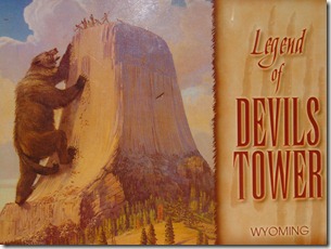
We started the walk close to 9:15 and didn’t finish until 10:45. First we stopped in the visitor’s center to catch up on the history and geology of the formation. The girls were intrigued by the Sioux legend in which 7 little girls are rescued from a bear when the rock they’re on begins growing and stretching toward the sky – sending them to become the Pleiades star cluster.

DSC02739

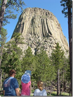
We found it interesting all the Native American names for the tower have something to do with bears, but the European settlers changed it to Devils Tower (and not just one devil, but many, because someone who didn’t know how to use an apostrophe left it out on the first submitted documents). The tower is fantastic to see up close because it looks different from every angle. On one side there are huge boulder piles Julia loved climbing on, at another point it is shaded forest, and from other angles it looks alternately smooth and rugged (like French fries, we decided).


DSC02686

Devils Tower binocular station. We could see at least 5 people

climbing the side of the tower. 

At one point we stopped at a binocular station and talked to a woman who was using them to watch her husband and two sons (ages 14 and 16) climb the tower with a guide. Her sons were just reaching the top while her husband had opted to head back down near the halfway mark. She was a lot calmer than I would have been! More amazing was that they were free-climbing without harnesses or anything. Elizabeth declared them crazy while Julia announced she was going to climb the tower someday before she died (apparently our 10 year old is already working on her “bucket list”). Anyway, it was a great walk and just the right length for us to make it back to the KOA to pack up before 11.

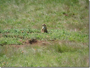
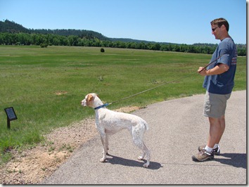
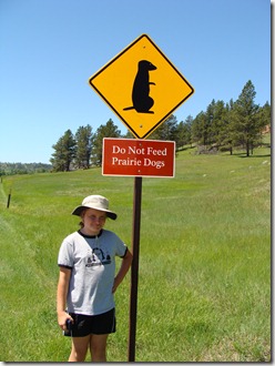
Before leaving the area, we drove back into the park about a mile to check out the prairie dog fields. When we first arrived, they were chirping now and then and you could see a few of them. Then we got Buster out to have a look, and the whole field went nuts!

DSC02689

DSC02691

Prairie Dog Freak Out:  Buster out of the car near the prairie dog field

The prairie dogs can really bark up a storm if they think a predator is nearby, and apparently shorthaired pointers fit that description. Buster, true to his nature, was “on point” and straining at the leash the whole time. The girls loved the prairie dog field, but eventually we had to return the car for another hard day of driving.

DSC02690

Everybody loved the prairie dogs

We picked up Highway 90 in Gillette, WY, where we stopped at an Anderson’s to get ice and cookies. Mike made PB&J’s while we were driving and we ate along the way.

Our next stop was the Little Bighorn Memorial in Crow Agency, Montana. We were pressed for time, and this stop was not dog-friendly (no dogs out of cars at all), so it had to be a quick trip. Mike and the girls got out, hit the visitor’s center to see the movie and museum, and then saw the Native American memorial along the hill. Mike was disappointed in the presentation because the movie was less about the importance of the battle itself (to both the Native American effort to retain a way of life and the US effort to remove the Native People from the area) and was heavy on the logistics of the battle which they didn’t understand at all. We were still 2.5 hours from our stop for the night, so Mike did some History Channel recapping along the drive. It was mostly a lost effort; the kids were most impressed by the canteen made from a cow bladder they saw in the museum.

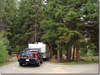
Just past Red Lodge, Montana, we stopped at Parkside Campground, a National Forest Campground, for the night. We had reservations, but someone was already set up on our spot so it took a while to work through our options with the campground host who had just received the reservation printouts for the night. While we were talking with him, the guy who was on our site pulled up and announced they were headed home, so we got our site back. It was gorgeous: right along a creek bed with mountains on both sides — snow at the tops of them.

DSC02699

Setting up at Parkside Campground near Red Lodge, Montana

DSC02697

Our view from the campsite

No water or electric service here, so the only disappointment of the night was that our refrigerator battery wasn’t working, so we wasted a good amount of time moving pop and drinks out of a cooler to make room for the fridge stuff. The LP still worked, though, so I heated up the manicotti that had been thawing in one of the coolers. We put the kids to bed at 10 pm and woke them up at 11 when dinner was ready. Instead of a fancy “candlelight dinner,” this was a more casual “flashlight supper.” Julia managed a, “Thanks, Mom . . . this is great,” while looking like she was going to collapse into her food.

  • Digg
  • Del.icio.us
  • StumbleUpon
  • Reddit
  • Twitter
  • RSS

Wednesday, June 23 (Badlands, Wall Drug, Mount Rushmore, and Devils Tower)

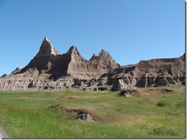
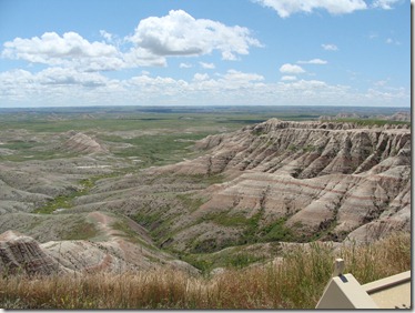
The long drive was totally worth it.  Our view out the windows in the morning was unexpected and absolutely beautiful.  We made a quick breakfast of scrambled eggs and toast, packed up the truck, made a quick stop at the visitor’s center, and started our tour of the Badlands.  It felt good to finally slow down the driving and start seeing things. 

DSC02640

Looking out the front door of the camper

DSC02659

Happy to start seeing the sights!

DSC02644

DSC02652

DSC02657

We drove through the park and stopped at most of the main overlooks and short walks along the way. Julia declared the place awesome and wanted to stay, but there was just so much to see! The girls had a map with them and couldn’t wait to see Big Foot Pass, thinking it had something to do with the creature and not the Native American leader it was named after. They were a little disappointed, so we decided we needed to do some background on the native people of the Black Hills area while we drove. We shared what we knew and read the guide sheets from the park.  We ended up most impressed that Chief Big Foot moved his people 65 miles in 4 days through that terrain.

Without any longer backcountry hikes planned, stopping at the overlooks was a pretty quick process. 

Managing the dog at Badlands wasn’t too bad ‘cause we weren’t heading out of the overlook areas. He was allowed in the parking areas and along most of the viewing points. There was only one stop where we couldn’t take him with us because it was a short boardwalk trail, so Mike and I just took turns along the Fossil Walk.

DSC02661

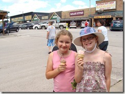
Ice cream from Wall Drug

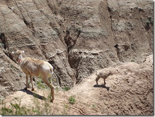
After a stop to see Bighorn Sheep at one of the last pullouts, we headed into the town of Wall and made the requisite stop at the very touristy Wall Drug for our free ice water. We also got ice cream and picked up homemade donuts for breakfast the next day. While Mike walked the dog, I put together sandwiches from the coolers. We ate in the car along the way to Mt. Rushmore.

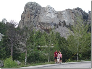
I’d already seen Mount Rushmore, so I opted to stay near the car with Buster. We knew this would be one of the rougher stops to handle with the dog, so we just planned his needed exercise for that time. I ran him around the parking areas for 45 minutes while Mike and the girls checked out the visitor’s center.

DSC02662

Mount Rushmore:  The view from the parking lot

Jumping back in the car, we drove straight to Devils Tower where we had reservations at the KOA. I made the reservations because there were electric hookups and we’d be able to leave the dog in the camper while we explored the tower the next morning.

DSC02665

Our awesome KOA campsite!

Turns out it was a good move because our campsite (number 22) had an amazing view of both the tower itself and the nearby Spearfish red rock formations (we noticed later the National Park campground was positioned with a slightly obstructed view of the tower). I’d made BBQ beef and frozen it before the trip (it had been defrosting in the cooler), so we heated that up quickly for dinner. Buster had a long day in the car, so Mike took him for a bike/run before dark. The camp shows Close Encounters of the Third Kind every night, but we were sadly too tired to stay up.
  • Digg
  • Del.icio.us
  • StumbleUpon
  • Reddit
  • Twitter
  • RSS

Tuesday, June 22 (Driving through Wisconsin, Minnesota, and South Dakota)

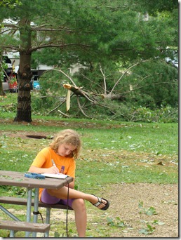
Evidence of the tornado could be seen a lot better in daylight. The guy in the next site had a tree on top of his trailer, so we watched them take it down with chainsaws while we cooked up eggs and toast and packed up the next morning.

DSC02626

Elizabeth starts her trip journal

DSC02740

A first page

Note: the bathrooms/showers were awesomely clean, and the place looked really nice (disc golf, swimming pool, big open grassy hills) and would have been a nice place to stop for an afternoon.

We wanted to get out of Wisconsin before lunch, but it was hard! Police were stationed every 5 miles and were pulling people over like crazy (???). Then, somewhere about an hour from LaCrosse, Julia went into a gas station bathroom and left her camera hanging in the stall – remembering it a half hour later! We had to go back, and she rode the whole way feeling awful ‘cause we told her it was certainly gone. I took her in to check it out, and sure enough, it wasn’t in the stall. She ran right up to the cashier, though, and asked if they’d found a camera. When they said they had, she started jumping up and down and was so seriously happy. She walked out saying the people of Wisconsin must be the nicest people in the world, ‘cause they didn’t take her camera. So here’s a shout out to Travis and the nice folks working at the Road Ranger somewhere in Wisconsin.

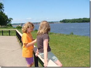
When we hit the Mississippi River, we pulled out the coolers and had sandwiches and chips at the Welcome Center.

DSC02627     DSC02632

           Looking out at the Mississippi                              Near our picnic spot

DSC02633

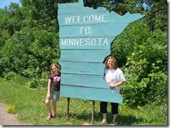
Minnesota!  Still a long ways to go

There were some long trails along the river, so Mike took Buster out for a good long bike ride/run before we packed back into the car. We made it through Minnesota and had to make some decisions when we crossed into South Dakota. It was already evening, and our desired destination, the Badlands, was still hours away. After driving through for a quick dinner at Taco Johns in Sioux Falls, we decided to just go for it. Storms were coming, and we were just going to drive until we had to stop.

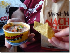
Side note: The girls’ favorite snack is nachos and salsa, so they decided to give this particular food a ranking every time they eat it on the trip. Taco Johns Chips and Salsa got 2 out of 5 stars because while it had a good spicy flavor, it wasn’t exactly salsa – more like the insides of a burrito. Burrito guts do not earn points for good salsa flavor.

DSC02638

Taco John’s “Not Quite Chips & Salsa”

Highlight of the night: The amazing lightning storm that stretched across the whole horizon in South Dakota and gave us a non-stop light show for over two hours. We had the radar on and could see we were threading a needle between two huge storms. We passed by the aftermath of the first storm and saw a Harley Davidson truck that blew over onto its side. A little scary, but it was a good move not to stop and get caught in the middle of the next one.

Driving into Badlands National Park after midnight felt unreal. One minute the scenery was bleak and empty, and the next there are these huge jagged red rocks lining the roadway that just come out of nowhere. It was dark and we couldn’t see much as we set up quickly at Cedar Pass Campground (only $14 a night!) to get sleep. Waking up with the red rocks out the windows was beautiful. So glad we drove the extra hours! 
  • Digg
  • Del.icio.us
  • StumbleUpon
  • Reddit
  • Twitter
  • RSS

Monday, June 21 (Driving through Michigan, Ohio, Indiana, Illinois, and Wisconsin)

The drive: When we left on Monday, we had two days to drive 17 hours to Badlands National Park, our first real stop. We were hoping to start out with a long day of driving and then a shorter drive on Tuesday so we could set up and see a bit of the Badlands before Tuesday night. In reality, we weren’t packed and ready to go until 4 pm, and after necessary side stops, we didn’t leave Michigan until almost 6. We were also tired, so a long night of driving wasn’t going to happen.

We made it past Chicago, only went as far as Milton and didn’t reach Madison like we’d hoped. We used the Google feature on the phone to find a campsite. If we had thought ahead and prepped the water so we had a bathroom, we might have joined the 5 or 6 campers we saw at a Wal Mart just off the highway, but without preparation, that wasn’t an option. At 9 pm, I called Hidden Valley RV Resort, and a woman answered by yelling very loudly, “I CAN’T TALK RIGHT NOW WE’RE HAVING A BIG STORM BYE!” and then hung up on me. Checking the radar, they were under a big red blob so we called back later and found out the area had been hit by an F2 tornado. For the first time all day, we felt lucky we were so slow to pack! We pulled in after midnight and had to weave through downed branches and tree limbs. We didn’t bother to use anything but electric and we didn’t pull anything out of the truck except overnight bags.
  • Digg
  • Del.icio.us
  • StumbleUpon
  • Reddit
  • Twitter
  • RSS

Current Trip: Out West 2010

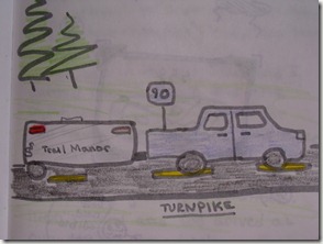
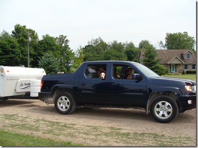
The trip: We’ve wanted to take some long camping trips with the girls, and this is our first trip longer than our 10 day trip to Michigan’s UP last summer. We’re bringing along our Trail Manor, a hard-sided pop-up camper that is loaded with a fridge, stove, and bathroom. We expect to do some shuffling with food as we move in and out of bear country, so we have two coolers with us as well. Our tow vehicle is a Honda Ridgeline. We’re keeping the blog for two reasons. First, it’s a nice way to share what we’re doing with any family or friends who want to follow us. Second, with such a long trip and numerous stops, we want to keep a good record of where we were and what worked (and didn’t). The girls are keeping written journals as we drive, and Mike and I will keep an online record of the trip.

DSC02623

On the Road . . . Finally!

Getting ready: Mike is still working off and on during the trip, so the front seat of the truck is loaded with computers, cords, and adapters. In the back seat, the girls share about 1 ½ of the space. The other section flips up, and Buster is settled there on the floor on top of an old couch cushion and a blanket. A non-tippable water bowl is next to him on the floor (under Elizabeth’s feet). Buster is with us because we didn’t want to leave him with someone for five weeks, and looking at our dog boarding options, there may only be occasional times when having him along impairs what we can see and do.

  • Digg
  • Del.icio.us
  • StumbleUpon
  • Reddit
  • Twitter
  • RSS

Road Trip 2010: South Dakota, Montana, Wyoming, Utah, Arizona, & Colorado

Hello everyone!  We’re still packing!  Once we get on the road, we hope to occasionally add a few pictures and trip reports.  Check in once in a while to see what we’ve been doing!

  • Digg
  • Del.icio.us
  • StumbleUpon
  • Reddit
  • Twitter
  • RSS