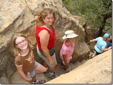
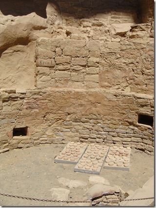
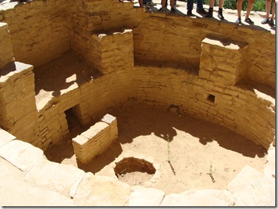
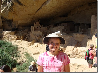
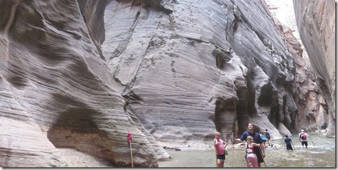
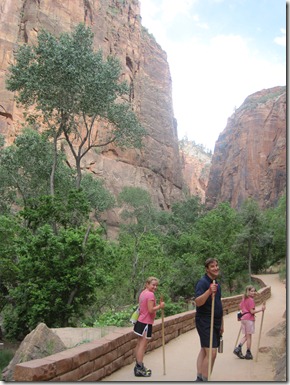
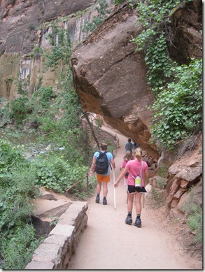
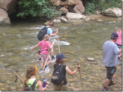
Going West: July 11 (Anaconda, MT, to Mt. Rainier National Park)


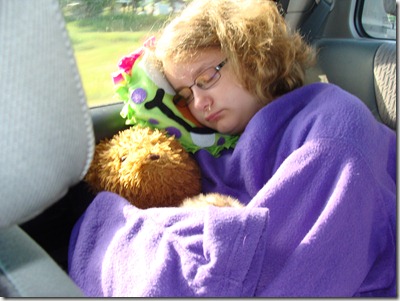
Another long day begins with sleepy kids.

DSC04593

Have I mentioned I love driving through Montana? It’s like being on a roller coaster for hours and hours. For much of today’s drive, the road followed the Clark Fork River. There were giant hills on both sides and a river running along the highway. Sometimes a train would follow us. I know my Michigan self is easily impressed by anything taller than a highway overpass, but this was exceptional by any scale.


IMG_1529

Woo hoo!  It was an awesome drive, but we’re finally out of Montana!

Eventually, we passed into Washington and the landscape changed. First came the urban bleh that looks like any other city, and then things looked more agricultural. The land flattened some, and I liked how the different crops made patterns in the rolling hills. A university somewhere along the route had set up signs identifying the crops in 15 miles of fields, so it was fun to guess them by site before reading the signs.


As we crossed the Columbia River, there was a great turnout where we could see Ginko Petrified Forest State Park and other stops along the river.  This was an important stop because it reminded me that the Columbia River is one of our family destinations when we reach Portland.  It made the distance feel a little closer. 

DSC04606


DSC04599

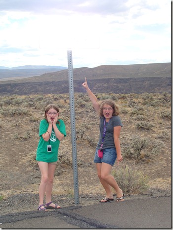
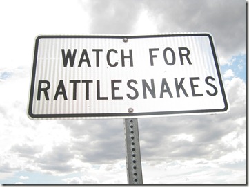
They’re not crazy . . . they’re just reacting to the sign

that disappeared with the camera flash . . .


IMG_1540

. . . there you go

IMG_1843

Chasing the kids with my camera

We bought some cherries from a stand outside Yakima and turned onto good ‘ole US-12 toward Mt. Rainier National Park.

Driving into Rainier is impressive. You definitely know you are off the main highway. The road becomes smaller and the mountains on both sides get higher. At 6 pm, the sun had already set below the mountain range, so it felt later than it was. The road winds and turns before reaching the park itself, and it took almost an hour to drive what we expected would take 30 minutes.

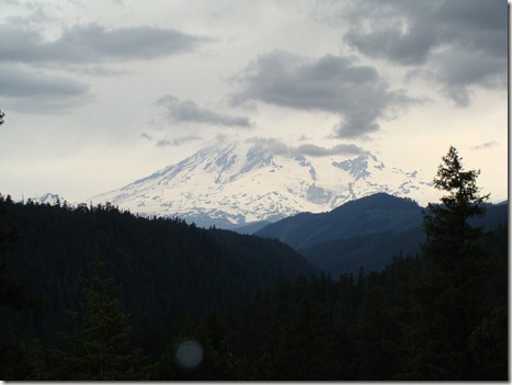
We did stop at a few turnouts to catch glimpses of the volcano.


DSC04611

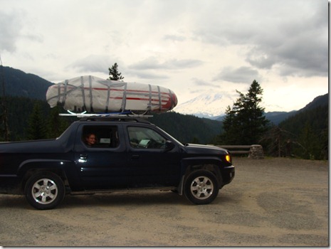
The velo arrives at Mt. Rainier

DSC04610


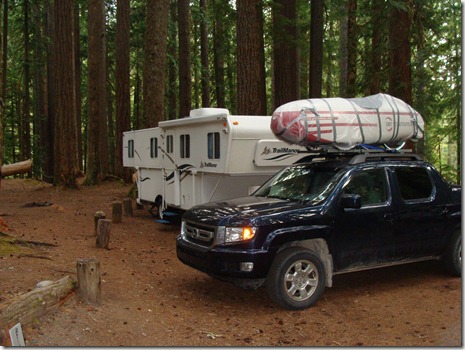
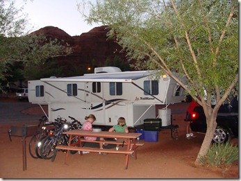
We had reservations at Ohanapecosh Campground just inside the eastern park boundary. It was getting dark quickly, so we set up and settled in. We could hear a river nearby and decided we would have to investigate in the morning.


DSC04613

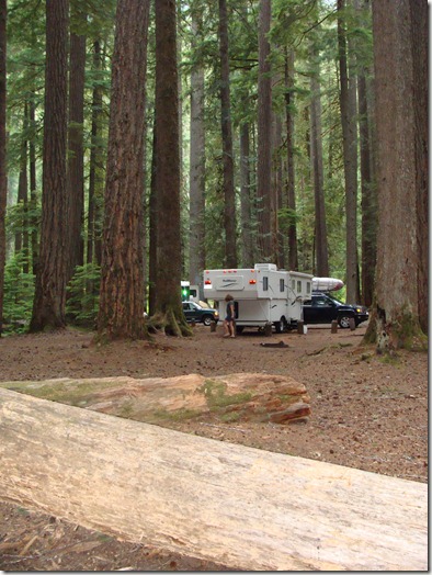
Front view of our campsite (F-11)


DSC04622

View from the back of the site


DSC04617

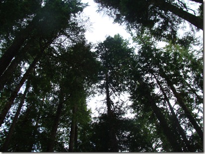
Standing in our campsite, looking up into the trees


DSC04631

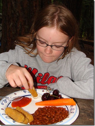
Dinner:  Cherries, a carrot, baked beans, and the mozzarella sticks

that were on sale at the gas station back in Yakima

  • Digg
  • Del.icio.us
  • StumbleUpon
  • Reddit
  • Twitter
  • RSS

Going West July 10: Glendive, MT, to Anaconda, MT

Today is part one of a two-day long drive. We need to put in 8 hours today. We were up by 6:30 and on the road before 8:00. We didn’t take time to make breakfast, so I promised McDonald’s if we could get moving on time. I sort of take for granted that some sort of fast food is a mile or two down the road. Not here. We drove for what felt like a looonnggg time before reaching the town of Deer Lodge where we ordered a couple McSkillet burritos. High fives all around to the McDonald’s staff in Deer Lodge, too, for handing us our bag and letting us know they’d put a couple extra hash browns in there. The girls were geeked. That and a Harry Potter collector’s magazine we found at the gas station elevated the mood for most of the morning.

I love driving through Montana because the hills are beautiful and for some reason the sky really does look bigger.

DSC04587

Driving into the mountains (after this, I decide the girls

need to be responsible for pictures while I’m driving)

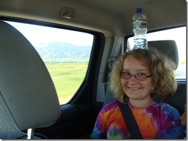
We had no stops planned, and we just wanted to keep moving. The girls amused themselves by balancing water bottles on their heads. They were running out of things to keep themselves busy.

DSC04589


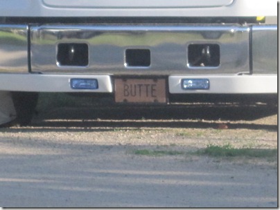
Oh yeah.  We did drive through Butte, Montana.  Put two kids in the car, and “Butte” jokes can take you through half a state.  Elizabeth started writing down her favorite  road signs:  Scenic Adventures in Butte . . . Do You Know the Real History of Butte? . . .you get the idea. 

IMG_1835

The kids had a feeling Mike would be sad to be missing out

on all the “Butte” jokes

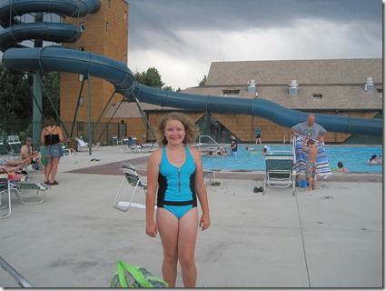
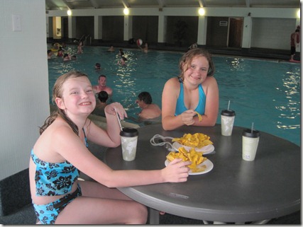
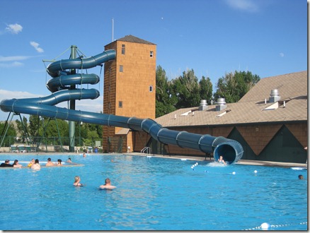
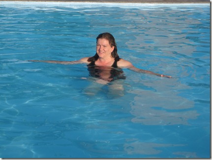
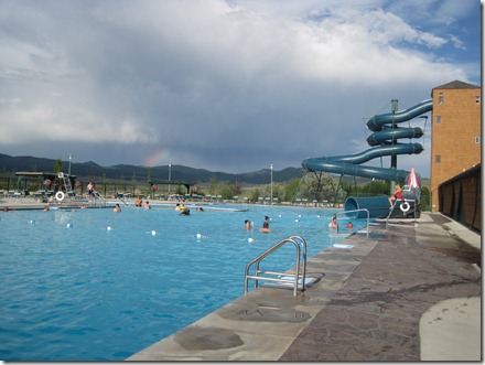
The payoff was that when we reached our campsite, Fairmont RV Park, we were across the street from a hot springs resort. We reached camp around 4:30, and we spent 3 good hours swimming and soaking before getting some sleep. It was a good night, and we were ready for another long drive.

IMG_1816

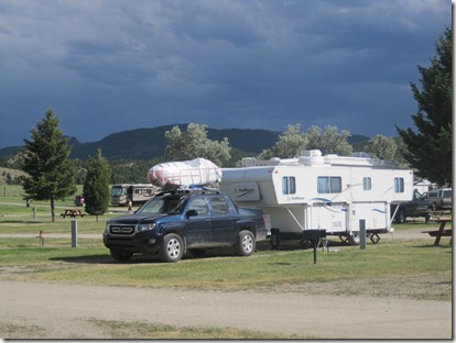
Our campsite in Anaconda (Fairmont RV)


IMG_1818

Getting in some pool time before the rain

IMG_1820

Nachos make thunderstorms pass more quickly


IMG_1826

Julia on the water slide


IMG_1834

Christine in the hot spring area


IMG_1823

After a brief storm, we had a rainbow

  • Digg
  • Del.icio.us
  • StumbleUpon
  • Reddit
  • Twitter
  • RSS

Going West: July 9 (Sauk Centre, MN to Glendive, MT)

After yesterday’s tire blowout, we had some time to make up. I was anxious to take off across North Dakota, but we first had to make a morning of phone calls and stops in order to track down a tire so we would have a useable spare. Everyone was sure they had one – “Just roll the busted tire on in” – until they physically saw it. It’s a weird size, but the number code sounds almost like a common one. Elizabeth and I got really good at taking the camper up and down and getting the tire off and on the spare holder. They really should make the spare accessible without requiring a ton of work first. It was exhausting, and by the time we found a Goodyear dealer in Fargo who came through on his promise of a replacement tire, we were more than ready to move on.

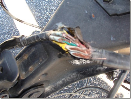
After only a few exits into N. Dakota, though, I just got this bad feeling that I should stop and check things. I pulled off to find our electric cable somehow came loose from where it was wrapped around things holding it off the ground and had been dragging along the highway for who knows how long. This is bad. Very bad.

DSC04544

Blurry (sorry):  Not what you want to see when you’re

hauling a camper through a state with few exits

DSC04547

The kids agree:  The whole breaking-down-every-few-miles thing is no fun

So . . . another bad news call home to Mike. In the end, I sliced the already-taped cord to expose more wire.  Then I wrapped electrical tape around each individual wire before  wrapping the whole thing in more tape. My brake and turn lights still work, so hopefully everything else will, too. As we pulled back on the highway, Julia said, “Mom, you’re awesome. I would have totally cracked back there.”

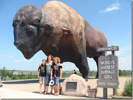
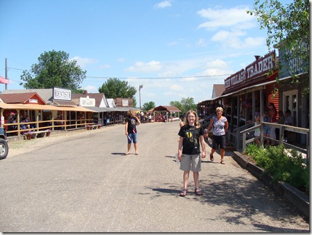
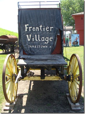
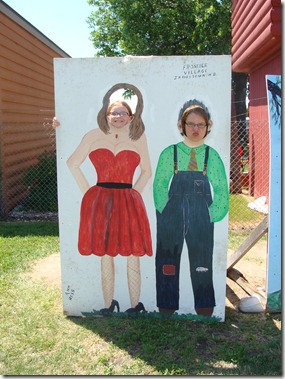
We made another stop in Jamestown where they were having a birthday party for their albino buffalo. The little wild west theme village was filled with people in costume getting ready for some kind of shoot reenactment (we didn’t stay long enough to see it), but we spent a little time checking out the exhibits and, of course, getting our picture taken with Dakota Thunder, the world’s tallest bison statue.

DSC04552

“Dakota Thunder”

DSC04550

The girls explore the village

DSC04561

DSC04549

DSC04557

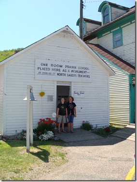
Visiting the old school house

The drive was quiet across most of the state. Dakota is extremely boring. There’s nothing to see and almost nowhere to stop. I started stopping for gas around the halfway mark just so I didn’t have to worry. The biggest excitement was watching workers set up barriers along several stretches of highway where floodwaters threatened to cover the road.

IMG_1467

Water lapping over the road barriers

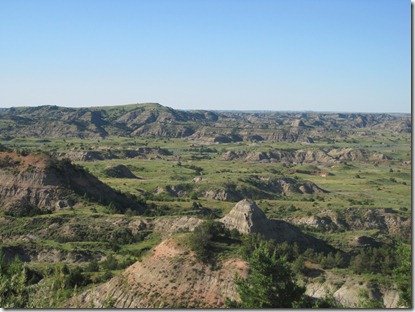
Finally, in the last few miles of the state, we entered Theodore Roosevelt National Park. We only stopped for a look at the overlook, but it was a fantastic view.

DSC04568

The lookout point into TRN Park

IMG_1815

Looking into the valley

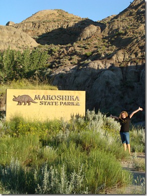
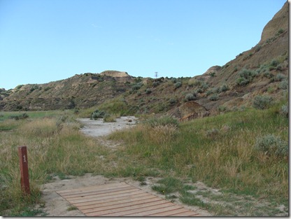
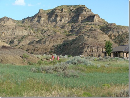
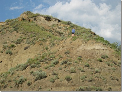
We ended our drive in Glendive, Montana, at Makoshika State Park – the Badlands of Montana. This park lacked the majestic feeling of the South Dakota Badlands, but it had a more relaxed personality. It also had what must be one of the coolest Frisbee golf courses ever. If we walked the trails, there were apparently lots of dinosaur fossils here, but it was too late for a hike.

DSC04577

The entrance to Makoshika (Glendive, Montana)

DSC04579

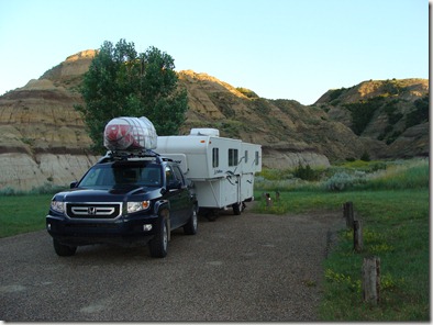
Our campsite for the night

DSC04583

Frisbee golf!  From this first throwing point, you can see the

Frisbee cage up on top of the hill

DSC04585

The girls explore the trails

IMG_1499

Julia makes a climb (easier going up than going down)DSC04580

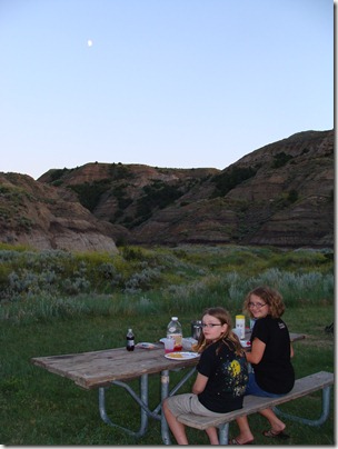
Eating dinner as the sun disappears behind the hills

No electricity here, and our rv batteries appear to be dead, so we went to sleep when it got dark.

  • Digg
  • Del.icio.us
  • StumbleUpon
  • Reddit
  • Twitter
  • RSS

Going West July 8: Rockford, IL, to Sauk Centre, MN

OK, so I was expecting to get a week or two out before things fell apart.

Today looked good when we started out. The girls ate leftover cold pizza and almost-ripe bananas for breakfast as we broke camp and packed up just after 6 am. I had planned to meet a friend in Minneapolis for lunch, and doing that kept us on schedule. The drive to Minneapolis was nice. We were finally out of Illinois and off the toll roads. The girls settled on a Star Wars movie — after opening several DVD cases they’d brought and finding them empty (they’d packed in a hurry) – and once we passed Madison the scenery changed and we could “ooh” and “ahh” over pretty rocks once in a while.

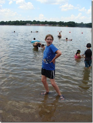
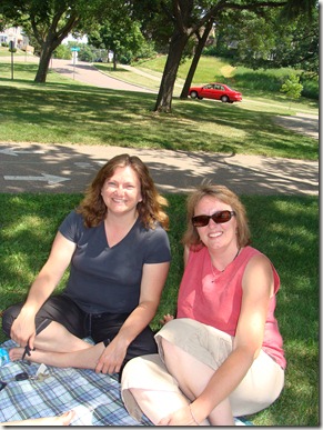
We reached Minneapolis in just over 5 hours. Melanie is an old friend from my stay-at-home-mommy days when I was part of a playgroup/bookclub that met once a week for a few hours in the morning but occasionally stretched into, “Oh wow – the kids have been playing so well I didn’t realize it’s almost dinnertime.” She moved to Minnesota years ago, so I was glad she had time to meet us for lunch and catch up a bit. We drove to a nearby park and ate as the girls wandered around, climbed in the trees, and cooled off in the lake.

DSC04529

Julia dancing in Lake Nokomis

DSC04533

Lunch with Melanie D.

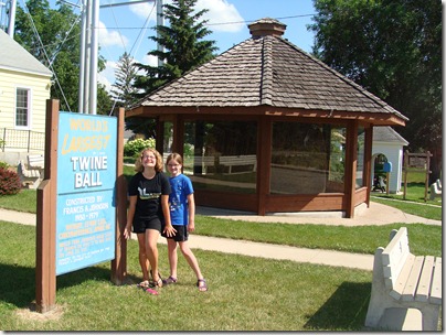
By two-thirty we were on the road. I only wanted to get as far as Fargo, ND, today, but we had a stop planned an hour away in Darwin, MN. If you weren’t watching music videos in 1996, you may not know that Weird Al Yankovic made Darwin famous by singing about the creation of Francis A. Johnson = a 12 foot diameter/10,400 ball of twine. Some folks in Kansas may have the record for the biggest ball of twine total, but Darwin’s twine ball is the biggest made by only one person. I mean, we were going to be within an hour. How could we NOT go a little out of our way to see the twine ball?

DSC04540

“If you could pick anywhere in this big world now, Where’d ya like to go ta?  They picked the biggest ball of twine in Minnesota.”  –Weird Al

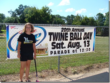
So we stopped, took a few pictures, bought some postcards, and even walked through the museum – yep, there’s a museum. It was a good stop. The twine ball does not disappoint. You don’t go into it expecting more. You expect to see a big ball of string, and there it is.

DSC04541

Darn it.  We’re going to miss the parade.

IMG_1798

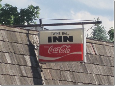
The Twine Ball Inn is closed.

Driving north toward Fargo, our mood was good and we were on schedule.

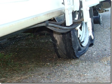
Then we heard a loud bang and in the rearview mirror I could see pieces of camper tire flying everywhere. Not good. As I explained earlier, I know how to change a tire, but the actual brute strength needed to do so is generally Mike’s area. I knew this going in, though, so I had purchased rv roadside assistance back in June. After a quick call to CoachNet, the tire was changed and we were moving again. I was driving with more caution, though, because I can’t figure out why the tire blew. We had just checked the pressure before leaving home, the camper is not carrying a lot of weight, and I didn’t see anything on the road, so who knows.

DSC04543

Not going far on this tire.

We pulled off early and stopped in Sauk Centre, MN. I found a campground not too far off the highway that ran along a river. Nothing special, but they had water and electric. It was our first night working the water system on our own, and I’m not going to embarrass us completely with the details, but it did not go well. Many things were overflowing and most of our towels now need to be washed. Whatever the opposite of beginner’s luck is, that‘s what we had. Tomorrow we attempt to cross the entire state of North Dakota.

  • Digg
  • Del.icio.us
  • StumbleUpon
  • Reddit
  • Twitter
  • RSS

Going West July 7: Milan, MI, to Rockford, IL

Before starting the trip, everyone should know I am excited about it, and traveling alone with the girls off and on for a month was my idea.  However, I do have slight panic moments when I wonder what I’ll do if something mechanical goes wrong with the truck, camper, or bike. I’m not incapable of fixing things, but that’s just always been Mike’s area. Mostly, I’m worried about getting the bike to Portland unscathed. To ease my mind, he has that thing strapped on really tight. It doesn’t even wiggle, so I have my fingers crossed we can say the same after 2000 miles at 70 mph.

My goal for today was to get a big chunk of driving done on the first day. I wanted to get to Minneapolis, but when we were still adjusting the bike at noon, I knew that wasn’t going to happen. When we crawled through Indiana and Illinois in rush hour traffic, I knew we weren’t getting far at all. We were also tired after packing and planning, so around 8:00, we turned off at the first campground available, Rock Cut State Park in Rockford, IL. We only saw the drive in and our campsite, #503, but the place looked nice.

IMG_1443

This is how we look arriving at Rock Cut State Park

IMG_1442

We successfully put the camper up and took it down with only

a half dozen calls home to Mike.  We were so proud.

It was our first time putting up the camper on our own, so it took Elizabeth and I a while to go over all the checklists and get everything taken care of. By dark, we were settled in and glad to be off the road.

High point of the day = getting a call from my friend, Marcia, who was on the road traveling toward Michigan while we drove away. Our paths crossed on the highway near Gary, Indiana, so we both pulled off within minutes of one another.

DSC04528

A quick hello somewhere near Gary, Indiana

Low point of the day = calling for pizza the minute we arrived in camp and waiting for more than 2 hours! Note to Maciano’s Pizza in Loves Park, IL = If someone asks, “Do you deliver to the state park?” — and you normally do not – the correct answer is, “No.” Saying it’s not a problem and then driving aimlessly around for hours makes tired campers grouchy. I give credit to our delivery guy, though. I had him on the cell phone for almost an hour as he drove all over that part of the state looking for us. First time I’ve happily given a tip for cold pizza.

  • Digg
  • Del.icio.us
  • StumbleUpon
  • Reddit
  • Twitter
  • RSS

Road Trip 2011: A Trip in Three Parts

The girls have been bugging me to start this year’s trip journal.  Mostly, I think they need something to do in the car . . . so here we go.

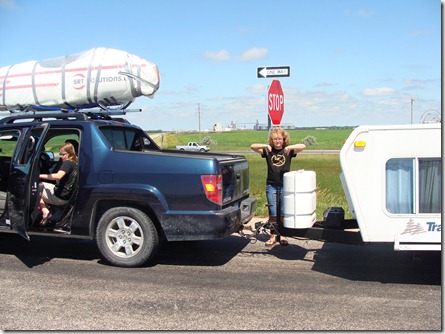
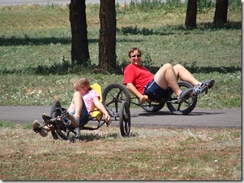
Our 2010 summer road trip was fantastic.  We knew we wanted to do another, but where did we want to go?  There were a lot of good ideas, but the plan  was settled when some velomobile riders from Europe  announced a 2011 summer ride across the United States.  Mike has been interested in a long bike trip, so the opportunity to see the country by velo with 49 other riders was too good to pass up.  As a result, everyone in our family is taking a long road trip; we just won’t all do it at the same time.

This year’s trip report will have three sections.

1.  The trip west. The girls and I will be transporting the velo from Michigan to Portland, Oregon.

2.  Family time in Portland:  We will meet Mike in Portland, spend some prep time there, and work as trip support for the first few days of the ride.

3.  The trip east:  Mike will pedal his way from Portland, OR, to Washington DC.  The girls and I will travel with him for the first few days.  We’re still working on how he might keep a record of the trip once we head home, but hopefully some of it can go here. Alternately, you can see the ride plan/riders/updates from the official site, Roll Over America, at http://www.rolloveramerica.eu.

This is definitely not a typical family road trip.  The girls and I set out on July 6th, Mike arrives in Portland on July 23rd, the velo ride begins on July 28th, and Mike reaches DC on appx August 26.  That’s a long time, and it should be exciting.  Check in on us once in a while!

DSC04524

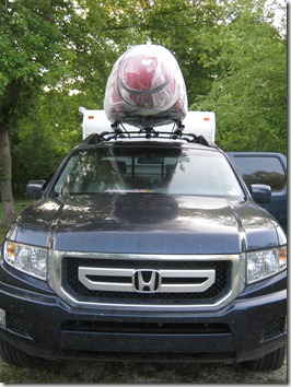
I promise we didn’t just duct-tape it to the top of the car

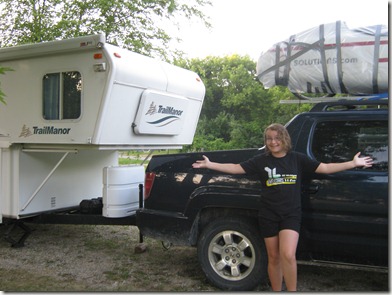
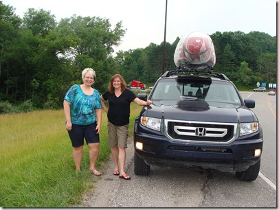
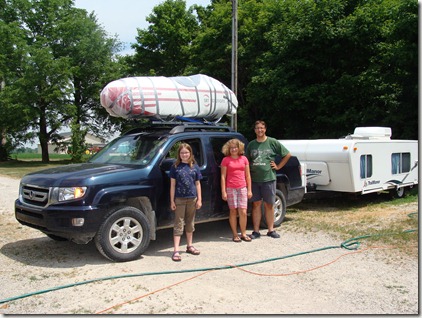
Tow vehicle = Honda Ridgeline, Camper = Trailmanor 2720, Velomobile = Quest

  • Digg
  • Del.icio.us
  • StumbleUpon
  • Reddit
  • Twitter
  • RSS

Tuesday, July 20, 2010 (Arches National Park–Hike to Delicate Arch)

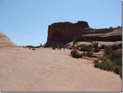
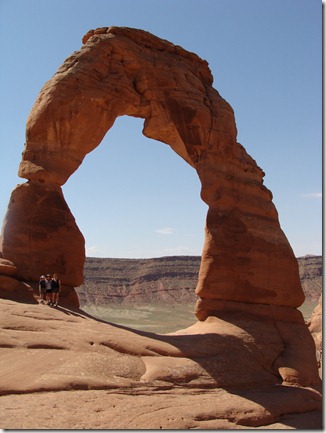
There are several long hikes in Arches NP that take you out to some spectacular places.  The most popular of the longer hikes is the walk to Delicate Arch.  This is “THE” arch everyone is familiar with.  It is the arch on all the Utah license plates and was used in promotional materials back when the Olympics came to Park City, UT.  It is only a 1.5 mile hike one way, so it doesn’t sound too bad.  All the hike literature, however, warns this is a “strenuous” hike and should only be done with “at least one quart of water per person – ideally more.”  This is a hike that gets very hot very fast.

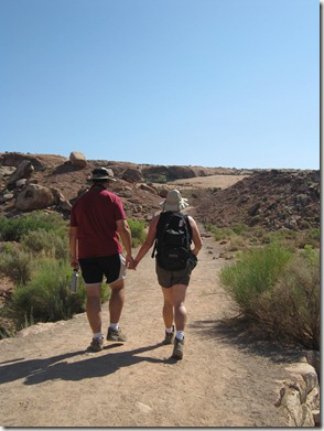
The hike starts out looking pretty mild.  The trailhead is at the sight of an old homesteader’s cabin which runs near a stream, so everything is green and pretty.  Then you pass over the first hill and realize the next mile and a quarter will  be mostly uphill – some is in sand and the rest is across slickrock – a strong red rock that heats up easily.  Even if there were shade available (which there is not), it is often too hot to comfortably take a rest.  For this hike, we packed even more water than yesterday.  We also packed Jolly Ranchers to stop our throats from getting dry.

DSC03948

IMG_0967

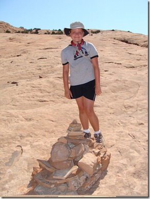
When the trail is along the slickrock, cairns (the stacked rocks) mark the trail.  If you know that, it is easy to find your way.  If you don’t know to follow the cairns, you can quickly end up lost.  A young couple following us started arguing about the path and went straight up the slickrock instead of turning when the cairns pointed that way.  We never saw them at the arch, so we’re guessing they gave up and went back to the trailhead.

DSC03947

Elizabeth found some small rocks to add to one of the cairns

DSC03946

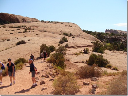
Walking up the slickrock.  I love this picture because the woman in the blue shirt (left) is walking back from the arch and looks totally miserable.

DSC03954

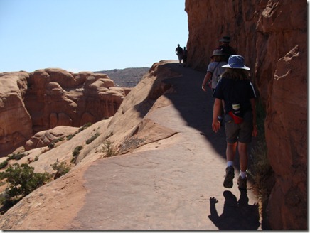
Once we were up high enough, we started weaving around ledges

DSC03953

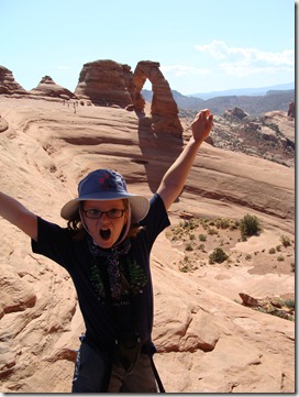
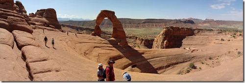
A smaller arch provides a window’s view of Delicate Arch.

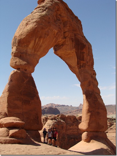
A first peek at Delicate Arch

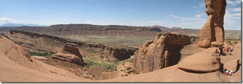
Delicate Arch stands opposite a bowl-shaped hollow.  There is really no flat surface across to reach it, so everybody just hangs far to the outside.  It’s a really bad place to drop a water bottle, though (Christine dropped hers and it rolled over the edge)

DSC03955

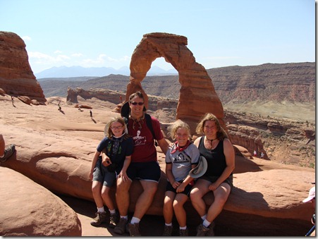
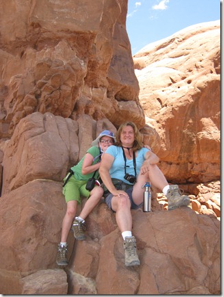
We’re either happy to enjoy the view or happy to finally sit down

DSC03965

Early settlers called the arch “Cowboy Chaps” or “Schoolmarm’s Bloomers”

The valley behind the arch

DSC03963

The walk back to the trailhead wasn’t too bad only because we were going downhill.  It still felt long.  It took us 3 hours to walk the 3 mile round-trip.  When we finished, it was noon and the sun was doing its heating-up-the-earth-thing.

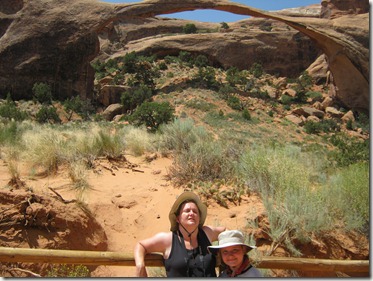
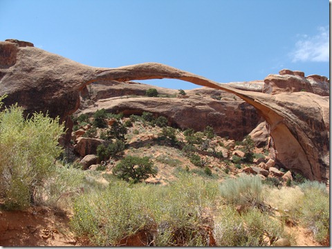
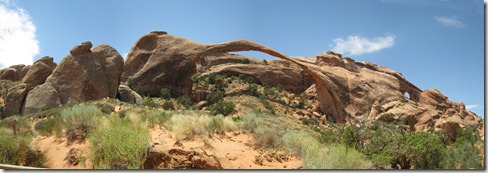
Knowing the heat was already bad and was only going to get worse, we apparently went a little nuts because we decided we still had one more arch to see before we left the park.  Landscape Arch is the longest such structure in the world.  Reaching it uses the furthest parking lot in the park at the Devil’s Garden trailhead.  The arch spans 306 feet and is currently 6 feet thick at its weakest point.  In 1991, a huge 70 foot section broke off and crashed down (almost hitting several hikers who ran scrambling when they heard it cracking).  One of the pamphlets noted Landscape Arch was standing while the Egyptians built the pyramids.  It was standing at the time of Christ. It was standing long before Europeans began exploring the Americas.  Then, one day, it will just fall.  It is already thinner and more fragile than an arch that collapsed in 2008 (Wall Arch was 70 feet wide and 33 feet tall when it disappeared overnight).  The park can’t guess when Landscape Arch will finally collapse.  Therefore, we wanted to see it while it still stands.  We hadn’t planned on taking 3 hours to hike Delicate Arch, though, so we weren’t totally prepared.  We hadn’t had breakfast because we were running late, and we didn’t have any extra snacks because we planned to eat lunch when we got back to camp.  Landscape Arch was only a 1.5 mile round-trip, so we hoped the water was good enough to get us through.  Refilling the bottles we’d emptied during the Delicate Arch hike, we started down the Devil’s Garden path.

IMG_1007

We made it, but we didn’t look good doing it.  At this point, it was almost 1:00 pm and the temperature was right around 101 degrees.  And yes, it was an impressive arch.

DSC03978

Its fragile structure means hikers can no longer get underneath the arch.  The path now only allows people go get about 150-200 feet away.

By the time we drove the length of the entire park and made it into town, nobody wanted to wait for lunch so we grabbed pizza.  Then I dropped everybody off at the campground while I went and picked up Buster from Karen’s Canine Campground.  I really have to give this business an extra-special note.  We’ve boarded Buster 6 times during the trip.  Most of these have been standard kennels adjacent to vet offices or just a typical boarding facility.  Karen’s CC is run out of her home.  Her backyard (which should be hot and covered in dirt in Moab) has fake grass and tents thrown up all over the yard for shade.  There are kiddy pools everywhere and misters cooling the dogs off.  As long as the dogs are well-behaved, they can run free and play with the other dogs.  When we picked Buster up, she noted he’d been playing ball all afternoon.  He honestly seemed to have a great time.  I didn’t feel so bad boarding him knowing he’d had one big playdate.

The rest of the afternoon was spent in the campground swimming pool until lightning drove us back into the camper.  Rain did cool things down and bring wind, though, so it was not nearly as uncomfortable as before.

Our original plan for the night was to pack a dinner and drive the 30 miles out to Dead Horse Point State Park.  Canyonlands was almost double that distance to get to an overlook and we were too tired.  Mostly, we wanted to see the overlook which we’d been told rivals the Grand Canyon.  Dead Horse Point was even used as a stand-in for the GC in the movie Thelma & Louise.  We wanted to eat dinner where Thelma & Louise drove off the cliff.  It didn’t happen, though, because (surprise!) it actually rained all afternoon.  The sky was really hazy and we just decided to hang around camp and use a bunch of leftovers to try a stew in the Dutch oven.  Another Dutch oven success – it was delicious.  After dinner, the girls went to bed and we spent a little time planning our route home.  We have no particular stops in mind, but we hope to drive through Denver and some parts of Nebraska we haven’t seen.

DSC03980

DSC03981

  • Digg
  • Del.icio.us
  • StumbleUpon
  • Reddit
  • Twitter
  • RSS

Monday, July 19, 2010 (Arches National Park)

This morning we dropped Buster off at Karen’s Canine Campground for an overnight visit.  This gave us all day Monday and part of the day Tuesday to see Arches National Park.  We knew it was going to be hot, so we loaded the backpack with extra water, filled our water bottles, and brought along an entire cooler of drinks.  It’s the last stop of the trip, and I think we’ve finally figured out this dry air requires an amazing amount of water to keep us all walking and feeling good. 
IMG_0814

DSC03875

Water:  Julia cools off during a hike


A bonus find came at the visitor’s center where everyone discovered bandanas with built-in cooling beads designed to stay cold for hours once soaked in water for 5 minutes.  If they worked, they were worth the money because we were tired of being miserable on hot hikes.  Mike and the girls got bandanas, and I got the hat version.
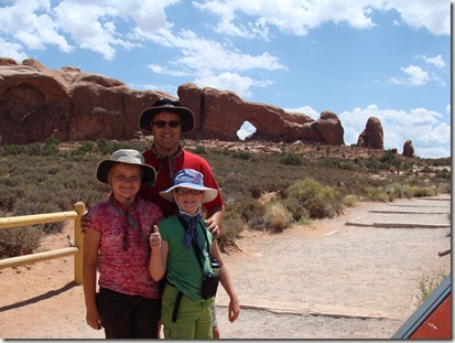
DSC03840

Everybody wearing their snazzy new cooling bandanas


I soon realized the cooling beads along the back of the hat work best if you don’t have a lot of hair in the way.  I put my hair up under the hat, but then Julia said my head looked like a carrot.  Oh well. The cooling beads are weird.  They look and feel just like the gel bead things in baby diapers.  We decided it was a bit ironic we spent years cloth-diapering babies in part to avoid the icky, mysterious gel beads and today we were saying, “Here, soak these up and put them on your head.”  Whatever keeps everybody cool and happy. 

We started the day with a couple of short hikes out to the Windows Arches, Turret Arch, and Double Arch.  Arches National Park has the greatest density of natural arch formations in the world; there are more than 2000 arches of all sizes, and 25 are more than 50 feet long. 

Park Avenue:  One of the first pull-off areas in Arches
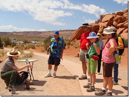
DSC03825

Talking about dirt:  A ranger gives a demonstration on how the arches were formed
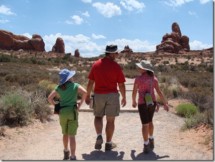
DSC03841

Mike and the girls walk toward the Windows Arches
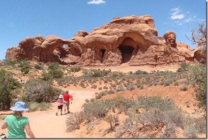
North Window:  Christine and Julia climbed higher for a good look
IMG_0830

     DSC03845

Looking across North Window:  Mike and Elizabeth are on the opposite side
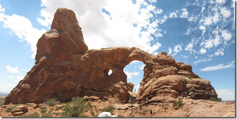
One look at Turret Arch
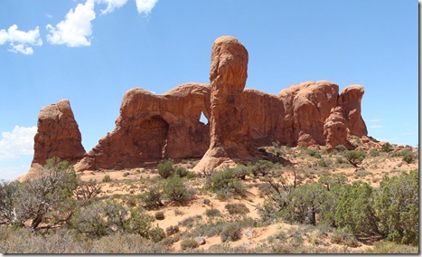
Another look at Turret

Julia is our daredevil, and knowing she wanted to climb high, one of us went with her at each arch.  Only once did she monkey-scramble up a rock face without a good way to safely get down.  That was at Double Arch where she and I climbed up to stand in the arch overlooking the road behind.  I knew I wasn’t strong enough to brace the two of us on the descent, so Mike had to climb up partway and help guide her down.
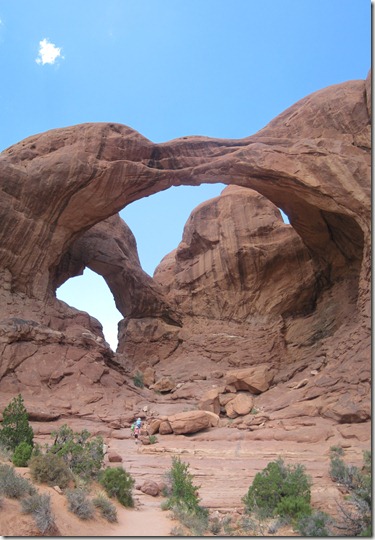
Double Arch
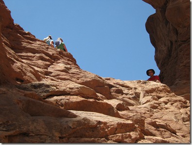
IMG_0874

Christine and Julia climb into the lookout point for Double Arch . . .
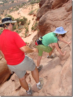
DSC03873

. . . and need Mike’s help to get Julia back down

Meanwhile, Elizabeth found herself a cozy little nook with a good view partway up and was perfectly happy hanging there while the rest of the family made sure Julia got up and down in one piece.  
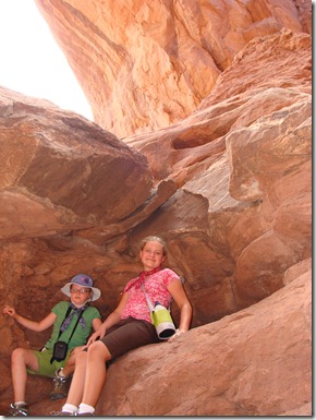
DSC03874


We also stopped a few times along the road to check out the rock formations you could see from there. 

Looking at Balanced Rock and the Garden of Eden area
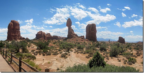
A closer look at Balanced Rock
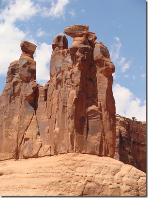
DSC03836

The Three Gossips

DSC03837

The Organ


We drove out to a picnic area hoping for shade but found only two picnic tables completely exposed to the hot midday sun.  The temp was reading 101, and nobody was anxious to sit outside and melt.  We joined several other families in parking at the picnic area but eating in the air-conditioned car.  Craziest looking picnics I ever saw.  We did make use of the rustic restroom facilities, though, and I just want to give a thumbs-up to the Arches National Park pit toilets.  They were sparkling clean and had nicer tile than my own bathroom at home.  When it’s super hot and you’re dreading entering a hot and humid bathroom, it’s the little things that count. 


Without a doubt, the highlight of the day was the ranger-led tour through the Fiery Furnace area.  Taking the hike requires advanced registration and a small fee, but we’d heard it was fantastic.  We reserved tickets back in April and took the last ones available for the day.  We were looking forward to it, but by the time we pulled into the parking lot and realized it was already 102 degrees, nobody was super excited about walking into a Fiery Furnace.  It wasn’t just our family; of the 28 people scheduled for our sold-out tour, only 22 showed up (the ranger said that is common on really hot days).
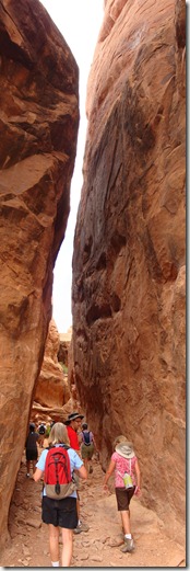
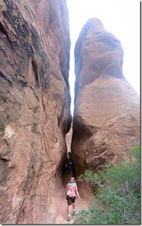


    Walking into the Fiery Furnace
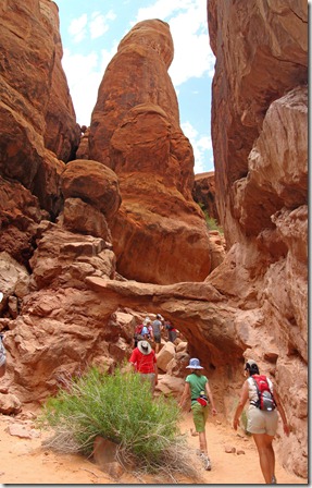
Walk-Through Arch

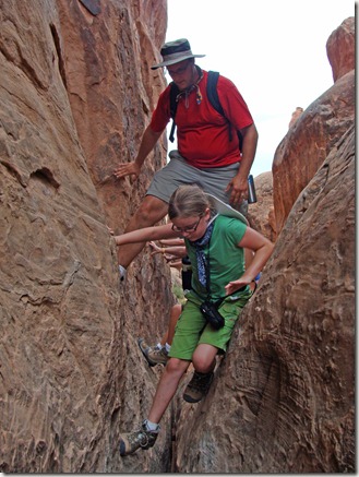
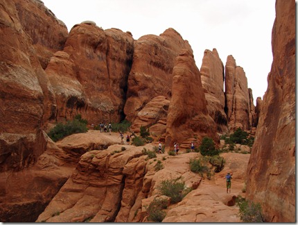
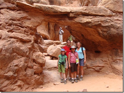
Once we started walking, however, we realized this was going to be okay.  The Woelmers officially like slot canyons.  Just like in Zion’s Narrows hike, there were many places here where the rock fins soared above us as we squeezed our way through the maze. The hike was primarily through rocks and canyons, so you could avoid the direct sun.  Also, the hike was broken into sections with ranger talks every few hundred feet, so you were never walking for a long distance without a break.
 

DSC03897


DSC03919

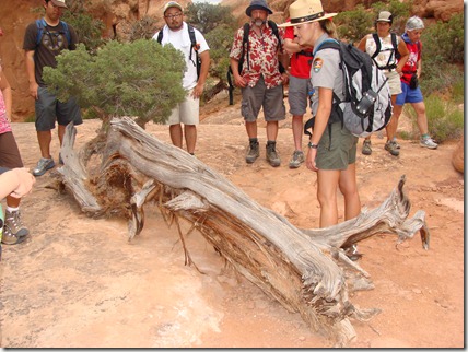
This Juniper tree is 300-400 years old
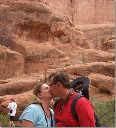
Imitating the arch called “The Kissing Turtles” behind and above us

We were glad for the breaks.  Even out of the sun, the air was so dry we were constantly having to drink water. This time we had a whole backpack full of extra water bottles, but I was worried it still wouldn’t be enough.  Sure enough, it was gone by the end of the hike. 
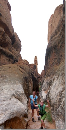


The ranger stops focused on the elements shaping the landscape:  earth, wind, and water.  Our kids were the youngest on the tour, so they each got to take a turn in demonstrations.  Elizabeth pretended to be a salt dome, and Julia was calcium carbonate.  Elizabeth was also asked to taste a Juniper berry, which turned out to be a small pinecone and did not taste good at all. 
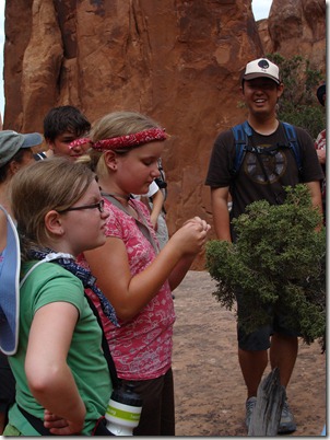
DSC03918

Tasting a Juniper berry

Between hikes, we scrambled up and down rocks, walked along cliff ledges, spider-walked along canyon walls, and crawled through some pretty tight spaces.  Julia loved it ‘cause she loves climbing and exploring things.  I just wish she had a slightly better sense of danger, so we had to keep a close eye on her. 
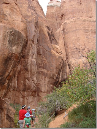
DSC03886


DSC03894

Crawl-Through Arch

DSC03895


DSC03924


Halfway through the tour, we hiked into a place called Skull Canyon.  Here the ranger talk focused on how life uses water in the arch areas.  Of special interest was the fairy shrimp – a small animal that creates a substance known as trehalose to survive through even 50 years without water.  This same substance is collected and used to keep transplant organs viable during transport.  Sadly, although the fairy shrimp can live without water for long periods of time, it can’t survive busy foot traffic, so there were no fairy shrimp living in Skull Canyon.  We were so caught up in the discussion about life in the water pools, we were actually surprised to turn around at the end and see the creepy eyes of the “skull” looking down at us.  
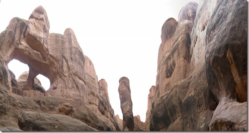
 

Toward the end of the hike, we made a technically difficult crawl into an alcove hiding the appropriately named Surprise Arch.  Everyone was tired, and the ranger had us all lie down and look up at the arch in silence for several minutes so we could hear only the wind blowing and sand moving across the rock.  Mike called it a “touchy-feely” moment he could have skipped, but it was a peaceful few minutes during what had been an exhausting three hours. 
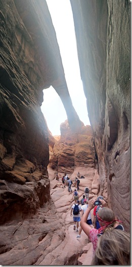
 

The last stop was a good place to observe how the Fiery Furnace got its name.  If you happen to be looking at the rock formations during a bright sunset, the rock fins take on a deep orange color and appear to burn.  Very cool. 
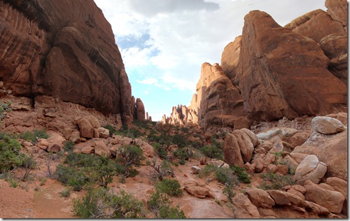
The rock fins look like flames in the furnace

Looking back at the Fiery Furnace area as we leave


Everyone was tired by the time we got back to town, so they voted to eat out at Fiesta Mexicana.  The salsa got a 4 out of 5 for taste because it had a good kick and the chips were tasty. 


DSC03945


It was a really tiring collection of hikes, but the whole family had a great time.  The only casualty of the day?  Julia’s shorts.  Cotton vs. Sandstone = Sandstone Wins. 
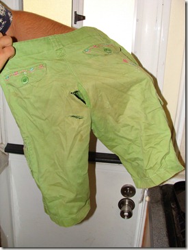
DSC03983

  • Digg
  • Del.icio.us
  • StumbleUpon
  • Reddit
  • Twitter
  • RSS

Sunday, July 18, 2010 (Why Camping World is Incompetent and the Drive to Moab)

This morning we left Mesa Verde and drove to Moab, Utah, a town within 30 miles of Arches National Park, Canyonlands National Park, and Dead Horse Point State Park.  We only have one scheduled hike for this stop, so we’re not sure yet what we will do.  Canyonlands is just a huge area that is really best-suited to those interested in backcountry driving or biking.  We’ve been told the view from the overlooks is actually more impressive at Dead Horse Point, so there is a possibility we may do that park and skip Canyonlands.  We’ll have to see what we have time to do. 

Anyway, packing up today was a little more difficult because we no longer have the bike rack.  The two surviving bikes and the useable remains of a third needed to be stored in the camper, so there was a great deal of puzzle-figuring to find a place for everything. 

The drive was interesting because as soon as we left Cortez and started driving north we saw a familiar landscape we hadn’t seen in weeks:  crops.  Farmers were actually growing things here, and the checkerboard fields were a welcome sight.  We passed a few grain elevators that advertised pinto bean processing, so we’re guessing some of what we saw were bean farms. 

The geology did change as we neared Arches.  There were some great sights along the way. 

DSC03814

Our first arch sighting!

DSC03813

Impressive scenery on the road to Moab


We were also reminded why it is important to keep parts of this beautiful country away from private industry; without the national parks, many of the gorgeous vistas we’ve seen may look like this:

DSC03816

Does the sign really have to be written on the rocks?


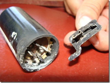
It was only a 2.5 hour drive to Moab and our campsite at Canyonlands Campground.  The heat was oppressive, so I immediately took the girls to the pool to cool off.  Mike and Buster stayed with the camper because Mike had a dream last night that he could fix the air conditioning.  There was always the chance he was just delirious from the heat, but it was worth a try.  He climbed up, started taking the AC apart, and immediately found the problem. 

DSC03818

A totally fried start capacitor:  Why we have no AC

Stupid Camping World people apparently never actually checked the AC unit itself – otherwise, they would have found it right away.  We don’t have access to replacement parts, however, so it’s going to be a hot few days.


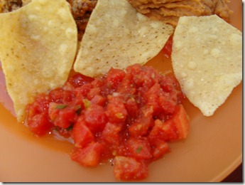
For dinner, I made enchiladas and supplemented it with chips and salsa from The Slickrock Café.  This batch only got 2.5 stars out of 5 because while there was nothing bad about it, there was nothing special about it either.  Too much black pepper and not enough cilantro.  Completely boring salsa with boring chips.

DSC03819

Chips & Salsa from The Slickrock Café:  Not worth a return trip


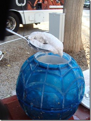
To use up some cream that had been in the fridge for a few days, Mike and the girls put together a batch of blueberry ice cream enhanced by a couple of Hershey bars.  That helped take the heat off for a while.  

DSC03822

The ice cream ball couldn’t quite solidify the blueberry ice cream when the temp hovered around 100 degrees.  Almost as good as Guernsey Farms Grandpa’s Blueberry Way!


As the evening went on, it was obvious we would no longer benefit from the higher elevation we had in Mesa Verde.  By midnight, the temperature had only cooled down to around 83 degrees.  That and no wind made for our first really uncomfortable night in the camper.  It was like sleeping in a food dehydrator where you could imagine all the moisture being sucked out of your body.  We were missing the cold nights in the Tetons when Mike and I tried to share Elizabeth’s extra sleeping bag and we flipped coins to see whether the kids or grown-ups won the honor of having the dog sleep on their bed to keep warm. 

We weren’t the only one having problems, though.  A German couple in a rented RV next to ours had their electric connection melt.  Mike smelled it just before the man came out and announced the electric had gone off.  He had a dilemma because the only tool he could bring over on the plane was a Swiss Army knife, and that wasn’t enough to do the job.  We, on the other hand, have been carting a massive amount of equipment around for thousands of miles, so Mike offered his help.  Together, they took apart the cord and repaired the damage.  They discovered that when you open a tool box and stand around talking, other people stop by to see what’s up.  A retired electrician from Florida wanted to make sure nobody was going to get electrocuted and offered the use of his tester.  His wife stopped by to see the dog.  The German man marveled our children have been out of school since June.  Finally, the wire got fixed, beers were passed around, and the men discussed the merits of the metric system before everybody retired to his own camper and called it a day. 

  • Digg
  • Del.icio.us
  • StumbleUpon
  • Reddit
  • Twitter
  • RSS

Saturday, July 17, 2010 (Mesa Verde, pt II)

Someone asked the other day why Buster was in some of our pictures but missing from other stops.  Easy answer:  in national parks, dogs are allowed in your campsite, but that’s about it.  No dogs on trails, in buildings, etc.  This makes sense because dogs do dumb things and generally don’t get along with bears, snakes, mountain lions, etc.  It’s just not safe to have them around.  We DO want to get on those trails and in the buildings, though, so when possible, Buster has spent time in doggy daycare while we explore the parks.  If we need to do something at night or early morning, he has stayed overnight in the kennel. 

So that’s our logistical situation today.  We wanted to do two cliff dwelling hikes yesterday, so we dropped Buster off at the Cortez Animal Bed & Breakfast around noon.  Today we got an early start to catch an early tour for our third hike before we picked the dog up in the afternoon.  All of this is, of course, complicated by the fact that the entire park is under construction.  The 11 miles from the campground to the visitor’s center can take an hour and a half. 

The Long House tour started at 10 am at the furthest point from our campsite.  We skipped a real breakfast, feasted on granola bars, and started driving at 8:15 . . . . . . . only to sail by all of the construction equipment that sat silent . . . because nobody works on Saturday.  We’ve totally lost track of the days.  No traffic back-ups meant we had some extra time while we waited for our tour. 

DSC03780

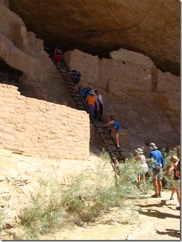
Elizabeth & Julia climb the ladder into Long House

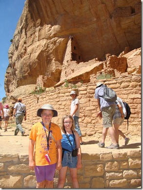
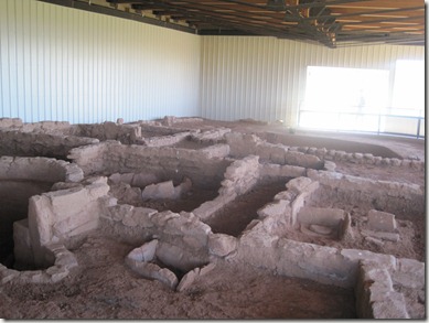
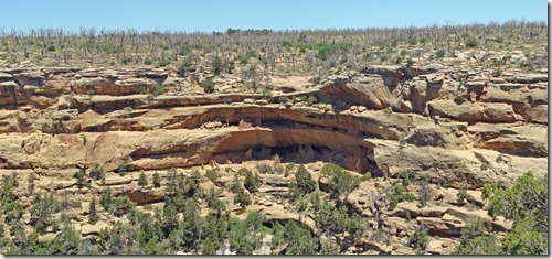
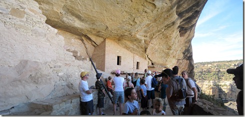
Long House is unique because of all the cliff dwellings in the park, it stretches the furthest across the rock face.  Unlike the others where the floor is divided into kivas and living quarters, a large portion of Long House is open space with a central fire pit and was likely a dance area reserved for weddings or other ceremonies. 

We later got a distant look at Long House and could appreciate its size along the cliff face

DSC03781

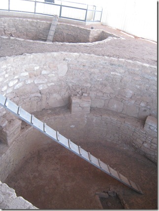
Looking down at the central fire pit/ceremonial area

DSC03785

A rare kiva:  This one still has part of its wooden/mud roof

The Long House tour focused on family life for the people who lived here.  Using two young pre-teens on the tour (who looked horribly embarrassed), the ranger asked them to imagine they were getting married and what they would have to do to prepare.  While they gave modern day answers, he redirected them to how the process would have worked if they lived with the Ancestral Puebloans:  A marriage partner chosen around age 10, two years to gather food for the celebration, married at 12-14 years, children immediately, dead by age 30.  It was a quick and difficult life.

The ranger expanded on the health challenges of the ancient people.  Surprisingly, even through most of this, Julia thought the cliff dwellings would be a great place to grow up.  We heard, “Cool!  I want to live here!” a lot.  Only one ailment gave her pause.  Constant tooth pain because of sandstone in the cornmeal?  No problem.  Everyday danger of falling off cliffs?  Just gotta be careful.  Continual dehydration and possible starvation during a 25-year drought?  Tough, but you could make it work.  It was finally the ranger’s description of chronic, incurable pinworm that made her face scrunch up in horror.  No matter how cool the houses were, “that itchy butt disease” is just not worth it – she is outta there. 

DSC03783

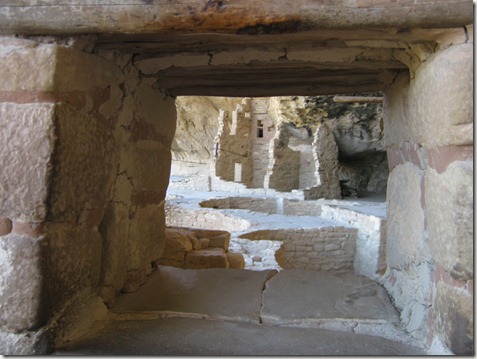
Missing its walls, you can see the many rooms once a part of the whole structure

We found it very interesting that although the people left no written records, answers to how they lived are still found in the stories and traditions of their current descendants.  For example, when archaeologists were trying to figure out why the dwellings have mud splatters at high points along family walls, they found the answer by asking today’s Hopi people.  Apparently, it is still an understood custom for the mothers and aunts of a young man who has just been married to go to his new home (in 1100 AD he would move in with his new wife and her family) and throw mud balls in a playful display of mock anger toward the new family for “stealing” their son.

IMG_0794

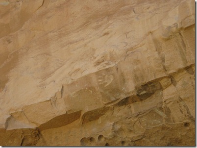
The mud ball splatters don’t show up well here, but a child’s handprint gives evidence the rooms once reached high into the alcove

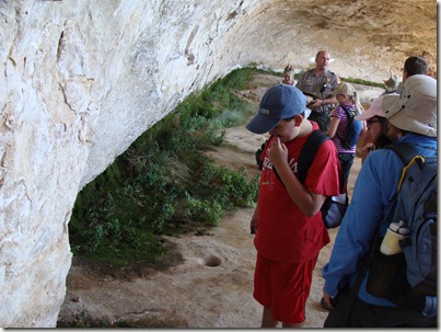
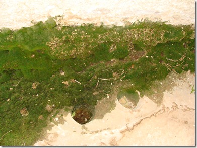
Long House was fun to explore because of its size.  Also interesting was seeing the spring used as its water source is still producing water.  It’s just puddles on the floor, but historians expect when people lived here, there were few trees on top of the mesas competing for the water.  When trees don’t use the water, it filters through the sandstone, hits the hard limestone, and runs along the floor into small pools. 

DSC03782

Moss and small plants offer clues to Long House’s water source

DSC03787

Holes carved in the floor were used to collect running water

DSC03793

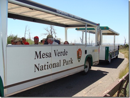
After our tour of Long House, we reboarded the tram escorting people between sites and got off at several other stops to see preserved ruins and overlooks for other cliff dwellings.  The mesa top dwellings were an interesting contrast to those built into the sides of cliffs. They were built much earlier, so there was often evidence of “remodeling” over time.  The park has a handful of these sites on display, but they may one day have more.  When the fires moved through 8-10 years ago and removed vegetation, more than 500 new mesa top sites were discovered. 

IMG_0847

Before the Ancestral Puebloans moved their homes onto the side of cliffs, they had similar homes on the mesa tops.  Several of these are preserved and protected from the sun

IMG_0802 (2)

Two kivas in a mesa top dwelling


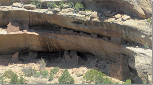
Kodak House from the opposite side of the canyon

A closer look at Kodak (no tours here, so only pictures from far away)


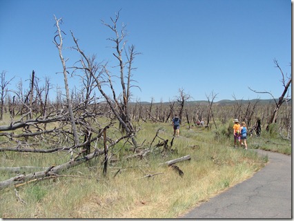
The tram driver pointed out the obvious damage done to the park by the fires in 2000 and 2002.

DSC03802 Mesa Verde transportation (Julia’s head is above the “e” in “Verde”)

DSC03796

Fire damage everywhere

Two interesting things here.  First, with less than 18 inches of rain each year, summer foliage is rather crispy and burns easily.  When fires start, they burn hard and high.  When the “Pony” fire of 2000 reached the canyon near Kodak House, it leaped right across the canyon and didn’t stop.  Second, conditions in the park are good for a fire all summer long.  All fires so far have been caused by lightning.  When lightning strikes a tree, it first heats up the roots.  Several days later the tree will burst into flames.  Therefore, when storms move through, the park assumes trees have been struck by lightning.  Helicopters with heat sensors fly over the next day and firefighters make visits to hot spots all the time; the most recent fire to be put out happened 2 days ago!  Finally, this vegetation is just different than what we see in Michigan.  The most common tree in the park is the Juniper – an extremely slow-growing tree.  We were shown seedlings that sprouted up after the 2000 fires, but after ten years of growth, they are only about a foot tall (not a lot different from the trees trying to grow in the heavy clay soil in my yard back in Michigan).  They will need almost 200 years to reach maturity.  Fires are a big deal simply because a forest in Mesa Verde will not recover in the same time as a burned area of Yellowstone.  While Yellowstone trees need occasional fires to seed new growth, Mesa Verde’s Juniper trees do not.

We needed to pick up Buster by 4:00, so we packed up the computers and drove into Cortez.  The Welcome Center there had comfy chairs and an internet connection we could use, so the while Mike and I worked on pictures, email, etc., the girls played games and read books (Julia is really into Sherlock Holmes right now, so she stops occasionally to brief us on random murder investigations – she was super geeked to find one story focused on the Mormons moving into Zion, a historical period she had just learned about when we visited Zion).  After gathering the dog, I dropped everybody off at the city park while I picked up a few groceries (Score!  Safeway stores are Kroger stores so I can finally use a shopper’s card and not pay ridiculous prices – yeah!).  Cortez is a neat little town.  I dropped everybody at one park, but they could have easily walked to three others all neighboring one another and set around ponds and schools.  Good place to walk the dog. 

IMG_0853

Relaxing while the kids do dishes

Driving back through town on our way to Mesa Verde (less than 10 miles away), we passed almost a dozen little Mexican restaurants.  Everybody was pushing for another salsa test, but I just bought groceries, darn it.  That will have to wait ‘til tomorrow when we reach our next and final destination:  Moab, Utah.  Tonight we made a campfire, grilled hamburgers, and relaxed. 

  • Digg
  • Del.icio.us
  • StumbleUpon
  • Reddit
  • Twitter
  • RSS

Friday, July 16, 2010 (Mesa Verde)

The girls were really excited about today because they both did reports on Mesa Verde this year in school.  They started out with more background about the history of the area and its people than Mike or I did.  I can definitely say we learned a lot during the two tours we took today. 

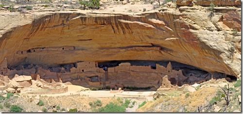
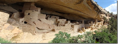
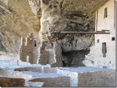
Mesa Verde is the site of what is left of more than 600 cliff dwellings once occupied by an ancient people once called Anasazi and now referred to as Ancestral Puebloans.  “Anasazi” is a Navajo word meaning “enemy ancestors,” so the descendants of those people prefer a less aggressive name.  (as a side note, I’m now going to have to rewatch an old X-Files episode titled “Anasazi” to see if the name conveys any meaning to the plot)   Anyway, it was long known the people lived here for thousands of years along the top of the mesas growing food and hunting.  At some point after 1100 AD, they moved their homes down from the mesas and into the rocky alcoves.   By 1300 AD, they had completely left the area.  European settlers didn’t stumble across the ruins of the cliff homes until the 1800’s when some cowboys looking for lost cows instead found Cliff Palace, the largest remaining cliff dwelling in the world. 

Most of the cliff homes are small, inaccessible, or dangerous to explore.  Several, though, are open to visitors.  Three of the largest can only be seen with a guided tour.  We had tickets for 3 tours and saw two of them today:  Cliff Palace and Balcony House. 

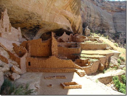
Cliff Palace was impressive because, at 122 rooms, it is the largest.  The top half has fallen away, but you can still see the base of the structure and imagine what it would have looked like.  Our ranger for this tour was a historian, so he spent most of his time focused on who the ancient people were, what their lives were like, and why they left the area.  He explained that the cliff homes are built in sandstone that constantly seeps water.  The largest homes have springs inside them.  In an area where water was valuable, the cliff homes provided a constant source.  He also linked water to the disappearance of the people.  Research into the trees used to support part of the structures give evidence to a 20-25 year drought just before everyone packed up and left.  If there was limited water and little food for that long, the common belief today is the people had to leave in order to survive. 

More of Cliff Palace:

A first look at Cliff Palace: Originally, the stone rooms would have reached the top of the overhang

DSC03720

Walking the steps to access the Palace

DSC03730

What would have been a family area

DSC03733

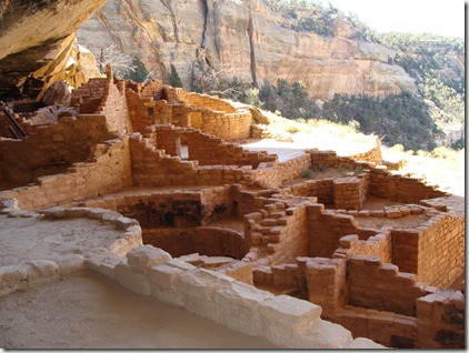
Looking into a Kiva:  When intact, a wooden roof covered this area so it could be walked on by those above.  Inside the Kiva from below, the space was used by individual families for religious ceremonies and warmth during the cold months (that is a fire pit in the center)

DSC03735


We grabbed a late lunch near the museum before taking our tour of Balcony House. Balcony House is known for its difficult accessibility.  Getting in requires a series of ladders and tunnels, and getting out requires more of the same with an additional climb along a rock ledge involving footholds and chains.  Balcony House is also important because there is evidence it was once an open structure but was eventually reconfigured to provide a stronger defense.  Again, the defense seems to surround the water source.  The ranger for this tour wasn’t as quick to support the theory the cliff dwellers fought with one another for food and water, although she admits other possibilities remain a mystery.
Balcony House:  Lots of walls and hard-to-get-to-spaces

IMG_0757 (2)

For better defense, a wall and series of crawlspaces were constructed sometime just before people left the cliff dwellings

DSC03754

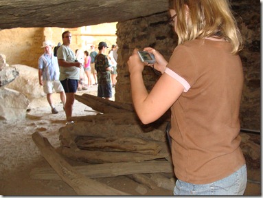
Julia snaps a picture of the remains of a Kiva wood roof from the year 1300

This was definitely our favorite tour so far because we could walk around inside the dwelling instead of just skirting the edges. 

DSC03743

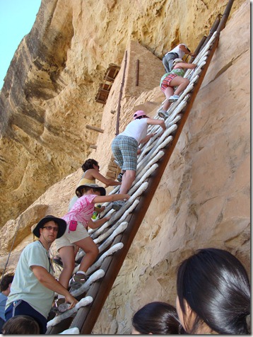
Climbing the ladder to reach the main area of Balcony House

IMG_0776

The black marks on the ceiling are apparently from ancient cooking fires

IMG_0766 (2)

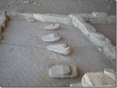
A corn-grinding area.  It is assumed that grinding corn with sandstone may have contributed to a shorter life span and most certainly contributed to grinding down the teeth of those who constantly ate corn meal containing bits of coarse sand

DSC03748


Looking out of Balcony House.  There are several smaller cliff dwellings on the opposite mesa

DSC03757  IMG_0778 (2)

Small openings make for a good defense    Mike follows Julia through the tunnel

IMG_0777 (2)

Not an easy crawl while carrying cameras and water bottles

DSC03747

A look at the ladder climbed to get in

DSC03759

Elizabeth starts the ladder climb to get out

DSC03761

A look back at the exit chains and ladders

We spent some time after the hike hanging out at Far View Lodge where we were told we could get internet service.  No luck, though.  It was just too slow.  I’m not sure what their current system is, but their fiber optic cables were destroyed in 2000 when fire destroyed a huge section of the park.  Two years later (I think), fire destroyed another section.  Right now, more than 85% of the park is recovering from fire.  Mesa Verde should be green on top according to its name, but that color is coming  back slowly.  The ranger pointed out a tree about 4 feet tall and said that because of the limited water in the area, these type of trees take a long time to grow.  The 4 foot tall tree was estimated to be 100 years old.  It will take hundreds of years for the park to be restored to full vegetation.  Hopefully, it won’t take that long until somebody runs internet into the lodges and campgrounds again.  

  • Digg
  • Del.icio.us
  • StumbleUpon
  • Reddit
  • Twitter
  • RSS

Thursday, July 15, 2010 (Drive to Mesa Verde = Multiple Equipment Failures)

Today we had problems.  Not big, important life problems – just disappointing, frustrating problems. 

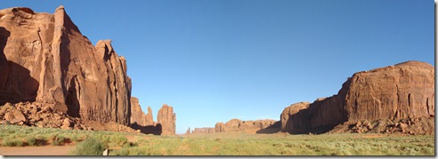
It started out pretty well.  We left Monument Valley and stopped at mile marker 13 (some websites say marker 16 to get one of the most famous shots of the valley. 

DSC03680

Right around Mile Marker 13 as you leave Monument Valley . . . .

DSC03681

Also known as, “Where Forrest Gump stopped running.”


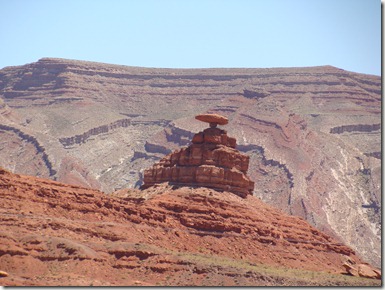
A bit further up the road we came to the town of Mexican Hat – named for the rock formation just to the north of town. 

DSC03683

Mexican Hat

We then took a 6 mile detour to drive out to Goosenecks State Park where we heard you could get a great view of the San Juan River.  Camping here is free for those who can take the heat, so it was our backup plan if we ended up not able to get into Monument Valley last night.  The overlook gives you a great perspective of the San Juan.  In a width of 1.5 miles, more than 6 miles of river curve beneath your feet.  Monument Valley is in the distance.  Really good stop. 

Goosenecks State Park:  You can camp right on the edge, but it’s not a great campsite for sleepwalkers!


Leaving Goosenecks, we realized we had no cell phone or internet service.  Therefore, we had no GPS and had no idea where we were going.  The only other visitors at Goosenecks were 3 older French couples; one of them spoke English really well and pulled out a map to get us pointed in the right direction.

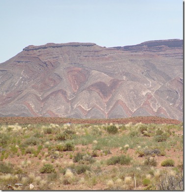
We passed one mountain the family has called “Charlie Brown Mountain.”  Amazing colors in the rocks. 

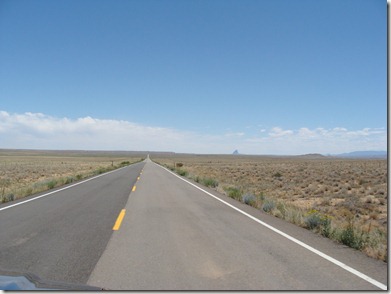
We expected a 3 hour drive to Cortez, Colorado, to put us at the entrance to Mesa Verde.  It was a long drive with few towns and a lot of road that looked like this:

DSC03708

Whole lotta nothin’

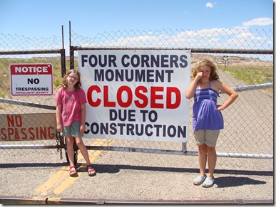
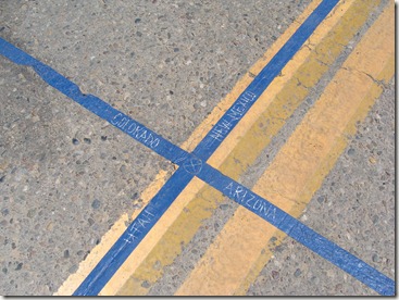
At one intersection, the sign said “Four Corners:  5 miles.”  It hadn’t been on our list, but for a five mile detour, we decided we had to do it.  We’d heard there wasn’t much there except a seal to stand on and a vendor selling ice cream.  This time there wasn’t even ice cream.  Four Corners was closed. 

DSC03709

Somebody put tape down outside the gate for the desperate who really felt the need to stand on something, but based on the tears from little kids and the cursing from adults who had likely driven many miles out of the way to get here, they weren’t fooling too many visitors. 

DSC03711


DSC03712

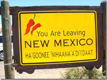
As a bonus, we did get to visit New Mexico for about 3 minutes – the only time we’ll be there on this trip.  Being there, we can say we were in New Mexico, Arizona, Colorado, and Utah – just not at the same time. 

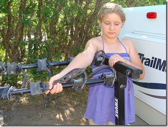
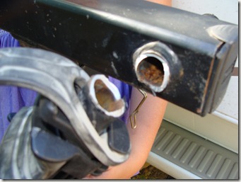
About 20 miles up the road, a car flagged us down to tell us we were dropping bikes everywhere in the road.  Sure enough, one of the arms on our trusty Thule bike rack  had snapped off.  We found my bike a few miles back in pretty bad shape.  We drove all the way back to Four Corners, but we never did find Elizabeth’s. We threw the other two bikes on top of the truck and hoped for the best. 

DSC03716  Elizabeth holds the arm where it should be

DSC03715

The bike rack snaps:  Not going to be an easy fix


We finally reached Mesa Verde and set up in our rustic campsite only to find the batteries had run down during the drive and the air conditioner was once again not working.  Same burning smell as at the Grand Canyon.  Apparently, the brown out really did fry the thing. We’re not sure why it worked at Monument Valley.  Mike “borrowed” the electric from another site to charge up the batteries for a while, but it wasn’t enough to run the fridge overnight.  Everything had to get moved to the coolers.  Ugh.  The Woelmers are not a desert people.  We start wilting in the mid-day sun.  I was really hoping we’d have air/refrigerator for this last week when we were in the desert, but at this point we’re not going to take the time to fix anything.  Instead, we spent our time in camp doing laundry and getting our tickets in order for the ranger-led hikes through Mesa Verde (to see the 3 most popular cliff dwellings, you need inexpensive tickets). 

Just a note:  Mesa Verde has no cell reception and only has wireless service in two buildings.  Right now, we’re hunkered down in the basement of the Far View Lodge to catch up on email, blog, etc.  Not being “connected” is both restful and frustrating! 

  • Digg
  • Del.icio.us
  • StumbleUpon
  • Reddit
  • Twitter
  • RSS

Wednesday, July 14, 2010 (Monument Valley)

Arizona was slowing us down.  Our destination, Monument Valley, was four hours away.  We wanted to break camp, drive, set up again, and still have time to visit Monument Valley before dark.   We always forget, though, that Arizona feels like it has its own time zone because they don’t recognize Daylight Savings Time.  So by the time we finally got moving today, we were already running an hour behind.  Also slowing our move this morning = the kids were having a great time playing with the dog at the KOA.  Mike even found some go-carts, so of course they had to check those out, too.

IMG_0680

IMG_0691

DSC03472 

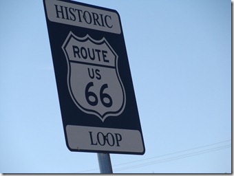
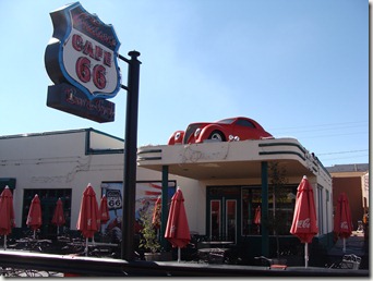
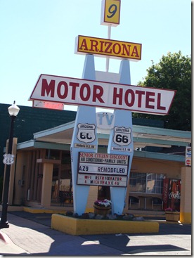
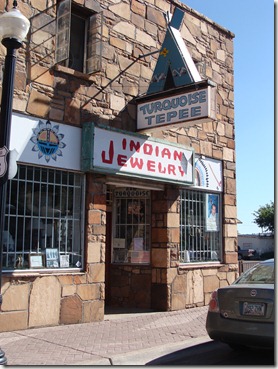
We picked up groceries in Williams, AZ.  Williams’ main street is registered as an historical landmark because it is a section of Old Route 66 that has been largely preserved as travelers would have seen it as they drove across country between Chicago and  Los Angeles back in the early to middle decades of the 1900’s.  Lots of neon and tacky statues.  I wish we’d have driven through at night when all the neon signs are lit up, but there were still a couple of interesting sights:

DSC03465

DSC03467

DSC03466

DSC03468

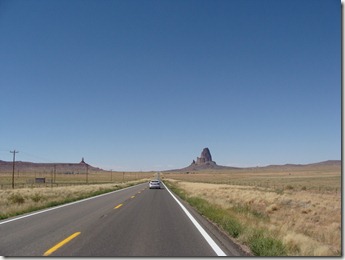
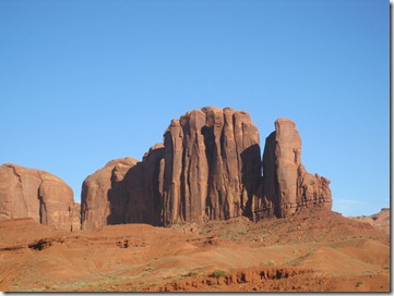
From Williams to Monument Valley was just under a four hour drive.  It’s really dry here in Arizona, and there are signs posted everywhere that fire danger is high.  We even saw a helicopter dumping water on what was most likely a high-risk area.  When we entered the Navajo reservation from the south, the rocks and dirt changed colors to a deep shade of red.  Beautiful in the hot sun (temp outside was 97 degrees).  In Kayenta, we broke away from the main traffic and joined a few other cars heading toward Monument Valley.  As soon as you pass behind the town recreation center and hotels, you get a glimpse of what is waiting down the road:

DSC03476


Monument Valley’s facilities are easy to navigate.  When you reach the junction, turning left takes you to Goulding’s Inn, campground, and stores.  Turning left takes you into Monument Valley Tribal Park.  We first went to Goulding’s to set up camp.  The campground is set behind tall rock walls.  It was rather pretty later in the evening, but it just felt unbelievably hot when we were hooking up the camper.  It’s not a large campground, but the kids were pretty excited the pool was right across from our site.  We realized later we were sharing the campground with 3 different large groups of French teenagers, so the pool area was always busy.  The kids were all in tents, though, so in that heat, I think the pool is pretty much your best option. 

DSC03678

After a minute to catch our breath, we crossed into the Tribal Park.  The girls and I explored the visitor’s center before starting our 17 mile loop tour.  There were some nice overlooks along the back of the hotel. 

DSC03498

DSC03499

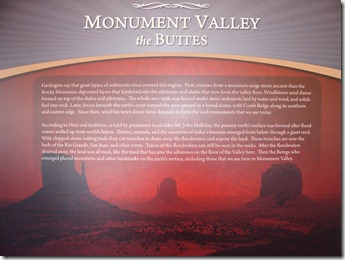
The girls also were excited to see a “John Holliday” listed on a plaque in one of the exhibit rooms as one of the respected elders and historians for the area Native Indian groups.  Hmmm . . . an interesting name – anything to that, fellow Holladays? 

DSC03515

IMG_0680 (2)

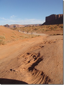
The Valley Loop Drive is 17 miles long and takes you to 11 overlooks throughout the park.  You can choose to drive it yourself, or for $40, you can catch a Jeep tour or ride along in the back of an open-air bus.  You wouldn’t think many would take the paid tours until you see the road.  It was Escalante all over again.  Huge ruts, sand pits, washboard surface, washouts along the sides . . . it is a slow 17 miles. 

DSC03544

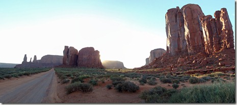
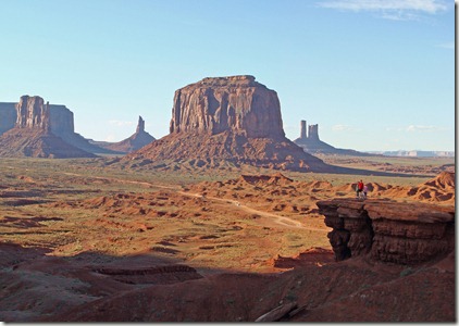
We started our tour at 6 pm and finished just after 8:30 as the sun disappeared.  Sunset is a great time to explore the valley because the sun catches the rocks in curious ways.  It was just a beautiful drive. 

IMG_0711

IMG_0718

IMG_0722 (2)

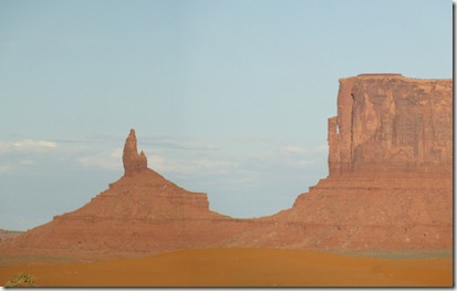
Elephant Butte (the “trunk” is on the right side)

You have to click to enlarge this one to really see it, but it’s pretty awesome

IMG_0744

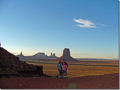
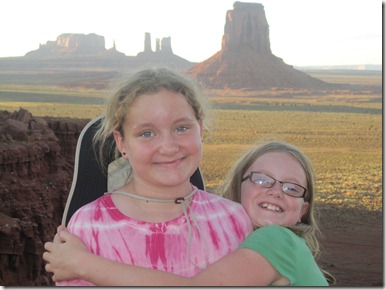
Elizabeth & Julia near the end of our tour

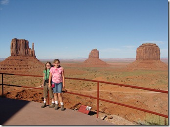
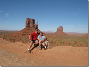
Mike, Elizabeth, Julia, & Buster stand at John Ford Point

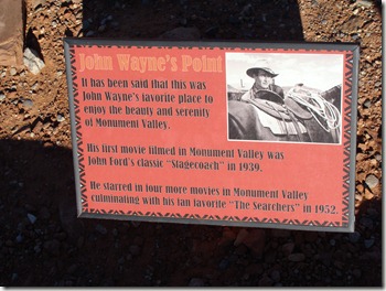
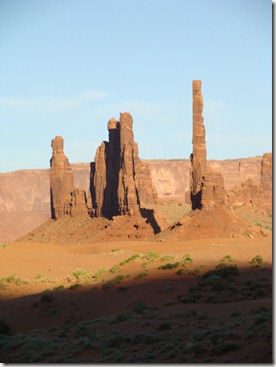
Stop #4 is called “John Ford Point” because the man who directed Stagecoach filmed more than 11 westerns in the valley.  From this overlook, the landscape looks familiar because it has been the backdrop for many, many movies.  The red earth was a perfect fit for the early parts of 2001: A Space Odyssey, Back to the Future Part III was here, and Mike read in one of the brochures that Clint Eastwood stood on top of one of the Totem Pole rocks during the movie The Eiger Sanction.  Hmm . . . that looks tricky, so we’ll have to add it to our Netflix list. 

DSC03601

“Totem Pole” features

We left the park just as the sun disappeared behind the mountains in the west.  Julia took the best shot of the sunset:

IMG_0748

  • Digg
  • Del.icio.us
  • StumbleUpon
  • Reddit
  • Twitter
  • RSS

Tuesday, July 13, 2010 (Flagstaff Area)

High Points: Swimming pool in the campground, giant meteor crater, brownies for dessert!

Low Point: Just one more reason to not like the Grand Canyon operation . . .

Our update should say “Grand Canyon Day 2,” but that didn’t happen. When we first plugged in to our campsite in Trailer Village (#46), all the alarms in the camper started blaring. When we got that resolved, the next few hours were a series of brown-outs and blown fuses. When that all simmered down, the air conditioner suddenly smelled like it was on fire, so we shut it down. We could smell burning plastic every time we turned it on. I talked to the people in the camp office, and they sent a guy from the Xanterra company out to look at our electric. He concluded we did indeed have electric service (no kidding), but he insisted that if anything was wrong with the power level/electricity, it was the fault of our equipment – not their service.

OK. We’re getting ready for the last leg of our trip which will be primarily desert. We will not be driving through any major cities until we drive home. Weighing our options, we decided to make a detour into Flagstaff today and see if Camping World could fix whatever was wrong with the air.

Conclusion: Nothing is wrong with our air conditioner. They turned it on for an hour and couldn’t replicate the burning smell. We’re spending tonight in a KOA near Flagstaff and have been running the air for a few hours with no problems. So thanks, Grand Canyon, for apparently nearly frying our electric system and then declining to investigate the problem. Maybe Xanterra wants to pay our Camping World bill?

IMG_0655

Buster watches us pack up

On the plus side, we’ve never been to Flagstaff, so we looked around for something to do while they ran a diagnostic on the camper. Mike and the kids voted to see the giant meteor crater just east of town. The familiar brown signs label it a national monument, but it is privately owned by the Barringer family so there is a fee to see the museum and walk the rim. At nearly 2 miles across, it is impressive.


DSC03428

Taking the guided tour of the crater rim

IMG_0662

Looking into the meteor crater

DSC03445

Exploring the museum

IMG_0657

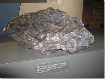
The largest piece of the meteor ever recovered

After leaving the meteor crater, we grabbed a few tacos from “The Whole Enchilada” – a little shop inside a gas station just down the road. Mike was lobbying to make the 20 minute drive into Winslow, AZ, so he could stand on the corner. We opted instead to turn Pandora radio onto an Eagles station and pick up the camper before they closed.

IMG_0676

. . . . and then we had to listen to Bugs Bunny jokes for the next half-hour

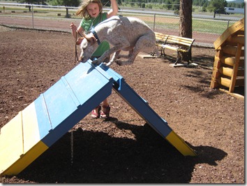
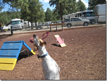
The KOA was a nice find as a way to reward the kids for being so patient with an unexpected day of driving. Pool, putt-putt, a dog agility area, go-carts. . . I think they’d stay here for a few days if we didn’t want to be in Monument Valley by tomorrow afternoon.

  • Digg
  • Del.icio.us
  • StumbleUpon
  • Reddit
  • Twitter
  • RSS

Monday, July 12, 2010 (Grand Canyon)

High Point:  Finding a good bike trail

Low Point:  Why is everybody YELLING???!!!!!

Coulda, Woulda, Shoulda . . .

It was bound to happen. Eventually, we had to end up somewhere we should have skipped. That place is the South Rim of the Grand Canyon. We could have gone to the North Rim. We would have gone to the North Rim if we hadn’t heard the South was more dog-friendly. We just should have gone to the North Rim.

We’ve previously marveled at the number of foreign visitors in the parks. Julia spent the Mammoth Hot Springs Trail in Yellowstone counting the number of different languages (5). The girls spent a night swimming and playing with children from Holland whose mom had to translate for them when they wanted to talk. One night while doing laundry, the park put up an oddly-phrased sign, and as the only native English speaker out of 9 people there, I had to figure out the directions so we could all wash our clothes. We’ve been wondering where the Americans are vacationing in large numbers this year. Well, we found them. They’re here on the south side of the Grand Canyon.

Our favorite part of this whole vacation has been the laid-back, friendly feeling at every park we have visited. We’ve enjoyed talking with people on busses and trails about where they’re from, where their trip is taking them, what trails they’ve hiked, and what they’ve done on their trip so far. Julia made me laugh the other day when she said she loved that in the parks, “Everyone is visiting with their families, is really friendly, and there aren’t any punks around.” I asked her to define “punks,” and she said, “You know . . . mean people.”

Hopefully, it’s just the large number of visitors that have resulted in us finding both the Americans and the “punks” in the same stop. The Grand Canyon gets almost 4.5 million visitors a year, while the next most popular from our trip, Yellowstone, receives fewer than 3 million.  But wow . . . this is either just a totally different group of people or it’s the same people but they’re all in a bad mood.  I mean, come on Team USA – let’s get it together and make this work!

What we overheard on a typical Zion Canyon shuttle bus: “This is the sound of the Red Tailed Hawk . . . . . . caw! caw! . . . Take some special time to yourself while you visit this majestic land to hear the little details.”

What we overheard on or near a typical Grand Canyon shuttle bus: “Did I say you could get on this bus yet?!” . . . “Do NOT board from the middle doors!” . . . “What do you mean the glass walkout is near Las Vegas?! I came to the Grand Canyon to stand on the glass, dammit! Screw this!” . . . “Darlene! I got us a bus!” (said as a woman throws her arms wide in front of a dozen people who have been waiting in the sun for 10 minutes as 8 people come running around a path carrying babies and lunch packs and use a stroller to push through the line as they jump in front of everybody).

This place is like a very hot, very rude Disneyland –where everyone is wearily lining up for the same ride and there are no dancing mice or princesses to keep the kids entertained. We would hide in the camper and nap, but the hook-ups are whacked out and the air conditioner keeps blowing the fuse.

After pushing through crowds near the visitors center, being honked at by impatient motorists who didn’t want to share the road with bicycles, and later being yelled at by a bus driver for sitting near the front of the bus because it’s reserved for older people (although two other kids ended up in the seats anyway), the girls announced they were done with the canyon after the first day. We tried to explain this park was just different from the others because the purpose of most visitors is not to get out and explore (especially in July when there aren’t many people exploring the trails through the canyon)but instead to move quickly through the viewpoints and get a good reservation for dinner. They weren’t buying it, though.  This is the first time the whole trip they were on edge and got homesick:  Elizabeth says she misses her privacy while Julia says she misses microwave burritos (which she only eats once or twice a year, so what’s up with that?!). 

But the view is spectacular, and that is why everyone is here.

DSC03341


DSC03342  IMG_0633


DSC03398

We day-boarded Buster so we could visit the museums and buildings, but after several hours of slogging along with the miserable masses from one shuttle bus stop to another, we had lunch and relaxed for the afternoon. After we picked up Buster, we explored for a while on bikes, which was much more pleasant – but still frustrating because the “greenway trail” and the recommended biking road are separated by almost a mile of busy restaurants, hotels, railroad crossings, horse stables, etc. Navigating through that with two kids and a dog wasn’t much fun.

IMG_0652

Biking Hermit’s Rest Road:  Shuttle busses and bikes only

We went as far as the first stop along Hermit’s Rest Road and watched the sunset until a storm got so close you could see the sheets of rain.

IMG_0651Julia takes a picture of the sunset across the canyon


IMG_0643

Elizabeth catches a picture of the approaching storm

  • Digg
  • Del.icio.us
  • StumbleUpon
  • Reddit
  • Twitter
  • RSS

Sunday, July 11, 2010 (Drive to Grand Canyon)

High Point:  Looking down into the Grand Canyon

Low Point:  The long drive from Zion to the Grand Canyon’s South Rim

This morning we packed up and left Zion National Park.

IMG_0578

On the way out of town (Springdale), we stopped for lunch at Casa de Amigos, a restaurant from which we’d picked up chips and salsa last night.  It’s been a long time since a salsa test because it seems we’ve never had opportunity.  Everyone has been happy eating lunch on a trail and then having a late dinner around 9 pm after we get back from whatever we’ve been doing each day.  No time to search for good salsa. 

Amigos won raves from the grown-ups as well as kids because the chips tasted homemade AND they gave us three different kinds of salsa (hot, verde, and a freshly chopped salsa with lots of cilantro).  After tasting the salsa as a snack, we decided it would be our meal out for our time in Zion.  Julia was the only one who didn’t give it 5 stars for reasons she couldn’t quite explain.  Friendly restaurant, too.  They brought water out to the patio for Buster, and when we said we lived near Detroit, they brought me back to the office where they tried to look up the name of a buddy’s restaurant in MexicanTown there.  They never figured out a name ‘cause the connection was slow, but if anybody happens to eat at a Mexican restaurant near Detroit that uses an old Spanish-style church as the logo on their menu, say “hey” from Utah. 

DSC03284

Chips & Salsa from Amigos!  So good, we ordered it twice in two days!

(the second day we ordered lunch, and that was good, too!)

According to our GPS, the drive to the Grand Canyon should take almost 6 hours.  Had we chosen to stay at the North Rim, we could have cut that time in half (the canyon is only 15 or so miles across but takes 3 hours to drive around).  We considered it because that side of the canyon is supposed to be quieter and less busy.  However, the weather is unpredictable and we would be camping with no hookups/air conditioning.  The dog isn’t allowed to walk along much of the trail on the north side, so the south side sounded like the best bet because they had trailer hookups, a dog kennel if we wanted to have more freedom, and they allowed dogs on trails along the canyon rim. 

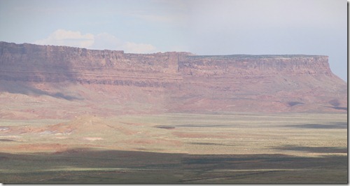
The girls spent their time watching movies.  Mike worked on the computer and organized the pictures we’d taken at Zion.  It was a long drive with little to see.  We did stop to take a picture along a fantastic viewpoint of a series of mountains that include the Vermillion Cliffs.  This was just before we entered the Navajo Reservation. 

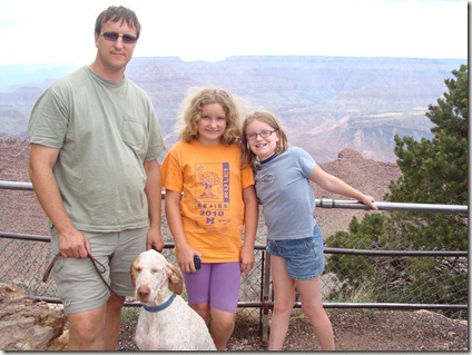
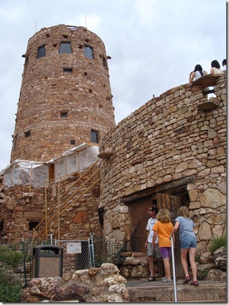
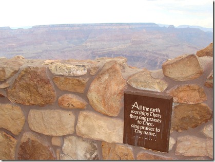
We entered the park through the East Entrance and stopped at Desert Viewpoint and the Watch Tower for our first look. 

DSC03314

A look at the canyon from Desert View

DSC03315 - Copy

The Watchtower, 70 feet high, is the tallest structure on the South Rim. 

It is decorated inside with Hopi-style artwork. 

DSC03318

After that, we had almost 15 miles to the campground.  The girls were doing quick math because they wanted to finish their movie before we went sightseeing.  I decided that’s a good sign we’ve been traveling for a while; we spent 3 week driving to the Grand Canyon and the kids are so tired of looking at rocks and holes in the ground they would rather watch Luke Skywalker blow up the Death Star for what must be the millionth time (we’re starting to wish we’d borrowed someone else’s DVD’s for this vacation!). 

DSC03326

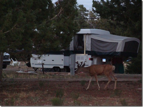
A deer wanders through Trailer Village

DSC03328

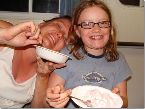
Mike made strawberry ice cream for dessert!  Yum!

  • Digg
  • Del.icio.us
  • StumbleUpon
  • Reddit
  • Twitter
  • RSS

Saturday, July 10, 2010 (Hike to Scout Lookout & Angels Landing)

When we announced we would be in Zion National Park this summer, my former bro-in-law told us a trail named Angels Landing was “mandatory hiking.” As we rode the shuttle busses the last two days, the pre-recorded announcements kept repeating that the trail was an “exciting adventure.” We determined there were actually two connecting trails: a 2 mile walk up a paved path to Scout Lookout and a further ¾ mile hike to Angels Landing. The ranger we talked to advised us that if we wanted to attempt the trail, the kids would be fine going to Scouts, and one of us might want to attempt the steeper climb to Angels. So although we went to bed anticipating a day of hiking the leisurely Emerald Pools trail, we woke up deciding we couldn’t leave Zion without at least making an effort of Scout & Angels.

Had we made the decision earlier, we would have been on the path before 8 am to miss the hottest part of the day. Here was our biggest mistake. We made the decision late, so when we started out at 11 am, we decided just to take it slowly. We filled our water bottles, packed a lunch, and started up the trail.

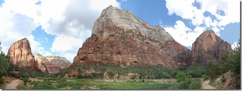
The first mountain on the left is Angel’s Landing.  Scout Lookout is out of view

If yesterday’s hike through The Narrows was a fun and happy walk, the two miles to Scout were the opposite – soooooo miserably hot. We decided we would each use a water bottle walking up, and then we’d split two others coming down. It was not nearly enough, and before the end of the first mile, we joined other pitiful hikers huddling under rock overhangs and corners in an effort to cool off. We were hot and slow. We moved forward, though, first through the long and uphill portion, next through the disappointingly named Refrigerator Canyon, and finally through Walter’s Wiggles – a series of 21 steep switchbacks to finish the final ascent.

The first section of trail:  a long uphill climb

DSC03232

Huddling for shade

Refrigerator Canyon

A view from Walter’s Wiggles: The back side of the canyon

Hiking the Wiggles

I think it took two hours to hike the two miles to Scout Lookout. Once there, we found a cluster of trees where weary climbers sat eating snacks or waiting for companions to finish the longer hike to Angels.  We ate lunch and watched people start up Angels Landing and disappear over a hill or start up and come back down.

DSC03257 DSC03260

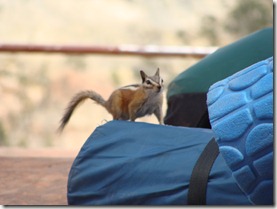
Julia rests at Scout Lookout      A chipmunk explores some Boy Scout packs

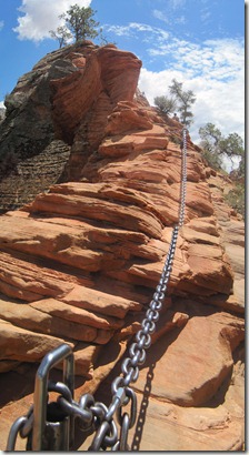
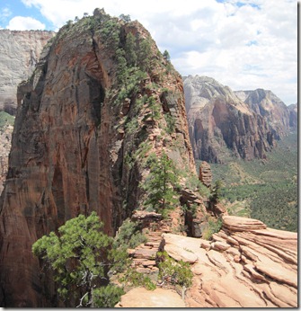
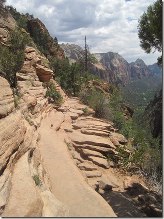
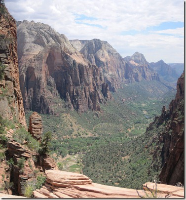
To appreciate this section of trail, you have to forget everything you’ve ever known about casual hiking safety. It is simply unbelievable that this trail is a trail. It is ¾ of a mile long and almost all a steep uphill climb. The mountain is maybe 20 feet wide but in some places only 3 or 4 feet wide. There are no guardrails. There is not a clearly marked path. In many places, there are chains strung between two poles hikers may use to steady or pull themselves up. On both sides of the trail, the mountain drops off 800-1200 feet.

Chain-assists for Angels Landing

As we sat and munched on apples and grapes, I was amazed that the groups coming down from the hike included whole families and a group of young Boy Scouts. One climber told me she’s seen people climb it while carrying their babies in backpacks.  If these folks were doing it, it must look worse than it is, right? Mike went first while I waited with the girls. The first portion is steep and involves chains.  He scrambled up that mountaintop and explored the area leading up to a catwalk that takes you over to the second peak. He assumed we were waiting, so he came back to give me a turn.
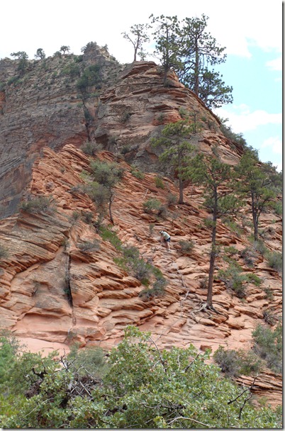
Mike tackles the first climb toward Angels Landing

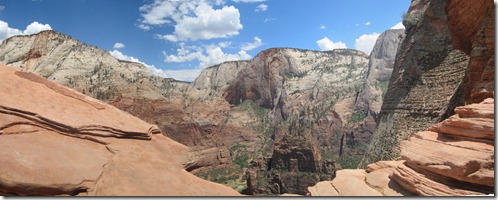
A view from the narrow rock “catwalk” leading to the final ascent

A different look at the rock bridge and the final climb

IMG_0586

A typical trail edge

I planned to stop when I didn’t feel comfortable anymore.  I assumed that would happen quickly, but it didn’t.  I actually made it across the infamous 4 foot wide “catwalk” before I knew I’d passed it.  By then, there was only a steep ascent to the top, so I sent word back to Mike that he should start the girls walking back because I was headed for the top.

It’s called Angels Landing because one of the earlier explorers decided only angels could land there. I’m wishing they did. Any self-respecting angel would have been waiting at the top with a bottle of Gatorade.

Here is an abbreviated video of the hike up. A few of notes:

1. The hike up only felt tricky at the end, so the going up section is pretty short.

2. I thought I was doing pretty well, so I have no idea why I look and sound like *%$# when I reach the top. I think I was more overheated than I thought. We’ve actually deleted a whole section where I look slightly delirious and just start rambling on about water rations and strategy like a Survivor contestant. Mike’s keeping that in case he needs a good laugh.

3. Whoa. Going up was pretty easy, but going down was crazy. Like, hanging onto chains and scooting down on my backside crazy.  A totally different feeling and much more scary.

4. The excitement of making it to the top, combined with my obviously dehydrated self, led to my missing the fact that Mike put Julia’s camera in my pack at the last minute. When I came down the mountain, I had only video and we didn’t get any still photos of the top view. Oops.
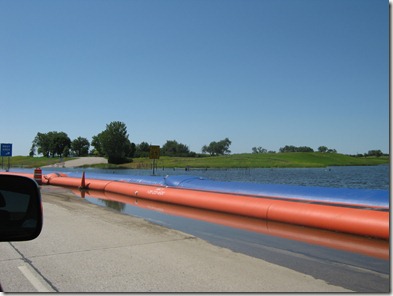
5. Watching the video freaks me out a little. It definitely looks worse on film than it was in real life.
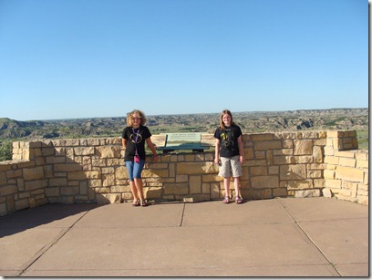
6. Keeping that in mind, this video is still Rated P: It may be inappropriate for my parents to watch.

Get Microsoft Silverlight

We’re leaving Zion with the impression that it feels the most wild of all the parks we’ve visited.  More so than in other parks, the most fantastic things to do and see involve accepting various levels of risk.  Yesterday in The Narrows it was the potential for flash flood.  Today on the hike to Scout Lookout and Angels Landing it was the possibility of falling off a mountain.  Nobody tells you not to do it, but the responsibility is on you to keep yourself and your family safe.  I respect that policy.  Even so, while I started the hike to Angels knowing I’d turn back if I thought I couldn’t handle it, I was slightly horrified that there were young kids climbing up the trail (I’d told my kids they weren’t even allowed to ask about it once we reached Scout).  Other parents appeared fine with it, though, so I suppose you have to assume they know themselves and their own children enough to know whether this is a good situation for them.

A look into Zion Canyon from part of the climb

IMG_0571We can now say we’ve seen Zion from top to bottom. Tomorrow we move on to the Grand Canyon.

  • Digg
  • Del.icio.us
  • StumbleUpon
  • Reddit
  • Twitter
  • RSS

Friday, July 9, 2010 (Zion Narrows)

Today we hiked part of The Narrows.  Wow.  Just wow. 

Lots of pictures in this post.  Click on any to make them larger.

The trail begins at the Temple of Sinawava, a massive cliff formation at the end of the Zion Canyon.  A paved path runs for a mile along the river before the trail itself becomes the river.  We hurried along this path and entered the river with about a dozen other hikers. 

IMG_0472

IMG_0475

IMG_0476

It was almost 9 am.  For the next mile, we picked our way upstream.  The river bottom is rock, and it took a while to get used to feeling for each step.  We walked further into the narrows for almost 3 hours.  We climbed over logs, weaved through boulder piles, splashed through shallow corners, and swam through deep pools.

IMG_0498

IMG_0500

IMG_0502

It was a slow walk because every step had to be made carefully.  Elizabeth is always cautious, and while she was excited and smiling most of the time, she was definitely nervous.  In her words, “I’m afraid of heights, and I know this isn’t heights – it’s just some other weird and dangerous thing.”  Julia started out over-excited about the water and fell down several times before the first turn – getting soaked and bruising her knees. She moved more carefully after that, but cold and wet clothes aren’t fun in a cool canyon.   Slowly, the rock walls got taller and narrower.  Eventually, the sun was at an offset angle and the temperature dropped.  Julia got cold, stopped talking non-stop, and felt a little clammy.  We actually got a little worried, so we took off her cold, wet cotton shirt and gave her Mike’s shirt, found a sunny spot for her to rest, and gave her some food.  As soon as she had a snack and warmed up, she bounced back and was ready to go. 

IMG_0507    IMG_0545

Just after noon we reached the area called Wall Street.  Here the trail begins to earn its name The Narrows because the occasional rocky beds or beach-like areas disappear from the sides, leaving only the towering walls of rock that reach as high as 1500 feet.  It is here the outfitters warned people not to spend too much time today because with heavy rains and flash floods possible, there is no high ground to provide safety.  It’s a shame, too, that the weather limited our time.  We were only 2 miles down the trail, and The Narrows continues for another 14 miles (only a mile or so is the Wall Street area, but overnight hikers told us the scenery was fantastic further upstream).  Our ultimate decision was to leave the girls at the turnoff for Wall Street where it met up with a side canyon(they needed a rest) while Mike and I moved further down the trail just to experience the Wall Street area for ourselves.  We went maybe another quarter mile and then rejoined the kids for lunch. 

IMG_0558

IMG_0559

After lunch, we turned around and made our way back.  We reached the trailhead at 3:00 – just as the sky turned dark and the we heard the first roll of thunder.  Before making a decision to begin the hike, we discussed the threat of a flash flood with the ranger who led our tour last night.  Although Wall Street is the most dangerous section during a flood, we had seen many pictures of even the trickling, shallow sections turned to crazy torrents of water and debris because of a thunderstorm upstream.  We had timed our hike well and were lucky.  We knew it had been raining earlier upstream because even the section near the entrance to the river had risen almost a foot between when we set out and when we returned. Today’s storm was brief, though, so those still walking the river in the afternoon simply had a little more water to deal with.  

IMG_0565

Fantastic hike.  Almost 6 hours to walk 5 miles.  My only concern is we spent so much time looking down to watch our footing, I’m afraid we missed some amazing things we could have seen if we’d been looking up.

  • Digg
  • Del.icio.us
  • StumbleUpon
  • Reddit
  • Twitter
  • RSS

July 8, 2010 (Zion National Park Intro)

We are in Utah’s first national park.  It is a huge area to explore.  Two of the most amazing day hikes in the world are here.  I woke up relatively early and made breakfast so we could plan our day and hit the trails.  So what did we do?  I caught up on emails, the girls crashed out in bed playing video games, and Mike drove half an hour to reach the closest hardware store to fix parts of the camper that shook loose during the ride down “The Hole in the Wall Road” back in Escalante.  Despite good intentions, we are still in a mid-trip slide where everybody is moving a little slower than we were a couple of weeks ago.  By the time we were pulled together enough to venture out, it was almost noon and it was almost 100 degrees.  Too hot for a first hike, so we postponed plans until mid-afternoon.

DSC03180Our Campsite just outside of Zion National Park

We didn’t start out fast, and we just kept falling behind.  Our eventual plan was to hike the Emerald Pools trail – a 2-3 hour series of ascending trails leading to three different waterfalls.  We also signed up for a guided ranger tour of the canyon in the evening.  By 3 pm, however, we scrapped the pools and instead walked a half-mile trail to Weeping Rock, an overhang of drizzling water.  After that, we hit the Human History Museum and then joined our ranger tour.

DSC03181

Waiting for the shuttle:  We’re finally on the move (but just barely)

DSC03183

Standing in front of “The Organ”:  a pipe-shaped rock structure

DSC03186

Catching water as it trickles down from rocks above

DSC03189

Looking out from under Weeping Rock

The tour took us on one of the park’s shuttle busses to several interesting areas of the park.  They spent a lot of time on the early people and eventually Mormon pioneer families who once lived in the park area.  They also pointed out places where the geology has changed in recent years, including a giant rock slide that wiped out a 300 ft. section of road in 1995.

DSC03197

An area where a recent rock slide changed the side of the mountain.  This would have looked different when I first visited in 1993.

We liked the shuttle busses.  Unless you’re staying in the lodge, the main road through the canyon is shuttle busses only, so once you park in the visitor’s center, you just hop on a shuttle and head to whatever trailhead or building you want to visit.  Actually, there’s no need to look for a parking space.  If you’re staying in town, free shuttles pick you up there every few minutes and drop you off at the park entrance.

After our tour, we cooked up a late dinner of chicken and biscuits while checking the weather report.  We want to hike the Narrows Trail through the river in the morning, but the potential for flash flooding moved from “Low” to “Moderate” this afternoon.  Not a good time to be in a slot canyon.

  • Digg
  • Del.icio.us
  • StumbleUpon
  • Reddit
  • Twitter
  • RSS

Wednesday, July 7, 2010 (Bryce National Park/Drive to Zion)

High Point: Walking down into Bryce Canyon

Low Point: Walking back up the 320 ft elevation change to the canyon rim

People com to Bryce to see the unique rocks and hoodoo spires, so we spent the day doing just that.  After packing up camp and leaving the trailer at a drop-off lot (no campers or trailers at some of the viewpoints), Mike and the girls headed down the trail at Sunset Point into the Queen’s Garden Trail (it was my turn to hang with the dog in the parking lot).  According to my happy hikers, the walk down into the canyon was great.  The walk back up the 320 feet was not a good time.  The trail itself was only .8 miles one way, and they’d planned on continuing the path where it hooks up with the Navajo Trail, but the sky looked threatening and they didn’t want to be climbing the slippery clay trails in the rain.  By the time they did climb out of the canyon, they were looking rough.  They had been moving fast to keep ahead of the weather, and Mike was impressed that the girls pushed forward and didn’t complain during the difficult climb.

DSC03117

Getting ready to explore the Queen’s Garden Trail

DSC03126

Standing in the Queen’s Garden

DSC03128

IMG_0533 

Finding some shade

IMG_0527

On the way up, looking back into the Garden

IMG_0532

Still quite a climb, and trying to beat the rain

Meanwhile, Buster and I were doing great.  We sat at one of the picnic tables where he got lots of attention from passing hikers.  He even had his picture taken with the kids from one of the Japanese tour busses.

Mike noted later that most of the other hikers they came across during their walk were French, German, or Japanese.  At some of our stops, you can be standing at an overlook with a dozen other people and hear 3 or 4 different languages.    It has been this way through most of the national parks we’ve visited since Yellowstone.  Julia thinks it’s cool, and it really is.  Obviously, people visiting the country make a point to see the famous landscapes.  That’s fantastic, and it’s great to feel like you’re seeing something amazing and sharing it with the world.  We just got to wondering if the economy has fewer Americans visiting the more remote parks.

We saw the rest of Bryce from the overlooks (click to see a more detailed view).

We drove to the end of the park at Rainbow Point and had a quick picnic lunch, stopping to take an obligatory photo at the elevation marker.

DSC03136

My sister and I had a our picture taken here in 1993.

It’s a family thing, but we were in such a hurry, we didn’t get me alone.

Driving back toward the park entrance, we  stopped at the viewpoints – Bryce Point was the most impressive, giving views of cave-like structures called grottos on one side of the canyon, a massive collection of hoodoos in the middle, and impressive valleys toward the other side.

DSC03151

DSC03157


Leaving Bryce and driving toward Zion National Park, we drove through Red Canyon and did lots of oohing and aaahing over the colorful cliffs.


DSC03162


Near Mt. Caramel, we came across this great sign.  I know it’s supposed to look all retro and wholesome and stuff, but the owner cannot be naïve enough to think nobody is doing a double-take when they drive by.


Bryce is characterized by delicate-looking spires you need to peek down into the canyons to see. Zion is its exact opposite; here, the canyon walls rise around you in massive, powerful forms.  It is impressive in its strength.

DSC03175

DSC03169We came in through the east entrance, where a series of tunnels built in the 1930’s bring visitors more than a mile under the mountains before winding through the valley floor toward the town of Springdale.  Our camper was 7’10” across – the minimum needed to require a $15 fee to use the tunnel because they clear everybody out first and send you through straight down the middle.  Apparently, vehicles are larger today than they were 80 years ago.

Once we were through the tunnel, it was a slow 6 miles into town over crumbling roads.  They were doing some night construction and hopefully improving the surface.

Our home in Springdale is Zion Canyon Campground, an rv park just outside Zion.  If you ignore the other trailers everywhere, the view of the canyon walls is great.  It doesn’t have the atmosphere of some of the other more rustic parks we’ve enjoyed, but the temperature here this past week has been around 102, so the girls are bound to enjoy the pool after some hiking in the hot sun.  After a run to the only local grocery store (yet another park-focused store on our trip that charges a fortune for the things campers routinely buy – $5 for lemonade mix – $6.35 for a package of Quaker granola bars), we ate sweet corn and beef/potato goulash before calling it a night.

  • Digg
  • Del.icio.us
  • StumbleUpon
  • Reddit
  • Twitter
  • RSS